
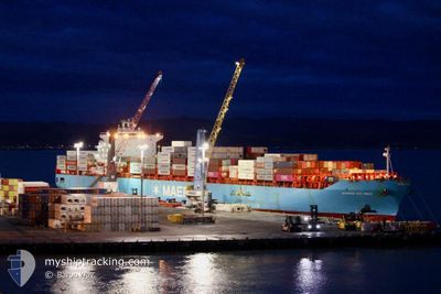
MAERSK RIO INDIA
Container Ship
Current Trip
| Time Travelled | 5 days |
|---|---|
| Remaining Time | 7 days |
| Distance Travelled | 2195.56 nm |
| Remaining Distance | 3411.17 nm |
| AVG Speed | 16.8 Noeuds |
| MAX Speed | 18.9 Noeuds |
| AVG Wind | 16.3 knots |
| MAX Wind | 33 knots |
| MIN Temp | 12.3°C / 54.14°F |
| MAX Temp | 25.8°C / 78.44°F |
| Tirant d eau | 13.5 m |
| Position reçue | 3 d depuis |
Current Position
| Longitude | 171.75791° |
|---|---|
| Latitude | -38.76740° |
| Etat | Under way using engine |
| Vitesse | 16.7 Noeuds |
| Parcours | 325.8° |
| Zone | Tasman Sea |
| Station | T-AIS |
| Position reçue | 3 d depuis |
Info
Information
The current position of MAERSK RIO INDIA is in Tasman Sea with coordinates -38.76740° / 171.75791° as reported on 2024-06-01 18:15 by AIS to our vessel tracker app. The vessel's current speed is 16.7 Noeuds and is heading at the port of TANJUNG PELEPAS. The estimated time of arrival as calculated by MyShipTracking vessel tracking app is 2024-06-13 20:26 LT
The vessel MAERSK RIO INDIA (IMO: 9357963, MMSI: 563052900) is a Container Ship that was built in 2008 ( 16 Age ). It's sailing under the flag of [SG] Singapore.
In this page you can find informations about the vessels current position, last detected port calls, and current voyage information. If the vessels is not in coverage by AIS you will find the latest position.
The current position of MAERSK RIO INDIA is detected by our AIS receivers and we are not responsible for the reliability of the data. The last position was recorded while the vessel was in Coverage by the Ais receivers of our vessel tracking app.
The current draught of MAERSK RIO INDIA as reported by AIS is 13.5 meters
Weather
| Temperature | 25.9°C / 78.62°F |
|---|---|
| Wind Speed | 13 knots |
| Direction | 128° SE |
| Pressure | 1012.6 hPa |
| Humidity | 84.3 % |
| Cloud Coverage | 42 % |
Featured Company
Last Port Calls
| Port | Arrival | Departure | Time In Port |
|---|---|---|---|
| 2024-05-28 21:15 | 2024-05-31 20:09 | 2 d | |
| 2024-05-26 19:43 | 2024-05-28 08:01 | 1 d | |
| 2024-05-24 07:15 | 2024-05-25 17:14 | 1 d | |
| 2024-05-18 17:20 | 2024-05-21 12:46 | 2 d | |
| 2024-05-12 13:17 | 2024-05-14 12:33 | 1 d | |
| 2024-04-30 19:59 | 2024-05-01 22:00 | 1 d | |
| 2024-04-28 13:24 | 2024-04-29 23:46 | 1 d | |
| 2024-04-09 21:36 | 2024-04-12 16:14 | 2 d | |
| 2024-04-08 06:18 | 2024-04-09 09:00 | 1 d | |
| 2024-04-04 16:30 | 2024-04-06 08:11 | 1 d |
Most Visited Ports (Last year)
| Port | Arrivals | |
|---|---|---|
| 8 | ||
| 7 | ||
| 7 | ||
| 7 | ||
| 7 | ||
| 6 |
Last Trips
| Origin | Departure | Destination | Arrival | Distance | |
|---|---|---|---|---|---|
| 2024-05-28 08:01 | 2024-05-28 21:15 | 195.69 nm | |||
| 2024-05-25 17:14 | 2024-05-26 19:43 | 381.01 nm | |||
| 2024-05-21 12:46 | 2024-05-24 07:15 | 309.36 nm | |||
| 2024-05-14 12:33 | 2024-05-18 17:20 | 1388.73 nm | |||
| 2024-05-01 22:00 | 2024-05-12 13:17 | 4257.46 nm | |||
| 2024-04-29 23:46 | 2024-04-30 19:59 | 203.17 nm | |||
| 2024-04-12 16:14 | 2024-04-28 13:24 | 5202.87 nm | |||
| 2024-04-09 09:00 | 2024-04-09 21:36 | 192.77 nm | |||
| 2024-04-06 08:11 | 2024-04-08 06:18 | 348.43 nm | |||
| 2024-03-31 23:46 | 2024-04-04 16:30 | 317.61 nm |
Events
| Heure | Evenement | Détails | Position/ Destination | Info |
|---|---|---|---|---|
| 2024-06-01 18:20 | Etat Changé | Default Under way using engine |
-38.74731 / 171.73961
MYTPP
|
Vitesse: 16.7 kn Parcours: 325.8° |
| 2024-06-01 18:15 | Etat Changé | Under way using engine Default |
-38.76740 / 171.75791
MYTPP
|
Vitesse: 16.8 kn Parcours: 328° |
| 2024-06-01 18:15 | Hors de la zone couverte |
-38.76740 / 171.75791
Tasman Sea
MYTPP
|
Vitesse: 16.7 kn Parcours: 325.8° |
|
| 2024-06-01 18:07 | Dans la zone couverte |
-38.76740 / 171.75791
Tasman Sea
MYTPP
|
Vitesse: 16.7 kn Parcours: 325.8° |
|
| 2024-06-01 16:08 | Etat Changé | Default Under way using engine |
-39.24863 / 172.18097
MYTPP
|
Vitesse: 16.4 kn Parcours: 324.4° |
| 2024-06-01 16:01 | Hors de la zone couverte |
-39.27490 / 172.20463
Tasman Sea
MYTPP
|
Vitesse: 16.4 kn Parcours: 324.4° |
|
| 2024-06-01 15:53 | Etat Changé | Under way using engine Default |
-39.30411 / 172.22997
MYTPP
|
Vitesse: 16.3 kn Parcours: 326° |
| 2024-06-01 15:49 | Etat Changé | Default Under way using engine |
-39.32238 / 172.24599
MYTPP
|
Vitesse: 16.6 kn Parcours: 328.5° |
| 2024-06-01 15:40 | Etat Changé | Under way using engine Default |
-39.35403 / 172.27246
MYTPP
|
Vitesse: 16 kn Parcours: 325° |
| 2024-06-01 15:32 | Etat Changé | Default Under way using engine |
-39.38699 / 172.30086
MYTPP
|
Vitesse: 16.5 kn Parcours: 325.8° |