
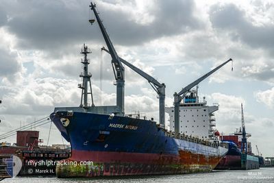
PUERTO LIMON EXPRESS
Container Ship
Current Trip
| Time Travelled | 18 h, 24 mins |
|---|---|
| Remaining Time | 16 h, 35 mins |
| Distance Travelled | 220.64 nm |
| Remaining Distance | 199.42 nm |
| AVG Speed | 12.3 Noeuds |
| MAX Speed | 18.1 Noeuds |
| AVG Wind | 7.5 knots |
| MAX Wind | 9.9 knots |
| MIN Temp | 9.5°C / 49.1°F |
| MAX Temp | 13.7°C / 56.66°F |
| Tirant d eau | 8.2 m |
| Position reçue | Maintenant |
Current Position
| Longitude | 4.85297° |
|---|---|
| Latitude | 53.44868° |
| Etat | Under way using engine |
| Vitesse | 12.2 Noeuds |
| Parcours | 63° |
| Zone | North Sea |
| Station | T-AIS |
| Position reçue | Maintenant |
Info
Information
The current position of PUERTO LIMON EXPRESS is in North Sea with coordinates 53.44868° / 4.85297° as reported on 2024-06-06 19:46 by AIS to our vessel tracker app. The vessel's current speed is 12.2 Noeuds and is heading at the port of HAMBURG. The estimated time of arrival as calculated by MyShipTracking vessel tracking app is 2024-06-07 14:22 LT
The vessel PUERTO LIMON EXPRESS (IMO: 9434943, MMSI: 477634900) is a Container Ship that was built in 2009 ( 15 Age ). It's sailing under the flag of [HK] Hong Kong.
In this page you can find informations about the vessels current position, last detected port calls, and current voyage information. If the vessels is not in coverage by AIS you will find the latest position.
The current position of PUERTO LIMON EXPRESS is detected by our AIS receivers and we are not responsible for the reliability of the data. The last position was recorded while the vessel was in Coverage by the Ais receivers of our vessel tracking app.
The current draught of PUERTO LIMON EXPRESS as reported by AIS is 8.2 meters
Weather
| Temperature | 12.3°C / 54.14°F |
|---|---|
| Wind Speed | 9 knots |
| Direction | 279° W |
| Pressure | 1017.5 hPa |
| Humidity | 65.3 % |
| Cloud Coverage | --- |
Featured Company
Last Port Calls
| Port | Arrival | Departure | Time In Port |
|---|---|---|---|
| 2024-06-05 16:54 | 2024-06-06 02:23 | 9 h | |
| 2024-06-04 08:50 | 2024-06-05 05:20 | 20 h | |
| 2024-05-23 12:07 | 2024-05-24 07:06 | 18 h | |
| 2024-05-17 11:45 | 2024-05-17 19:57 | 8 h | |
| 2024-05-13 10:46 | 2024-05-14 03:55 | 17 h | |
| 2024-05-08 09:17 | 2024-05-09 05:50 | 20 h | |
| 2024-05-04 06:53 | 2024-05-04 20:06 | 13 h | |
| 2024-04-23 12:21 | 2024-04-24 02:44 | 14 h | |
| 2024-04-21 17:35 | 2024-04-22 12:03 | 18 h | |
| 2024-04-19 04:23 | 2024-04-19 19:06 | 14 h |
Most Visited Ports (Last year)
| Port | Arrivals | |
|---|---|---|
| 13 | ||
| 8 | ||
| 8 | ||
| 8 | ||
| 7 | ||
| 7 |
Last Trips
| Origin | Departure | Destination | Arrival | Distance | |
|---|---|---|---|---|---|
| 2024-06-05 05:20 | 2024-06-05 16:54 | 181.78 nm | |||
| 2024-05-24 07:06 | 2024-06-04 08:50 | 4044.46 nm | |||
| 2024-05-17 19:57 | 2024-05-23 12:07 | 1474.01 nm | |||
| 2024-05-14 03:55 | 2024-05-17 11:45 | 488.68 nm | |||
| 2024-05-09 05:50 | 2024-05-13 10:46 | 1345.21 nm | |||
| 2024-05-04 20:06 | 2024-05-08 09:17 | 807.72 nm | |||
| 2024-04-24 02:44 | 2024-05-04 06:53 | 3054.97 nm | |||
| 2024-04-22 12:03 | 2024-04-23 12:21 | 132.30 nm | |||
| 2024-04-19 19:06 | 2024-04-21 17:35 | 431.29 nm | |||
| 2024-04-17 21:37 | 2024-04-19 04:23 | 415.16 nm |
Events
| Heure | Evenement | Détails | Position/ Destination | Info |
|---|---|---|---|---|
| 2024-06-06 16:17 | Changement d'ETA | 2024/06/07 12:30 2024/06/07 14:00 |
52.85043 / 4.25705
DEHAM
|
Vitesse: 12.5 kn Parcours: 44° |
| 2024-06-06 12:08 | Etat Changé | Under way using engine Default |
52.23580 / 3.29587
DEHAM
|
Vitesse: 9 kn Parcours: 51° |
| 2024-06-06 12:08 | Dans la zone couverte |
52.23580 / 3.29587
North Sea
DEHAM
|
Vitesse: 12 kn Parcours: 43° |
|
| 2024-06-06 10:58 | Etat Changé | Default Under way using engine |
52.07933 / 3.07242
DEHAM
|
Vitesse: 10.9 kn Parcours: 37° |
| 2024-06-06 10:53 | Hors de la zone couverte |
52.06760 / 3.05788
North Sea
DEHAM
|
Vitesse: 10.9 kn Parcours: 37° |
|
| 2024-06-06 08:35 | Changement de zone | Dutch part of the North Sea Belgian part of the North Sea |
51.81200 / 2.65015
North Sea
DEHAM
|
Vitesse: 10.1 kn Parcours: 43° |
| 2024-06-06 08:08 | Changement de zone | Belgian part of the North Sea United Kingdom part of the North Sea |
51.83722 / 2.51683
North Sea
DEHAM
|
Vitesse: 11.8 kn Parcours: 114° |
| 2024-06-06 01:23 | Etat Changé | Under way using engine Moored |
51.50028 / .49418
DEHAM
|
Vitesse: 3.4 kn Parcours: 118° |
| 2024-06-06 01:23 | Démarrage |
51.50052 / .49378
[GB] THAMES
|
Vitesse: 3.1 kn Parcours: 127° |
|
| 2024-06-06 01:23 | PORT DE DEPART |
|
51.50043 / .49392
DEHAM
|
Vitesse: 3.1 kn Parcours: 127° |