
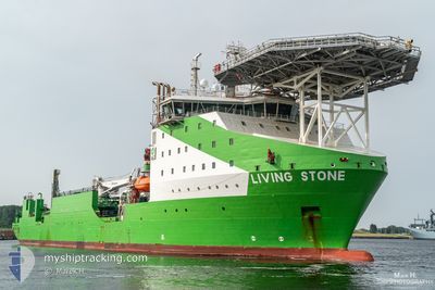
LIVING STONE
Other Type
Current Trip
ROTTERDAM,NL
| Time Travelled | 16 days |
|---|---|
| Remaining Time | --- |
| Distance Travelled | 1154.34 nm |
| Remaining Distance | --- |
| AVG Speed | 10.6 Noeuds |
| MAX Speed | 13.4 Noeuds |
| AVG Wind | 11.3 knots |
| MAX Wind | 23.9 knots |
| MIN Temp | -1.9°C / 28.58°F |
| MAX Temp | 10.5°C / 50.9°F |
| Tirant d eau | 6.5 m |
| Position reçue | 2 m depuis |
Current Position
| Longitude | 24.35208° |
|---|---|
| Latitude | 60.08490° |
| Etat | Moored |
| Vitesse | |
| Parcours | 177° |
| Zone | Gulf of Finland |
| Station | T-AIS |
| Position reçue | 2 m depuis |
Info
Information
The current position of LIVING STONE is in Gulf of Finland with coordinates 60.08490° / 24.35208° as reported on 2024-05-01 07:47 by AIS to our vessel tracker app. The vessel's current speed is 0 Noeuds
The vessel LIVING STONE (IMO: 9776925, MMSI: 244010952) is a Other Type It's sailing under the flag of [NL] Netherlands.
In this page you can find informations about the vessels current position, last detected port calls, and current voyage information. If the vessels is not in coverage by AIS you will find the latest position.
The current position of LIVING STONE is detected by our AIS receivers and we are not responsible for the reliability of the data. The last position was recorded while the vessel was in Coverage by the Ais receivers of our vessel tracking app.
The current draught of LIVING STONE as reported by AIS is 6.5 meters
Weather
| Temperature | 7.2°C / 44.96°F |
|---|---|
| Wind Speed | 9 knots |
| Direction | 91° E |
| Pressure | 1029.8 hPa |
| Humidity | 75.5 % |
| Cloud Coverage | --- |
Featured Company
Last Port Calls
| Port | Arrival | Departure | Time In Port |
|---|---|---|---|
| 2024-04-14 13:31 | 2024-04-14 20:08 | 6 h | |
| 2024-04-11 06:07 | 2024-04-14 13:26 | 3 d | |
| 2024-04-10 15:46 | 2024-04-11 05:51 | 14 h |
Most Visited Ports (Last year)
| Port | Arrivals | |
|---|---|---|
| 5 | ||
| 3 | ||
| 2 | ||
| 2 | ||
| 2 | ||
| 1 |
Last Trips
| Origin | Departure | Destination | Arrival | Distance | |
|---|---|---|---|---|---|
| 2024-04-14 15:26 | 2024-04-14 15:31 | 0.69 nm | |||
| 2024-04-11 07:51 | 2024-04-11 08:07 | 1.96 nm | |||
| 2024-02-02 17:38 | 2024-04-10 17:46 | 838.21 nm |
Events
| Heure | Evenement | Détails | Position/ Destination | Info |
|---|---|---|---|---|
| 2024-05-01 07:42 | Tirant d'eau modifié | 6.5 5.7 |
60.08490 / 24.35207
ROTTERDAM,NL
|
Vitesse: Parcours: 177° |
| 2024-05-01 07:42 | Changement de destination | ROTTERDAM,NL PIKKALA,FIN |
60.08490 / 24.35207
ROTTERDAM,NL
|
Vitesse: Parcours: 177° |
| 2024-05-01 07:42 | Changement d'ETA | 2024/05/05 18:00 2025/04/22 14:00 |
60.08490 / 24.35207
ROTTERDAM,NL
|
Vitesse: Parcours: 177° |
| 2024-05-01 00:03 | Changement d'ETA | 2025/04/22 14:00 2024/04/22 14:00 |
60.08490 / 24.35208
PIKKALA,FIN
|
Vitesse: Parcours: 177° |
| 2024-04-22 13:38 | Etat Changé | Moored Under way using engine |
60.08490 / 24.35208
PIKKALA,FIN
|
Vitesse: Parcours: 177° |
| 2024-04-22 11:41 | Arret | 13.55 nm, East of INKOO |
60.08367 / 24.35268
PIKKALA,FIN
|
Vitesse: 0.3 kn Parcours: 169° |
| 2024-04-22 11:28 | Démarrage | 13.63 nm, East of INKOO |
60.07908 / 24.35823
PIKKALA,FIN
|
Vitesse: 3.1 kn Parcours: 132° |
| 2024-04-22 11:20 | Arret | 13.72 nm, East of INKOO |
60.07745 / 24.36250
PIKKALA,FIN
|
Vitesse: 0.3 kn Parcours: 179° |
| 2024-04-22 11:11 | Démarrage | 14.07 nm, East of INKOO |
60.08202 / 24.37195
PIKKALA,FIN
|
Vitesse: 3.5 kn Parcours: 235° |
| 2024-04-22 09:03 | Etat Changé | Under way using engine Moored |
60.08333 / 24.37490
PIKKALA,FIN
|
Vitesse: Parcours: 231° |