
LINDE
General Cargo
Current Trip
| Time Travelled | 1 day |
|---|---|
| Remaining Time | 1 h, 14 mins |
| Distance Travelled | 262.69 nm |
| Remaining Distance | 11.43 nm |
| AVG Speed | 8.3 Noeuds |
| MAX Speed | 10.7 Noeuds |
| AVG Wind | 12 knots |
| MAX Wind | 19 knots |
| MIN Temp | 3.8°C / 38.84°F |
| MAX Temp | 12.3°C / 54.14°F |
| Tirant d eau | 6.1 m |
| Position reçue | 1 m depuis |
Current Position
| Longitude | 4.48817° |
|---|---|
| Latitude | 52.47010° |
| Etat | Under way using engine |
| Vitesse | 8.3 Noeuds |
| Parcours | 98° |
| Zone | North Sea |
| Station | T-AIS |
| Position reçue | 1 m depuis |
Info
Information
The current position of LINDE is in North Sea with coordinates 52.47010° / 4.48817° as reported on 2024-04-28 02:12 by AIS to our vessel tracker app. The vessel's current speed is 8.3 Noeuds and is heading at the port of AMSTERDAM. The estimated time of arrival as calculated by MyShipTracking vessel tracking app is 2024-04-28 03:27 LT
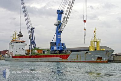
The vessel LINDE (IMO: 9141352, MMSI: 304052000) is a General Cargo that was built in 1998 ( 26 Age ). It's sailing under the flag of [AG] Antigua Barbuda.
In this page you can find informations about the vessels current position, last detected port calls, and current voyage information. If the vessels is not in coverage by AIS you will find the latest position.
The current position of LINDE is detected by our AIS receivers and we are not responsible for the reliability of the data. The last position was recorded while the vessel was in Coverage by the Ais receivers of our vessel tracking app.
The current draught of LINDE as reported by AIS is 6.1 meters
Weather
| Temperature | 12.4°C / 54.32°F |
|---|---|
| Wind Speed | 17 knots |
| Direction | 145° SE |
| Pressure | 1001.9 hPa |
| Humidity | 79.6 % |
| Cloud Coverage | 100 % |
Featured Company
Last Port Calls
| Port | Arrival | Departure | Time In Port |
|---|---|---|---|
| 2024-04-25 14:57 | 2024-04-26 18:58 | 1 d | |
| 2024-04-20 12:14 | 2024-04-23 20:36 | 3 d | |
| 2024-04-17 20:36 | 2024-04-19 03:23 | 1 d | |
| 2024-04-15 01:02 | 2024-04-16 12:04 | 1 d | |
| 2024-04-10 07:22 | 2024-04-12 17:14 | 2 d | |
| 2024-04-05 15:37 | 2024-04-08 17:59 | 3 d | |
| 2024-03-27 20:06 | 2024-03-29 11:32 | 1 d | |
| 2024-03-26 20:12 | |||
| 2024-03-20 19:52 | 2024-03-23 04:10 | 2 d | |
| 2024-03-19 21:33 |
Last Trips
| Origin | Departure | Destination | Arrival | Distance | |
|---|---|---|---|---|---|
| 2024-04-23 22:36 | 2024-04-25 15:57 | 297.34 nm | |||
| 2024-04-19 04:23 | 2024-04-20 14:14 | 259.30 nm | |||
| 2024-04-16 13:04 | 2024-04-17 21:36 | 235.30 nm | |||
| 2024-04-12 18:14 | 2024-04-15 02:02 | 468.50 nm | |||
| 2024-04-08 18:59 | 2024-04-10 08:22 | 303.92 nm | |||
| 2024-03-29 12:32 | 2024-04-05 16:37 | 770.23 nm | |||
| 2024-03-26 21:12 | 2024-03-27 21:06 | 199.33 nm | |||
| 2024-03-19 22:33 | 2024-03-20 20:52 | 214.12 nm | |||
| 2024-03-11 23:10 | 2024-03-13 00:15 | 185.59 nm | |||
| 2024-03-06 22:57 | 2024-03-09 06:01 | 235.36 nm |
Events
| Heure | Evenement | Détails | Position/ Destination | Info |
|---|---|---|---|---|
| 2024-04-28 01:16 | Etat Changé | Under way using engine Default |
52.47897 / 4.28350
NLAMS
|
Vitesse: 8.2 kn Parcours: 94° |
| 2024-04-28 01:10 | Etat Changé | Default Under way using engine |
52.48082 / 4.26180
NLAMS
|
Vitesse: 8.1 kn Parcours: 93° |
| 2024-04-28 00:07 | Etat Changé | Under way using engine Default |
52.46605 / 4.03467
NLAMS
|
Vitesse: 7.6 kn Parcours: 77° |
| 2024-04-27 23:52 | Etat Changé | Default Under way using engine |
52.45968 / 3.98490
NLAMS
|
Vitesse: 7.6 kn Parcours: 78° |
| 2024-04-27 23:13 | Detecté en mer | Dutch part of the North Sea |
52.44372 / 3.84920
North Sea
NLAMS
|
Vitesse: 7.7 kn Parcours: 81° |
| 2024-04-27 23:13 | Etat Changé | Under way using engine Default |
52.44372 / 3.84920
NLAMS
|
Vitesse: 7.6 kn Parcours: 81° |
| 2024-04-27 23:13 | Dans la zone couverte |
52.44372 / 3.84920
North Sea
NLAMS
|
Vitesse: 7.7 kn Parcours: 81° |
|
| 2024-04-27 17:56 | Etat Changé | Default Under way using engine |
52.63106 / 2.67625
NLAMS
|
Vitesse: 7.9 kn Parcours: 112° |
| 2024-04-27 17:51 | Hors de la zone couverte |
52.63505 / 2.65572
North Sea
NLAMS
|
Vitesse: 7.9 kn Parcours: 112° |
|
| 2024-04-27 17:48 | Etat Changé | Under way using engine Default |
52.63723 / 2.64728
NLAMS
|
Vitesse: 8.2 kn Parcours: 109° |