
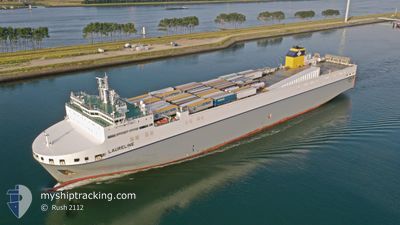
LAURELINE
Other Type
Current Trip
| Time Travelled | 22 h, 20 mins |
|---|---|
| Remaining Time | 2 days |
| Distance Travelled | 279.68 nm |
| Remaining Distance | 748.57 nm |
| AVG Speed | 13.4 Noeuds |
| MAX Speed | 17 Noeuds |
| AVG Wind | 9.6 knots |
| MAX Wind | 16.9 knots |
| MIN Temp | 12.3°C / 54.14°F |
| MAX Temp | 20.3°C / 68.54°F |
| Tirant d eau | 7.4 m |
| Position reçue | 2 m depuis |
Current Position
| Longitude | -0.93426° |
|---|---|
| Latitude | 49.60142° |
| Etat | At anchor |
| Vitesse | 0.1 Noeuds |
| Parcours | 168° |
| Zone | English Channel |
| Station | T-AIS |
| Position reçue | 2 m depuis |
Info
Information
The current position of LAURELINE is in English Channel with coordinates 49.60142° / -0.93426° as reported on 2024-05-14 09:02 by AIS to our vessel tracker app. The vessel's current speed is 0.1 Noeuds and is heading at the port of LEIXOES. The estimated time of arrival as calculated by MyShipTracking vessel tracking app is 2024-05-16 20:03 LT
The vessel LAURELINE (IMO: 9823352, MMSI: 248743000) is a Other Type It's sailing under the flag of [MT] Malta.
In this page you can find informations about the vessels current position, last detected port calls, and current voyage information. If the vessels is not in coverage by AIS you will find the latest position.
The current position of LAURELINE is detected by our AIS receivers and we are not responsible for the reliability of the data. The last position was recorded while the vessel was in Coverage by the Ais receivers of our vessel tracking app.
The current draught of LAURELINE as reported by AIS is 7.4 meters
Weather
| Temperature | 13.2°C / 55.76°F |
|---|---|
| Wind Speed | 16 knots |
| Direction | 167° SSE |
| Pressure | 1000.1 hPa |
| Humidity | 85.3 % |
| Cloud Coverage | 100 % |
Featured Company
Last Port Calls
| Port | Arrival | Departure | Time In Port |
|---|---|---|---|
| 2024-05-11 21:30 | 2024-05-13 10:45 | 1 d | |
| 2024-05-11 20:27 | 2024-05-11 21:14 | 47 m | |
| 2024-05-11 08:23 | 2024-05-11 14:15 | 5 h | |
| 2024-05-08 05:15 | 2024-05-08 22:11 | 16 h | |
| 2024-05-05 09:08 | 2024-05-05 17:36 | 8 h | |
| 2024-05-05 08:03 | 2024-05-05 08:55 | 51 m | |
| 2024-05-02 05:02 | 2024-05-02 21:50 | 16 h | |
| 2024-04-27 21:40 | 2024-04-28 21:34 | 23 h | |
| 2024-04-27 20:42 | 2024-04-27 21:29 | 47 m | |
| 2024-04-27 08:19 | 2024-04-27 15:13 | 6 h |
Last Trips
| Origin | Departure | Destination | Arrival | Distance | |
|---|---|---|---|---|---|
| 2024-05-11 23:14 | 2024-05-11 23:30 | 0.65 nm | |||
| 2024-05-11 16:15 | 2024-05-11 22:27 | 91.32 nm | |||
| 2024-05-08 23:11 | 2024-05-11 10:23 | 896.38 nm | |||
| 2024-05-05 19:36 | 2024-05-08 06:15 | 982.79 nm | |||
| 2024-05-05 10:55 | 2024-05-05 11:08 | 0.77 nm | |||
| 2024-05-02 22:50 | 2024-05-05 10:03 | 950.68 nm | |||
| 2024-04-28 23:34 | 2024-05-02 06:02 | 986.17 nm | |||
| 2024-04-27 23:29 | 2024-04-27 23:40 | 0.66 nm | |||
| 2024-04-27 17:13 | 2024-04-27 22:42 | 88.30 nm | |||
| 2024-04-25 00:07 | 2024-04-27 10:19 | 897.88 nm |
Events
| Heure | Evenement | Détails | Position/ Destination | Info |
|---|---|---|---|---|
| 2024-05-14 07:56 | Etat Changé | At anchor Under way using engine |
49.60007 / -.93362
PTLEI PILOT
|
Vitesse: 0.2 kn Parcours: 142° |
| 2024-05-14 07:55 | Arret | 12.35 nm, East of ILE DE TATIHOU |
49.59999 / -.93351
PTLEI PILOT
|
Vitesse: 0.3 kn Parcours: 145° |
| 2024-05-14 05:16 | Changement de zone | French part of the English Channel United Kingdom part of the English Channel |
50.13087 / -.92264
English Channel
PTLEI PILOT
|
Vitesse: 14 kn Parcours: 182.1° |
| 2024-05-13 19:55 | Changement de zone | United Kingdom part of the English Channel United Kingdom part of the North Sea |
51.07918 / 1.46913
English Channel
PTLEI PILOT
|
Vitesse: 12.8 kn Parcours: 233.2° |
| 2024-05-13 15:37 | Changement de zone | United Kingdom part of the North Sea Belgian part of the North Sea |
51.85309 / 2.51837
North Sea
PTLEI PILOT
|
Vitesse: 16.4 kn Parcours: 230.4° |
| 2024-05-13 15:35 | Changement de zone | Belgian part of the North Sea Dutch part of the North Sea |
51.85925 / 2.53019
North Sea
PTLEI PILOT
|
Vitesse: 16.4 kn Parcours: 230.4° |
| 2024-05-13 10:45 | PORT DE DEPART |
|
51.90579 / 4.22602
PTLEI PILOT
|
Vitesse: 4.3 kn Parcours: 348° |
| 2024-05-13 10:22 | Démarrage |
51.89537 / 4.23773
[NL] ROZENBURG
|
Vitesse: 3.2 kn Parcours: 97° |
|
| 2024-05-13 09:50 | Tirant d'eau modifié | 7.4 7.1 |
51.89523 / 4.24313
[NL] ROZENBURG
|
Vitesse: Parcours: 107° |
| 2024-05-13 09:50 | Changement d'ETA | 2024/05/17 06:00 2024/05/16 06:00 |
51.89523 / 4.24313
[NL] ROZENBURG
|
Vitesse: Parcours: 107° |