
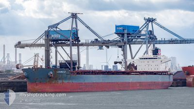
LAURA D
Cargo
Current Trip
INDMQ
| Time Travelled | 9 days |
|---|---|
| Remaining Time | --- |
| Distance Travelled | 2216.99 nm |
| Remaining Distance | --- |
| AVG Speed | 9.9 Noeuds |
| MAX Speed | 12.9 Noeuds |
| AVG Wind | 7.6 knots |
| MAX Wind | 26.8 knots |
| MIN Temp | 26.3°C / 79.34°F |
| MAX Temp | 30.4°C / 86.72°F |
| Tirant d eau | 14.4 m |
| Position reçue | 2 d depuis |
Current Position
| Longitude | 77.29583° |
|---|---|
| Latitude | 7.62750° |
| Etat | Under way using engine |
| Vitesse | 9.9 Noeuds |
| Parcours | 127° |
| Zone | Laccadive Sea |
| Station | T-AIS |
| Position reçue | 2 d depuis |
Info
Information
The current position of LAURA D is in Laccadive Sea with coordinates 7.62750° / 77.29583° as reported on 2024-05-16 18:12 by AIS to our vessel tracker app. The vessel's current speed is 9.9 Noeuds
The vessel LAURA D (IMO: 9589633, MMSI: 255915640) is a Cargo It's sailing under the flag of [PT] Portugal.
In this page you can find informations about the vessels current position, last detected port calls, and current voyage information. If the vessels is not in coverage by AIS you will find the latest position.
The current position of LAURA D is detected by our AIS receivers and we are not responsible for the reliability of the data. The last position was recorded while the vessel was in Coverage by the Ais receivers of our vessel tracking app.
The current draught of LAURA D as reported by AIS is 14.4 meters
Weather
| Temperature | 28.3°C / 82.94°F |
|---|---|
| Wind Speed | 6 knots |
| Direction | 225° SW |
| Pressure | 1005.3 hPa |
| Humidity | 79.8 % |
| Cloud Coverage | 100 % |
Featured Company
Events
| Heure | Evenement | Détails | Position/ Destination | Info |
|---|---|---|---|---|
| 2024-05-16 18:39 | Etat Changé | Default Under way using engine |
7.58249 / 77.35623
INDMQ
|
Vitesse: 9.9 kn Parcours: 127° |
| 2024-05-16 18:12 | Hors de la zone couverte |
7.62750 / 77.29583
Laccadive Sea
INDMQ
|
Vitesse: 9.9 kn Parcours: 127° |
|
| 2024-05-16 17:57 | Etat Changé | Under way using engine Default |
7.65321 / 77.26172
INDMQ
|
Vitesse: 10.1 kn Parcours: 124° |
| 2024-05-16 17:25 | Etat Changé | Default Under way using engine |
7.70160 / 77.18776
INDMQ
|
Vitesse: 9.9 kn Parcours: 124° |
| 2024-05-16 12:46 | Changement d'ETA | 2024/05/22 06:00 2024/05/22 12:00 |
8.18318 / 76.56336
INDMQ
|
Vitesse: 10 kn Parcours: 125° |
| 2024-05-16 11:40 | Changement de zone | Indian part of the Laccadive Sea Iranian part of the Gulf of Oman |
8.29690 / 76.42320
Laccadive Sea
INDMQ
|
Vitesse: 9.9 kn Parcours: 134° |
| 2024-05-16 11:40 | Etat Changé | Under way using engine Default |
8.29690 / 76.42320
INDMQ
|
Vitesse: 10.3 kn Parcours: 128° |
| 2024-05-16 11:40 | Dans la zone couverte |
8.29690 / 76.42320
Laccadive Sea
INDMQ
|
Vitesse: 9.9 kn Parcours: 134° |
|
| 2024-05-10 05:45 | Etat Changé | Default Under way using engine |
25.66283 / 57.14467
INDMQ
|
Vitesse: 9.1 kn Parcours: 143.1° |
| 2024-05-10 05:43 | Hors de la zone couverte |
25.66622 / 57.14177
Gulf of Oman
INDMQ
|
Vitesse: 9.1 kn Parcours: 143.1° |