
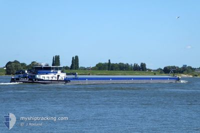
LAILA-M
Cargo
Current Trip
| Time Travelled | 2 days |
|---|---|
| Remaining Time | 4 days |
| Distance Travelled | 303.32 nm |
| Remaining Distance | 325.58 nm |
| AVG Speed | 10 Noeuds |
| MAX Speed | 11.3 Noeuds |
| AVG Wind | 4.9 knots |
| MAX Wind | 15 knots |
| MIN Temp | 0.7°C / 33.26°F |
| MAX Temp | 7.4°C / 45.32°F |
| Tirant d eau | 0 m |
| Position reçue | Maintenant |
Current Position
| Longitude | --- |
|---|---|
| Latitude | --- |
| Etat | Under way using engine |
| Vitesse | |
| Parcours | --- |
| Zone | North Sea |
| Station | T-AIS |
| Position reçue | Maintenant |
Info
Information
The current position of LAILA-M is in North Sea with coordinates 51.91130° / 5.44734° as reported on 2025-12-06 23:08 by AIS to our vessel tracker app. The vessel's current speed is 0 Noeuds and is heading at the port of KEHL. The estimated time of arrival as calculated by MyShipTracking vessel tracking app is 2025-12-11 05:00 LT
The vessel LAILA-M (MMSI: 205058100) is a Cargo It's sailing under the flag of [BE] Belgium.
In this page you can find informations about the vessels current position, last detected port calls, and current voyage information. If the vessels is not in coverage by AIS you will find the latest position.
The current position of LAILA-M is detected by our AIS receivers and we are not responsible for the reliability of the data. The last position was recorded while the vessel was in Coverage by the Ais receivers of our vessel tracking app.
Weather
| Temperature | 10.1°C / 50.18°F |
|---|---|
| Wind Speed | 16 knots |
| Direction | 229° SW |
| Pressure | 1003.1 hPa |
| Humidity | 88.5 % |
| Cloud Coverage | 100 % |
Featured Company
Last Port Calls
| Port | Arrival | Departure | Time In Port |
|---|---|---|---|
| 2025-12-04 12:51 | |||
| 2025-12-03 09:38 | |||
| 2025-12-03 09:38 | |||
| 2025-11-30 11:19 | |||
| 2025-11-27 11:23 | 2025-11-27 11:50 | 27 m | |
| 2025-11-26 16:30 | 2025-11-27 11:18 | 18 h | |
| 2025-11-25 05:39 | 2025-11-25 06:04 | 25 m | |
| 2025-11-21 21:36 | 2025-11-25 03:54 | 3 d | |
| 2025-11-21 19:18 | 2025-11-21 19:57 | 39 m | |
| 2025-11-21 03:54 | 2025-11-21 04:10 | 16 m |
Most Visited Ports (Last year)
| Port | Arrivals | |
|---|---|---|
| 22 | ||
| 13 | ||
| 13 | ||
| 13 | ||
| 12 | ||
| 12 |
Last Trips
| Origin | Departure | Destination | Arrival | Distance | |
|---|---|---|---|---|---|
| 2025-12-03 09:38 | 2025-12-03 09:38 | --- | |||
| 2025-11-27 11:50 | 2025-11-30 11:19 | 221.32 nm | |||
| 2025-11-27 11:18 | 2025-11-27 11:23 | 0.20 nm | |||
| 2025-11-25 06:04 | 2025-11-26 16:30 | 169.36 nm | |||
| 2025-11-25 03:54 | 2025-11-25 05:39 | 18.28 nm | |||
| 2025-11-21 19:57 | 2025-11-21 21:36 | 17.81 nm | |||
| 2025-11-21 04:10 | 2025-11-21 19:18 | 69.32 nm | |||
| 2025-11-20 19:22 | 2025-11-21 03:54 | 71.04 nm | |||
| 2025-11-16 04:17 | 2025-11-19 22:45 | 78.22 nm | |||
| 2025-11-11 14:07 | 2025-11-15 19:31 | 261.16 nm |
Events
| Heure | Evenement | Détails | Position/ Destination | Info |
|---|---|---|---|---|
| 2025-12-05 22:00 | Arret | 1.25 nm, North of TIEL |
51.90696 / 5.45190
KEHL
|
Vitesse: 0.2 kn Parcours: 511° |
| 2025-12-05 21:54 | Démarrage | 1.06 nm, North of TIEL |
51.90336 / 5.45362
KEHL
|
Vitesse: 3.5 kn Parcours: 337.4° |
| 2025-12-05 21:41 | Arret | 0.97 nm, North East of TIEL |
51.90148 / 5.45462
KEHL
|
Vitesse: 0.2 kn Parcours: 511° |
| 2025-12-05 18:27 | Etat Changé | Under way using engine Default |
51.83149 / 6.19042
KEHL
|
Vitesse: 10.4 kn Parcours: 284° |
| 2025-12-05 17:59 | Etat Changé | Default Under way using engine |
51.80500 / 6.30167
KEHL
|
Vitesse: 10 kn Parcours: 327.4° |
| 2025-12-05 17:55 | Etat Changé | Under way using engine Default |
51.79695 / 6.31531
KEHL
|
Vitesse: 10 kn Parcours: 287° |
| 2025-12-05 17:55 | Dans la zone couverte |
51.79695 / 6.31531
North Sea
|
Vitesse: 10 kn Parcours: 327.4° |
|
| 2025-12-05 16:59 | Etat Changé | Default Under way using engine |
51.70667 / 6.44500
KEHL
|
Vitesse: 10.4 kn Parcours: 263.6° |
| 2025-12-05 16:34 | Hors de la zone couverte |
51.66212 / 6.51338
North Sea
|
Vitesse: 10.4 kn Parcours: 263.6° |
|
| 2025-12-05 12:07 | Etat Changé | Under way using engine Default |
51.19917 / 6.73079
KEHL
|
Vitesse: 10.1 kn Parcours: 340° |