
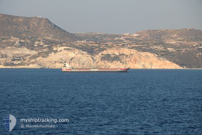
LAGANBORG
General Cargo
Current Trip
| Time Travelled | 2 days |
|---|---|
| Remaining Time | 20 h, 2 mins |
| Distance Travelled | 537.21 nm |
| Remaining Distance | 231.09 nm |
| AVG Speed | 11.1 Noeuds |
| MAX Speed | 12 Noeuds |
| AVG Wind | 6.5 knots |
| MAX Wind | 13 knots |
| MIN Temp | -1°C / 30.2°F |
| MAX Temp | 10.2°C / 50.36°F |
| Tirant d eau | 5.7 m |
| Position reçue | 13 m depuis |
Current Position
| Longitude | 17.01054° |
|---|---|
| Latitude | 56.52925° |
| Etat | Under way using engine |
| Vitesse | 11.5 Noeuds |
| Parcours | 201.6° |
| Zone | Baltic Sea |
| Station | T-AIS |
| Position reçue | 13 m depuis |
Info
Information
The current position of LAGANBORG is in Baltic Sea with coordinates 56.52925° / 17.01054° as reported on 2024-05-04 22:46 by AIS to our vessel tracker app. The vessel's current speed is 11.5 Noeuds and is heading at the port of ROSTOCK. The estimated time of arrival as calculated by MyShipTracking vessel tracking app is 2024-05-05 19:01 LT
The vessel LAGANBORG (IMO: 9407419, MMSI: 244297000) is a General Cargo that was built in 2008 ( 16 Age ). It's sailing under the flag of [NL] Netherlands.
In this page you can find informations about the vessels current position, last detected port calls, and current voyage information. If the vessels is not in coverage by AIS you will find the latest position.
The current position of LAGANBORG is detected by our AIS receivers and we are not responsible for the reliability of the data. The last position was recorded while the vessel was in Coverage by the Ais receivers of our vessel tracking app.
The current draught of LAGANBORG as reported by AIS is 5.7 meters
Weather
| Temperature | 7.3°C / 45.14°F |
|---|---|
| Wind Speed | 9 knots |
| Direction | 212° SSW |
| Pressure | 1013.6 hPa |
| Humidity | 91.2 % |
| Cloud Coverage | 100 % |
Featured Company
Last Port Calls
| Port | Arrival | Departure | Time In Port |
|---|---|---|---|
| 2024-04-29 11:05 | 2024-05-02 22:34 | 3 d | |
| 2024-04-26 08:18 | 2024-04-26 08:21 | 3 m | |
| 2024-04-23 02:14 | 2024-04-24 14:31 | 1 d | |
| 2024-04-22 23:19 | 2024-04-23 00:36 | 1 h | |
| 2024-04-22 04:58 | 2024-04-22 22:43 | 17 h | |
| 2024-04-22 04:25 | 2024-04-22 04:37 | 12 m | |
| 2024-04-20 09:25 | 2024-04-20 10:26 | 1 h | |
| 2024-04-11 04:01 | 2024-04-16 16:55 | 5 d | |
| 2024-03-24 22:18 | 2024-03-26 19:14 | 1 d | |
| 2024-03-21 02:30 | 2024-03-22 11:22 | 1 d |
Last Trips
| Origin | Departure | Destination | Arrival | Distance | |
|---|---|---|---|---|---|
| 2024-04-26 10:21 | 2024-04-29 14:05 | 840.15 nm | |||
| 2024-04-24 16:31 | 2024-04-26 10:18 | 390.50 nm | |||
| 2024-04-23 02:36 | 2024-04-23 04:14 | 23.27 nm | |||
| 2024-04-23 00:43 | 2024-04-23 01:19 | 1.65 nm | |||
| 2024-04-22 06:37 | 2024-04-22 06:58 | 1.48 nm | |||
| 2024-04-20 12:26 | 2024-04-22 06:25 | 381.94 nm | |||
| 2024-04-16 19:55 | 2024-04-20 11:25 | 954.45 nm | |||
| 2024-03-26 20:14 | 2024-04-11 07:01 | 1497.71 nm | |||
| 2024-03-22 12:22 | 2024-03-24 23:18 | 547.23 nm | |||
| 2024-03-14 02:49 | 2024-03-21 03:30 | 421.10 nm |
Events
| Heure | Evenement | Détails | Position/ Destination | Info |
|---|---|---|---|---|
| 2024-05-04 22:23 | Etat Changé | Under way using engine Default |
56.59735 / 17.05938
DE RSK
|
Vitesse: 11.3 kn Parcours: 203° |
| 2024-05-04 22:23 | Dans la zone couverte |
56.59636 / 17.05868
Baltic Sea
DE RSK
|
Vitesse: 11.5 kn Parcours: 202.1° |
|
| 2024-05-04 19:06 | Etat Changé | Default Under way using engine |
57.16856 / 17.48094
DE RSK
|
Vitesse: 11.5 kn Parcours: 197.5° |
| 2024-05-04 19:01 | Hors de la zone couverte |
57.18315 / 17.48910
Baltic Sea
DE RSK
|
Vitesse: 11.5 kn Parcours: 197.5° |
|
| 2024-05-04 18:55 | Etat Changé | Under way using engine Default |
57.20242 / 17.50006
DE RSK
|
Vitesse: 11.6 kn Parcours: 197° |
| 2024-05-04 18:51 | Etat Changé | Default Under way using engine |
57.21321 / 17.50614
DE RSK
|
Vitesse: 11.6 kn Parcours: 196.9° |
| 2024-05-04 18:33 | Etat Changé | Under way using engine Default |
57.26851 / 17.53773
DE RSK
|
Vitesse: 11.7 kn Parcours: 197° |
| 2024-05-04 18:12 | Etat Changé | Default Under way using engine |
57.33174 / 17.57708
DE RSK
|
Vitesse: 11.3 kn Parcours: 201.1° |
| 2024-05-04 17:37 | Etat Changé | Under way using engine Default |
57.43382 / 17.64936
DE RSK
|
Vitesse: 11.4 kn Parcours: 204° |
| 2024-05-04 17:36 | Etat Changé | Default Under way using engine |
57.43671 / 17.65177
DE RSK
|
Vitesse: 11.6 kn Parcours: 216.2° |