
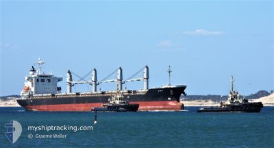
LADY MONICA
Bulk Carrier
Current Trip
| Time Travelled | 24 days |
|---|---|
| Remaining Time | 7 h, 48 mins |
| Distance Travelled | 2544.32 nm |
| Remaining Distance | 171.11 nm |
| AVG Speed | 10.9 Noeuds |
| MAX Speed | 13.9 Noeuds |
| AVG Wind | 7.7 knots |
| MAX Wind | 29.5 knots |
| MIN Temp | 8.3°C / 46.94°F |
| MAX Temp | 21.9°C / 71.42°F |
| Tirant d eau | 10.4 m |
| Position reçue | 8 h, 0 m depuis |
Current Position
| Longitude | --- |
|---|---|
| Latitude | --- |
| Etat | Under way using engine |
| Vitesse | 11.7 Noeuds |
| Parcours | 307° |
| Zone | Adriatic Sea |
| Station | T-AIS |
| Position reçue | 8 h, 0 m depuis |
Info
Information
The current position of LADY MONICA is in Adriatic Sea with coordinates 42.68662° / 15.64513° as reported on 2025-12-05 10:54 by AIS to our vessel tracker app. The vessel's current speed is 11.7 Noeuds and is heading at the port of RAVENNA. The estimated time of arrival as calculated by MyShipTracking vessel tracking app is 2025-12-06 03:43 LT
The vessel LADY MONICA (IMO: 9392078, MMSI: 354668000) is a Bulk Carrier that was built in 2009 ( 16 Age ). It's sailing under the flag of [PA] Panama.
In this page you can find informations about the vessels current position, last detected port calls, and current voyage information. If the vessels is not in coverage by AIS you will find the latest position.
The current position of LADY MONICA is detected by our AIS receivers and we are not responsible for the reliability of the data. The last position was recorded while the vessel was in Coverage by the Ais receivers of our vessel tracking app.
The current draught of LADY MONICA as reported by AIS is 10.4 meters
Weather
| Temperature | 13.7°C / 56.66°F |
|---|---|
| Wind Speed | 17 knots |
| Direction | 336° NNW |
| Pressure | 1008.7 hPa |
| Humidity | 72.4 % |
| Cloud Coverage | 100 % |
Featured Company
Events
| Heure | Evenement | Détails | Position/ Destination | Info |
|---|---|---|---|---|
| 2025-12-05 11:00 | Etat Changé | Default Under way using engine |
42.69960 / 15.62643
ITRAN
|
Vitesse: 11.7 kn Parcours: 307° |
| 2025-12-05 10:54 | Hors de la zone couverte |
42.68662 / 15.64513
Adriatic Sea
ITRAN
|
Vitesse: 11.7 kn Parcours: 307° |
|
| 2025-12-05 07:20 | Changement de zone | Croatian part of the Adriatic Sea Italian part of the Adriatic Sea |
42.20428 / 16.34428
Adriatic Sea
ITRAN
|
Vitesse: 12.1 kn Parcours: 314° |
| 2025-12-05 07:19 | Etat Changé | Under way using engine Default |
42.20265 / 16.34647
ITRAN
|
Vitesse: 11.9 kn Parcours: 311° |
| 2025-12-05 06:56 | Etat Changé | Default Under way using engine |
42.14953 / 16.42392
ITRAN
|
Vitesse: 12 kn Parcours: 311° |
| 2025-12-05 05:52 | Etat Changé | Under way using engine Default |
42.01040 / 16.63755
ITRAN
|
Vitesse: 12.1 kn Parcours: 311° |
| 2025-12-05 05:31 | Etat Changé | Default Under way using engine |
41.96363 / 16.70785
ITRAN
|
Vitesse: 12.2 kn Parcours: 312° |
| 2025-12-05 05:25 | Etat Changé | Under way using engine Default |
41.95040 / 16.72753
ITRAN
|
Vitesse: 12.2 kn Parcours: 312° |
| 2025-12-05 05:07 | Dans la zone couverte |
41.95040 / 16.72753
Adriatic Sea
ITRAN
|
Vitesse: 12.2 kn Parcours: 312° |
|
| 2025-12-04 19:58 | Hors de la zone couverte |
40.69808 / 18.60233
Adriatic Sea
ITRAN
|
Vitesse: 10.9 kn Parcours: 310° |