
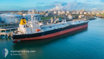
LADY HENRIETTA
Oil Products Tanker
Current Trip
| Time Travelled | 9 days |
|---|---|
| Remaining Time | 8 days |
| Distance Travelled | 2553.69 nm |
| Remaining Distance | 2257.46 nm |
| AVG Speed | 11.1 Noeuds |
| MAX Speed | 15 Noeuds |
| AVG Wind | 18.8 knots |
| MAX Wind | 36 knots |
| MIN Temp | 2.9°C / 37.22°F |
| MAX Temp | 15.7°C / 60.26°F |
| Tirant d eau | 14.4 m |
| Position reçue | 3 h, 17 m depuis |
Current Position
| Longitude | --- |
|---|---|
| Latitude | --- |
| Etat | Under way using engine |
| Vitesse | 11.2 Noeuds |
| Parcours | 166.3° |
| Zone | North Atlantic Ocean |
| Station | T-AIS |
| Position reçue | 3 h, 17 m depuis |
Info
Information
The current position of LADY HENRIETTA is in North Atlantic Ocean with coordinates 38.48177° / -10.13370° as reported on 2025-12-13 07:19 by AIS to our vessel tracker app. The vessel's current speed is 11.2 Noeuds and is heading at the port of PORT SAID. The estimated time of arrival as calculated by MyShipTracking vessel tracking app is 2025-12-21 12:40 LT
The vessel LADY HENRIETTA (IMO: 9604380, MMSI: 538010003) is a Oil Products Tanker that was built in 2012 ( 13 Age ). It's sailing under the flag of [MH] Marshall Is.
In this page you can find informations about the vessels current position, last detected port calls, and current voyage information. If the vessels is not in coverage by AIS you will find the latest position.
The current position of LADY HENRIETTA is detected by our AIS receivers and we are not responsible for the reliability of the data. The last position was recorded while the vessel was in Coverage by the Ais receivers of our vessel tracking app.
The current draught of LADY HENRIETTA as reported by AIS is 14.4 meters
Weather
| Temperature | 15.5°C / 59.9°F |
|---|---|
| Wind Speed | 23 knots |
| Direction | 54° NE |
| Pressure | 1018.6 hPa |
| Humidity | 79.1 % |
| Cloud Coverage | 73 % |
Featured Company
Events
| Heure | Evenement | Détails | Position/ Destination | Info |
|---|---|---|---|---|
| 2025-12-13 07:25 | Etat Changé | Default Under way using engine |
38.46250 / -10.12730
EG PSD
|
Vitesse: 11.2 kn Parcours: 166.3° |
| 2025-12-13 07:19 | Hors de la zone couverte |
38.48177 / -10.13370
North Atlantic Ocean
EG PSD
|
Vitesse: 11.2 kn Parcours: 166.3° |
|
| 2025-12-13 07:16 | Etat Changé | Under way using engine Default |
38.49154 / -10.13666
EG PSD
|
Vitesse: 12 kn Parcours: 166° |
| 2025-12-13 07:14 | Etat Changé | Default Under way using engine |
38.49833 / -10.13833
EG PSD
|
Vitesse: 11.6 kn Parcours: 163.4° |
| 2025-12-13 06:28 | Etat Changé | Under way using engine Default |
38.64667 / -10.19021
EG PSD
|
Vitesse: 12 kn Parcours: 159° |
| 2025-12-13 05:41 | Etat Changé | Default Under way using engine |
38.80333 / -10.20833
EG PSD
|
Vitesse: 11.5 kn Parcours: 180.8° |
| 2025-12-13 05:35 | Etat Changé | Under way using engine Default |
38.82456 / -10.20973
EG PSD
|
Vitesse: 11.7 kn Parcours: 184° |
| 2025-12-13 05:25 | Etat Changé | Default Under way using engine |
38.85536 / -10.20927
EG PSD
|
Vitesse: 11.6 kn Parcours: 181.1° |
| 2025-12-13 05:17 | Etat Changé | Under way using engine Default |
38.88057 / -10.20920
EG PSD
|
Vitesse: 11 kn Parcours: 183° |
| 2025-12-13 05:14 | Etat Changé | Default Under way using engine |
38.89167 / -10.20833
EG PSD
|
Vitesse: 11.6 kn Parcours: 180.4° |