
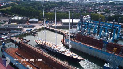
KORU
Pleasure Craft
Current Trip
CRUISING
| Time Travelled | 8 days |
|---|---|
| Remaining Time | --- |
| Distance Travelled | 388.01 nm |
| Remaining Distance | --- |
| AVG Speed | 13.1 Noeuds |
| MAX Speed | 14.1 Noeuds |
| AVG Wind | 6.2 knots |
| MAX Wind | 15.6 knots |
| MIN Temp | 21.8°C / 71.24°F |
| MAX Temp | 27.4°C / 81.32°F |
| Tirant d eau | 5.2 m |
| Position reçue | 3 d depuis |
Current Position
| Longitude | 23.81170° |
|---|---|
| Latitude | 37.80923° |
| Etat | Under way using engine |
| Vitesse | 4.5 Noeuds |
| Parcours | 224° |
| Zone | Aegean Sea |
| Station | T-AIS |
| Position reçue | 3 d depuis |
Info
Information
The current position of KORU is in Aegean Sea with coordinates 37.80923° / 23.81170° as reported on 2024-06-07 05:31 by AIS to our vessel tracker app. The vessel's current speed is 4.5 Noeuds
The vessel KORU (IMO: 9857298, MMSI: 319225400) is a Pleasure Craft It's sailing under the flag of [KY] Cayman Is.
In this page you can find informations about the vessels current position, last detected port calls, and current voyage information. If the vessels is not in coverage by AIS you will find the latest position.
The current position of KORU is detected by our AIS receivers and we are not responsible for the reliability of the data. The last position was recorded while the vessel was in Coverage by the Ais receivers of our vessel tracking app.
The current draught of KORU as reported by AIS is 5.2 meters
Weather
| Temperature | 23.3°C / 73.94°F |
|---|---|
| Wind Speed | 10 knots |
| Direction | 319° NW |
| Pressure | 1012.4 hPa |
| Humidity | 70.6 % |
| Cloud Coverage | --- |
Featured Company
Most Visited Ports (Last year)
| Port | Arrivals | |
|---|---|---|
| 4 | ||
| 4 | ||
| 2 | ||
| 2 | ||
| 2 | ||
| 1 |
Events
| Heure | Evenement | Détails | Position/ Destination | Info |
|---|---|---|---|---|
| 2024-06-07 05:31 | Hors de la zone couverte |
37.80923 / 23.81170
Aegean Sea
|
Vitesse: 4.5 kn Parcours: 225.2° |
|
| 2024-06-07 05:29 | Démarrage | 0.62 nm, South East of VARKIZA |
37.80990 / 23.81273
CRUISING
|
Vitesse: 3.5 kn Parcours: 235° |
| 2024-06-07 05:22 | Etat Changé | Under way using engine At anchor |
37.80985 / 23.81441
CRUISING
|
Vitesse: 0.4 kn Parcours: 356° |
| 2024-06-03 21:28 | Arret | 0.71 nm, South East of VARKIZA |
37.81019 / 23.81543
CRUISING
|
Vitesse: Parcours: 295° |
| 2024-06-03 21:22 | Etat Changé | At anchor Under way using engine |
37.81042 / 23.81475
CRUISING
|
Vitesse: 0.5 kn Parcours: 291° |
| 2024-06-03 13:50 | Changement de zone | Greek part of the Aegean Sea Greek part of the Ionian Sea |
36.39294 / 23.05829
Aegean Sea
|
Vitesse: 13.9 kn Parcours: 99.7° |
| 2024-06-03 13:50 | Dans la zone couverte |
36.39294 / 23.05829
Aegean Sea
|
Vitesse: 13.9 kn Parcours: 99.7° |
|
| 2024-06-03 03:04 | Hors de la zone couverte |
37.60488 / 20.73511
Ionian Sea
|
Vitesse: 13.4 kn Parcours: 137.1° |
|
| 2024-06-02 21:55 | Tirant d'eau modifié | 5.2 5 |
38.63331 / 20.28236
CRUISING
|
Vitesse: 13.5 kn Parcours: 183° |
| 2024-06-02 18:09 | Dans la zone couverte |
39.44132 / 20.13197
Ionian Sea
|
Vitesse: 13.5 kn Parcours: 149.8° |