
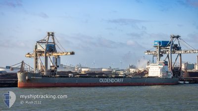
KIRSTEN OLDENDORFF
Cargo
Current Trip
| Time Travelled | 12 days |
|---|---|
| Remaining Time | --- |
| Distance Travelled | 3682.77 nm |
| Remaining Distance | --- |
| AVG Speed | 12.4 Noeuds |
| MAX Speed | 18.5 Noeuds |
| AVG Wind | 12.7 knots |
| MAX Wind | 31.9 knots |
| MIN Temp | 1.8°C / 35.24°F |
| MAX Temp | 25°C / 77°F |
| Tirant d eau | 7.6 m |
| Position reçue | 2 m depuis |
Current Position
| Longitude | -76.12239° |
|---|---|
| Latitude | 37.22805° |
| Etat | At anchor |
| Vitesse | |
| Parcours | 19° |
| Zone | North Atlantic Ocean |
| Station | T-AIS |
| Position reçue | 2 m depuis |
Info
Information
The current position of KIRSTEN OLDENDORFF is in North Atlantic Ocean with coordinates 37.22805° / -76.12239° as reported on 2024-05-10 13:22 by AIS to our vessel tracker app. The vessel's current speed is 0 Noeuds and is heading at the port of NEWPORT.
The vessel KIRSTEN OLDENDORFF (IMO: 9863091, MMSI: 636019972) is a Cargo It's sailing under the flag of [LR] Liberia.
In this page you can find informations about the vessels current position, last detected port calls, and current voyage information. If the vessels is not in coverage by AIS you will find the latest position.
The current position of KIRSTEN OLDENDORFF is detected by our AIS receivers and we are not responsible for the reliability of the data. The last position was recorded while the vessel was in Coverage by the Ais receivers of our vessel tracking app.
The current draught of KIRSTEN OLDENDORFF as reported by AIS is 7.6 meters
Weather
| Temperature | 18.5°C / 65.3°F |
|---|---|
| Wind Speed | 10 knots |
| Direction | 295° WNW |
| Pressure | 1003 hPa |
| Humidity | 88.2 % |
| Cloud Coverage | 97 % |
Featured Company
Last Port Calls
| Port | Arrival | Departure | Time In Port |
|---|---|---|---|
| 2024-04-22 02:19 | 2024-04-27 22:44 | 5 d | |
| 2024-03-28 22:09 | 2024-03-31 10:37 | 2 d | |
| 2024-03-28 17:28 | 2024-03-28 17:43 | 14 m | |
| 2024-03-13 16:22 | 2024-03-19 21:20 | 6 d |
Last Trips
| Origin | Departure | Destination | Arrival | Distance | |
|---|---|---|---|---|---|
| 2024-03-31 10:37 | 2024-04-22 04:19 | 3360.32 nm | |||
| 2024-03-28 17:43 | 2024-03-28 22:09 | 1.06 nm | |||
| 2024-03-19 21:20 | 2024-03-28 17:28 | 1706.62 nm | |||
| 2024-01-29 03:55 | 2024-03-13 16:22 | 2620.61 nm |
Events
| Heure | Evenement | Détails | Position/ Destination | Info |
|---|---|---|---|---|
| 2024-05-10 13:24 | Tirant d'eau modifié | 7 7.6 |
37.22805 / -76.12239
NEWPORT USA
|
Vitesse: Parcours: 19° |
| 2024-05-10 13:18 | Tirant d'eau modifié | 7.6 7 |
37.22805 / -76.12228
NEWPORT USA
|
Vitesse: Parcours: 15° |
| 2024-05-10 13:18 | Changement d'ETA | 2024/05/09 20:00 |
37.22805 / -76.12228
NEWPORT USA
|
Vitesse: Parcours: 15° |
| 2024-05-10 13:06 | Tirant d'eau modifié | 7 7.6 |
37.22798 / -76.12206
NEWPORT USA
|
Vitesse: Parcours: 11° |
| 2024-05-10 13:00 | Tirant d'eau modifié | 7.6 7 |
37.22798 / -76.12195
NEWPORT USA
|
Vitesse: 0.1 kn Parcours: 6° |
| 2024-05-10 13:00 | Changement d'ETA | 2024/05/09 20:00 |
37.22798 / -76.12195
NEWPORT USA
|
Vitesse: 0.1 kn Parcours: 6° |
| 2024-05-10 12:42 | Tirant d'eau modifié | 7 7.6 |
37.22796 / -76.12168
NEWPORT USA
|
Vitesse: Parcours: 2° |
| 2024-05-10 12:36 | Tirant d'eau modifié | 7.6 7 |
37.22794 / -76.12167
NEWPORT USA
|
Vitesse: Parcours: 2° |
| 2024-05-10 12:36 | Changement d'ETA | 2024/05/09 20:00 |
37.22794 / -76.12167
NEWPORT USA
|
Vitesse: Parcours: 2° |
| 2024-05-10 12:12 | Tirant d'eau modifié | 7 7.6 |
37.22793 / -76.12136
NEWPORT USA
|
Vitesse: Parcours: 356° |