
KEY STREAM
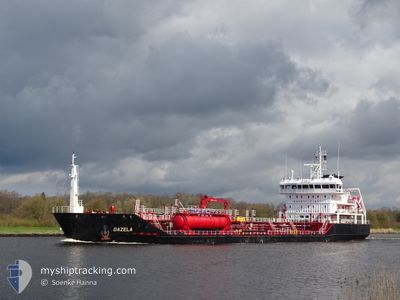
Oil/Chemical Tanker
Current Trip
| Time Travelled | 2 days |
|---|---|
| Remaining Time | 1 day |
| Distance Travelled | 480.58 nm |
| Remaining Distance | 377.82 nm |
| AVG Speed | 10.4 Noeuds |
| MAX Speed | 12.1 Noeuds |
| AVG Wind | 11.8 knots |
| MAX Wind | 16 knots |
| MIN Temp | 4.7°C / 40.46°F |
| MAX Temp | 7°C / 44.6°F |
| Tirant d eau | 7.1 m |
| Position reçue | 1 m depuis |
Current Position
| Longitude | --- |
|---|---|
| Latitude | --- |
| Etat | Under way using engine |
| Vitesse | 11.2 Noeuds |
| Parcours | 273.9° |
| Zone | Skaggerak |
| Station | T-AIS |
| Position reçue | 1 m depuis |
Info
Information
The current position of KEY STREAM is in Skaggerak with coordinates 57.85047° / 10.75903° as reported on 2025-12-06 14:21 by AIS to our vessel tracker app. The vessel's current speed is 11.2 Noeuds and is heading at the port of FLORO. The estimated time of arrival as calculated by MyShipTracking vessel tracking app is 2025-12-08 02:25 LT
The vessel KEY STREAM (IMO: 9525572, MMSI: 212878000) is a Oil/Chemical Tanker that was built in 2010 ( 15 Age ). It's sailing under the flag of [CY] Cyprus.
In this page you can find informations about the vessels current position, last detected port calls, and current voyage information. If the vessels is not in coverage by AIS you will find the latest position.
The current position of KEY STREAM is detected by our AIS receivers and we are not responsible for the reliability of the data. The last position was recorded while the vessel was in Coverage by the Ais receivers of our vessel tracking app.
The current draught of KEY STREAM as reported by AIS is 7.1 meters
Weather
| Temperature | 6.9°C / 44.42°F |
|---|---|
| Wind Speed | 16 knots |
| Direction | 154° SSE |
| Pressure | 1007.1 hPa |
| Humidity | 78.8 % |
| Cloud Coverage | 100 % |
Featured Company
Last Port Calls
| Port | Arrival | Departure | Time In Port |
|---|---|---|---|
| 2025-12-02 18:37 | 2025-12-04 13:24 | 1 d | |
| 2025-11-28 09:52 | 2025-11-30 09:21 | 1 d | |
| 2025-11-25 01:36 | 2025-11-26 01:47 | 1 d | |
| 2025-11-16 19:04 | 2025-11-25 00:44 | 8 d | |
| 2025-11-06 12:47 | 2025-11-07 19:16 | 1 d | |
| 2025-10-31 19:24 | 2025-11-02 01:48 | 1 d | |
| 2025-10-28 09:05 | 2025-10-29 11:26 | 1 d | |
| 2025-10-27 09:25 | 2025-10-27 17:26 | 8 h | |
| 2025-10-17 11:09 | 2025-10-18 08:13 | 21 h | |
| 2025-10-12 07:18 | 2025-10-12 12:28 | 5 h |
Last Trips
| Origin | Departure | Destination | Arrival | Distance | |
|---|---|---|---|---|---|
| 2025-11-30 09:21 | 2025-12-02 18:37 | 515.71 nm | |||
| 2025-11-26 01:47 | 2025-11-28 09:52 | 610.79 nm | |||
| 2025-11-25 00:44 | 2025-11-25 01:36 | 4.72 nm | |||
| 2025-11-07 19:16 | 2025-11-16 19:04 | 893.45 nm | |||
| 2025-11-02 01:48 | 2025-11-06 12:47 | 1090.69 nm | |||
| 2025-10-29 11:26 | 2025-10-31 19:24 | 523.07 nm | |||
| 2025-10-27 17:26 | 2025-10-28 09:05 | 157.54 nm | |||
| 2025-10-18 08:13 | 2025-10-27 09:25 | 1162.87 nm | |||
| 2025-10-12 12:28 | 2025-10-17 11:09 | 1049.28 nm | |||
| 2025-10-09 16:43 | 2025-10-12 07:18 | 508.31 nm |
Events
| Heure | Evenement | Détails | Position/ Destination | Info |
|---|---|---|---|---|
| 2025-12-06 13:46 | Changement de zone | Danish part of the Skaggerak Danish part of the Kattegat |
57.80248 / 10.92168
Skaggerak
SEGOT>NOFRO
|
Vitesse: 10.7 kn Parcours: 315° |
| 2025-12-06 12:34 | Changement de zone | Danish part of the Kattegat Swedish part of the Kattegat |
57.64793 / 11.20391
Kattegat
SEGOT>NOFRO
|
Vitesse: 10.9 kn Parcours: 284.9° |
| 2025-12-06 11:31 | Changement d'ETA | 2025/12/08 04:00 2025/12/08 05:00 |
57.59257 / 11.54198
SEGOT>NOFRO
|
Vitesse: 11.3 kn Parcours: 281.9° |
| 2025-12-06 11:00 | Démarrage | 2.76 nm, South West of SANDVIK |
57.60181 / 11.69243
SEGOT>NOFRO
|
Vitesse: 4.3 kn Parcours: 244° |
| 2025-12-06 10:52 | Etat Changé | Under way using engine At anchor |
57.60269 / 11.69492
SEGOT>NOFRO
|
Vitesse: 0.5 kn Parcours: 174° |
| 2025-12-06 10:17 | Tirant d'eau modifié | 7.1 6.7 |
57.60425 / 11.69406
SEGOT>NOFRO
|
Vitesse: 0.6 kn Parcours: 164° |
| 2025-12-06 10:17 | Changement de destination | SEGOT>NOFRO LTKLJ > SEGOT |
57.60425 / 11.69406
SEGOT>NOFRO
|
Vitesse: 0.6 kn Parcours: 164° |
| 2025-12-06 10:17 | Changement d'ETA | 2025/12/08 05:00 2025/12/06 05:00 |
57.60425 / 11.69406
SEGOT>NOFRO
|
Vitesse: 0.6 kn Parcours: 164° |
| 2025-12-06 10:06 | Etat Changé | At anchor Default |
57.60424 / 11.69427
LTKLJ > SEGOT
|
Vitesse: 0.1 kn Parcours: 189° |
| 2025-12-06 10:03 | Etat Changé | Default At anchor |
57.60440 / 11.69445
LTKLJ > SEGOT
|
Vitesse: 0.1 kn Parcours: 189° |