
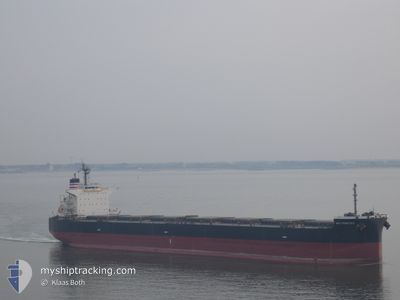
KEY FRONTIER
Bulk Carrier
Current Trip
JP YKK
| Time Travelled | 3 days |
|---|---|
| Remaining Time | --- |
| Distance Travelled | 30.74 nm |
| Remaining Distance | --- |
| AVG Speed | 9.1 Noeuds |
| MAX Speed | 9.5 Noeuds |
| AVG Wind | 8.6 knots |
| MAX Wind | 15 knots |
| MIN Temp | 12.4°C / 54.32°F |
| MAX Temp | 20.1°C / 68.18°F |
| Tirant d eau | 14.1 m |
| Position reçue | 3 d depuis |
Current Position
| Longitude | 136.70913° |
|---|---|
| Latitude | 34.91052° |
| Etat | Under way using engine |
| Vitesse | 5.3 Noeuds |
| Parcours | 190° |
| Zone | Philippine Sea |
| Station | T-AIS |
| Position reçue | 3 d depuis |
Info
Information
The current position of KEY FRONTIER is in Philippine Sea with coordinates 34.91052° / 136.70913° as reported on 2024-05-10 11:59 by AIS to our vessel tracker app. The vessel's current speed is 5.3 Noeuds
The vessel KEY FRONTIER (IMO: 9454292, MMSI: 356676000) is a Bulk Carrier that was built in 2011 ( 13 Age ). It's sailing under the flag of [PA] Panama.
In this page you can find informations about the vessels current position, last detected port calls, and current voyage information. If the vessels is not in coverage by AIS you will find the latest position.
The current position of KEY FRONTIER is detected by our AIS receivers and we are not responsible for the reliability of the data. The last position was recorded while the vessel was in Coverage by the Ais receivers of our vessel tracking app.
The current draught of KEY FRONTIER as reported by AIS is 14.1 meters
Weather
| Temperature | 18.5°C / 65.3°F |
|---|---|
| Wind Speed | 8 knots |
| Direction | 182° S |
| Pressure | 1016.7 hPa |
| Humidity | 75.8 % |
| Cloud Coverage | --- |
Featured Company
Last Trips
Events
| Heure | Evenement | Détails | Position/ Destination | Info |
|---|---|---|---|---|
| 2024-05-10 12:32 | Arret | 3.55 nm, East of SUZUKA |
34.88499 / 136.70578
JP YKK
|
Vitesse: 0.3 kn Parcours: 211° |
| 2024-05-10 12:04 | Etat Changé | Default Under way using engine |
34.90345 / 136.70770
JP YKK
|
Vitesse: 5.3 kn Parcours: 190° |
| 2024-05-10 11:59 | Hors de la zone couverte |
34.91052 / 136.70913
Philippine Sea
|
Vitesse: 5.3 kn Parcours: 190° |
|
| 2024-05-10 11:53 | Etat Changé | Under way using engine Default |
34.92113 / 136.71151
JP YKK
|
Vitesse: 8.6 kn Parcours: 190° |
| 2024-05-10 11:37 | Dans la zone couverte |
34.92113 / 136.71151
Philippine Sea
|
Vitesse: 7.1 kn Parcours: 190.3° |
|
| 2024-05-10 11:24 | PORT DE DEPART |
|
34.98669 / 136.70448
JP YKK
|
Vitesse: 7.1 kn Parcours: 93° |
| 2024-05-10 11:12 | Démarrage |
34.98937 / 136.67992
[JP] YOKKAICHI
|
Vitesse: 3.1 kn Parcours: 90° |
|
| 2024-05-09 21:56 | Arret |
34.98780 / 136.67670
[JP] YOKKAICHI
|
Vitesse: Parcours: 299° |
|
| 2024-05-09 21:32 | Port d'arrivée |
|
34.98911 / 136.69333
[JP] YOKKAICHI
|
Vitesse: 4.7 kn Parcours: 270° |
| 2024-05-09 20:36 | Démarrage | 3.45 nm, East of SUZUKA |
34.90402 / 136.70041
JP YKK
|
Vitesse: 3.9 kn Parcours: 18° |