
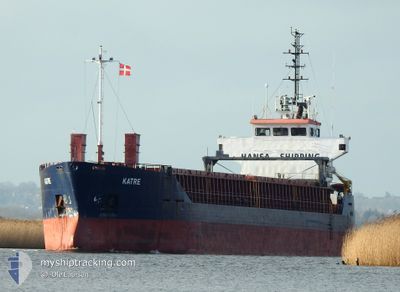
KATRE
General Cargo
Current Trip
| Time Travelled | 1 day |
|---|---|
| Remaining Time | 1 day |
| Distance Travelled | 377.88 nm |
| Remaining Distance | 362.17 nm |
| AVG Speed | 9.3 Noeuds |
| MAX Speed | 10.2 Noeuds |
| AVG Wind | 11.2 knots |
| MAX Wind | 17 knots |
| MIN Temp | 8.7°C / 47.66°F |
| MAX Temp | 14.3°C / 57.74°F |
| Tirant d eau | 5.8 m |
| Position reçue | 1 m depuis |
Current Position
| Longitude | 10.60559° |
|---|---|
| Latitude | 54.57565° |
| Etat | Under way using engine |
| Vitesse | 8.9 Noeuds |
| Parcours | 265.8° |
| Zone | Baltic Sea |
| Station | T-AIS |
| Position reçue | 1 m depuis |
Info
Information
The current position of KATRE is in Baltic Sea with coordinates 54.57565° / 10.60559° as reported on 2024-05-14 12:58 by AIS to our vessel tracker app. The vessel's current speed is 8.9 Noeuds and is heading at the port of SCHIEDAM. The estimated time of arrival as calculated by MyShipTracking vessel tracking app is 2024-05-16 03:54 LT
The vessel KATRE (IMO: 9014937, MMSI: 256793000) is a General Cargo that was built in 1991 ( 33 Age ). It's sailing under the flag of [MT] Malta.
In this page you can find informations about the vessels current position, last detected port calls, and current voyage information. If the vessels is not in coverage by AIS you will find the latest position.
The current position of KATRE is detected by our AIS receivers and we are not responsible for the reliability of the data. The last position was recorded while the vessel was in Coverage by the Ais receivers of our vessel tracking app.
The current draught of KATRE as reported by AIS is 5.8 meters
Weather
| Temperature | 14.8°C / 58.64°F |
|---|---|
| Wind Speed | 16 knots |
| Direction | 99° E |
| Pressure | 1013.9 hPa |
| Humidity | 81.2 % |
| Cloud Coverage | 10 % |
Featured Company
Last Port Calls
| Port | Arrival | Departure | Time In Port |
|---|---|---|---|
| 2024-05-12 08:27 | 2024-05-12 23:25 | 14 h | |
| 2024-05-08 17:35 | 2024-05-10 13:46 | 1 d | |
| 2024-05-03 07:23 | 2024-05-04 20:08 | 1 d | |
| 2024-05-01 12:28 | 2024-05-02 14:21 | 1 d | |
| 2024-04-29 19:14 | 2024-04-29 20:06 | 51 m | |
| 2024-04-26 22:48 | 2024-04-27 11:04 | 12 h | |
| 2024-04-24 18:55 | 2024-04-25 19:35 | 1 d | |
| 2024-04-22 20:10 | 2024-04-22 20:14 | 3 m | |
| 2024-04-18 17:25 | 2024-04-20 11:08 | 1 d | |
| 2024-04-18 02:18 | 2024-04-18 03:11 | 53 m |
Last Trips
| Origin | Departure | Destination | Arrival | Distance | |
|---|---|---|---|---|---|
| 2024-05-10 13:46 | 2024-05-12 08:27 | 270.09 nm | |||
| 2024-05-04 20:08 | 2024-05-08 17:35 | 883.35 nm | |||
| 2024-05-02 14:21 | 2024-05-03 07:23 | 165.46 nm | |||
| 2024-04-29 20:06 | 2024-05-01 12:28 | 351.51 nm | |||
| 2024-04-27 11:04 | 2024-04-29 19:14 | 582.59 nm | |||
| 2024-04-25 19:35 | 2024-04-26 22:48 | 251.37 nm | |||
| 2024-04-22 20:14 | 2024-04-24 18:55 | 462.45 nm | |||
| 2024-04-20 11:08 | 2024-04-22 20:10 | 423.52 nm | |||
| 2024-04-18 03:11 | 2024-04-18 17:25 | 101.88 nm | |||
| 2024-04-18 01:08 | 2024-04-18 02:18 | 3.56 nm |
Events
| Heure | Evenement | Détails | Position/ Destination | Info |
|---|---|---|---|---|
| 2024-05-14 12:14 | Detecté en mer | Danish part of the Baltic Sea |
54.58451 / 10.79954
Baltic Sea
SCHIEDAM
|
Vitesse: 9.3 kn Parcours: 259° |
| 2024-05-14 10:17 | Detecté en mer | German part of the Baltic Sea |
54.56216 / 11.33440
Baltic Sea
SCHIEDAM
|
Vitesse: 10.2 kn Parcours: 293.2° |
| 2024-05-14 05:25 | Changement de zone | Danish part of the Baltic Sea German part of the Baltic Sea |
54.68299 / 12.43566
Baltic Sea
SCHIEDAM
|
Vitesse: 9.3 kn Parcours: 237.6° |
| 2024-05-14 05:19 | Changement de zone | German part of the Baltic Sea Danish part of the Baltic Sea |
54.69134 / 12.45763
Baltic Sea
SCHIEDAM
|
Vitesse: 9.3 kn Parcours: 236.7° |
| 2024-05-14 03:16 | Changement de zone | Danish part of the Baltic Sea German part of the Baltic Sea |
54.83503 / 12.93165
Baltic Sea
SCHIEDAM
|
Vitesse: 8.9 kn Parcours: 254.5° |
| 2024-05-13 22:55 | Changement de zone | German part of the Baltic Sea Danish part of the Kattegat |
54.91233 / 14.05194
Baltic Sea
SCHIEDAM
|
Vitesse: 9.2 kn Parcours: 269.6° |
| 2024-05-13 16:23 | Detecté en mer | Danish part of the Kattegat |
55.04143 / 15.78855
Kattegat
SCHIEDAM
|
Vitesse: 9.5 kn Parcours: 255.4° |
| 2024-05-13 16:13 | Etat Changé | Under way using engine Default |
55.04819 / 15.83310
SCHIEDAM
|
Vitesse: 9.6 kn Parcours: 254° |
| 2024-05-13 16:12 | Etat Changé | Default Under way using engine |
55.04880 / 15.83683
SCHIEDAM
|
Vitesse: 9.6 kn Parcours: 253.4° |
| 2024-05-13 14:45 | Etat Changé | Under way using engine Default |
55.10396 / 16.23207
SCHIEDAM
|
Vitesse: 9.5 kn Parcours: 256° |