
JUMBO KINETIC
Heavy Load Carrier
Current Trip
| Time Travelled | 15 days |
|---|---|
| Remaining Time | 6 days |
| Distance Travelled | 5119.35 nm |
| Remaining Distance | 2326.06 nm |
| AVG Speed | 14.1 Noeuds |
| MAX Speed | 18.1 Noeuds |
| AVG Wind | 15.4 knots |
| MAX Wind | 29 knots |
| MIN Temp | 15.4°C / 59.72°F |
| MAX Temp | 31°C / 87.8°F |
| Tirant d eau | 7.5 m |
| Position reçue | 2 h, 5 m depuis |
Current Position
| Longitude | 16.07898° |
|---|---|
| Latitude | -32.35759° |
| Etat | Under way using engine |
| Vitesse | 15.4 Noeuds |
| Parcours | 330.6° |
| Zone | South Atlantic Ocean |
| Station | T-AIS |
| Position reçue | 2 h, 5 m depuis |
Info
Information
The current position of JUMBO KINETIC is in South Atlantic Ocean with coordinates -32.35759° / 16.07898° as reported on 2024-05-14 07:29 by AIS to our vessel tracker app. The vessel's current speed is 15.4 Noeuds and is heading at the port of BONNY. The estimated time of arrival as calculated by MyShipTracking vessel tracking app is 2024-05-20 19:10 LT
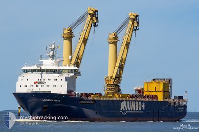
The vessel JUMBO KINETIC (IMO: 9634165, MMSI: 244810054) is a Heavy Load Carrier that was built in 2014 ( 10 Age ). It's sailing under the flag of [NL] Netherlands.
In this page you can find informations about the vessels current position, last detected port calls, and current voyage information. If the vessels is not in coverage by AIS you will find the latest position.
The current position of JUMBO KINETIC is detected by our AIS receivers and we are not responsible for the reliability of the data. The last position was recorded while the vessel was in Coverage by the Ais receivers of our vessel tracking app.
The current draught of JUMBO KINETIC as reported by AIS is 7.5 meters
Weather
| Temperature | 18.7°C / 65.66°F |
|---|---|
| Wind Speed | 5 knots |
| Direction | 31° NNE |
| Pressure | 1014.9 hPa |
| Humidity | 80.5 % |
| Cloud Coverage | 60 % |
Featured Company
Events
| Heure | Evenement | Détails | Position/ Destination | Info |
|---|---|---|---|---|
| 2024-05-14 07:36 | Etat Changé | Default Under way using engine |
-32.33437 / 16.06315
BONNY NIG
|
Vitesse: 15.4 kn Parcours: 330.6° |
| 2024-05-14 07:29 | Etat Changé | Under way using engine Default |
-32.35759 / 16.07898
BONNY NIG
|
Vitesse: 15.3 kn Parcours: 331° |
| 2024-05-14 07:29 | Hors de la zone couverte |
-32.35759 / 16.07898
South Atlantic Ocean
BONNY NIG
|
Vitesse: 15.4 kn Parcours: 330.6° |
|
| 2024-05-14 07:28 | Etat Changé | Default Under way using engine |
-32.36402 / 16.08337
BONNY NIG
|
Vitesse: 15.3 kn Parcours: 330.7° |
| 2024-05-14 07:27 | Etat Changé | Under way using engine Default |
-32.36588 / 16.08462
BONNY NIG
|
Vitesse: 15.3 kn Parcours: 330° |
| 2024-05-14 07:16 | Dans la zone couverte |
-32.36588 / 16.08462
South Atlantic Ocean
BONNY NIG
|
Vitesse: 15.3 kn Parcours: 330.7° |
|
| 2024-05-14 03:12 | Etat Changé | Default Under way using engine |
-33.21321 / 16.81711
BONNY NIG
|
Vitesse: 14.6 kn Parcours: 321.4° |
| 2024-05-14 03:04 | Etat Changé | Under way using engine Default |
-33.23692 / 16.83957
BONNY NIG
|
Vitesse: 14.6 kn Parcours: 321° |
| 2024-05-14 03:04 | Hors de la zone couverte |
-33.23692 / 16.83957
South Atlantic Ocean
BONNY NIG
|
Vitesse: 14.6 kn Parcours: 321.4° |
|
| 2024-05-14 02:24 | Etat Changé | Default Under way using engine |
-33.36869 / 16.95424
BONNY NIG
|
Vitesse: 14.6 kn Parcours: 324.2° |