
JULIETA
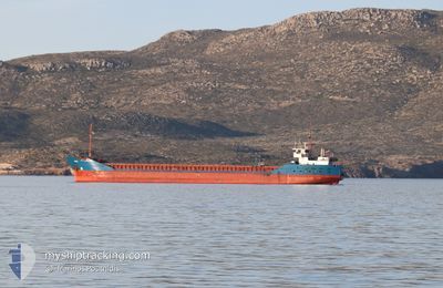
General Cargo
Current Trip
| Time Travelled | 1 day |
|---|---|
| Remaining Time | 1 h, 24 mins |
| Distance Travelled | 252.08 nm |
| Remaining Distance | 12.44 nm |
| AVG Speed | 7.4 Noeuds |
| MAX Speed | 8.3 Noeuds |
| AVG Wind | 13 knots |
| MAX Wind | 23.8 knots |
| MIN Temp | 16.4°C / 61.52°F |
| MAX Temp | 18.2°C / 64.76°F |
| Tirant d eau | 5.1 m |
| Position reçue | Maintenant |
Current Position
| Longitude | 10.16092° |
|---|---|
| Latitude | 43.40624° |
| Etat | Under way using engine |
| Vitesse | 7.2 Noeuds |
| Parcours | 25.5° |
| Zone | Tyrrhenian Sea |
| Station | T-AIS |
| Position reçue | Maintenant |
Info
Information
The current position of JULIETA is in Tyrrhenian Sea with coordinates 43.40624° / 10.16092° as reported on 2024-05-17 04:12 by AIS to our vessel tracker app. The vessel's current speed is 7.2 Noeuds and is heading at the port of LIVORNO. The estimated time of arrival as calculated by MyShipTracking vessel tracking app is 2024-05-17 07:37 LT
The vessel JULIETA (IMO: 9115913, MMSI: 305992000) is a General Cargo that was built in 1995 ( 29 Age ). It's sailing under the flag of [AG] Antigua Barbuda.
In this page you can find informations about the vessels current position, last detected port calls, and current voyage information. If the vessels is not in coverage by AIS you will find the latest position.
The current position of JULIETA is detected by our AIS receivers and we are not responsible for the reliability of the data. The last position was recorded while the vessel was in Coverage by the Ais receivers of our vessel tracking app.
The current draught of JULIETA as reported by AIS is 5.1 meters
Weather
| Temperature | 17.6°C / 63.68°F |
|---|---|
| Wind Speed | 18 knots |
| Direction | 248° WSW |
| Pressure | 1009.4 hPa |
| Humidity | 74.6 % |
| Cloud Coverage | --- |
Featured Company
Last Port Calls
| Port | Arrival | Departure | Time In Port |
|---|---|---|---|
| 2024-05-12 21:40 | 2024-05-15 20:36 | 2 d | |
| 2024-05-09 15:11 | 2024-05-10 16:22 | 1 d | |
| 2024-05-05 22:07 | 2024-05-05 22:43 | 36 m | |
| 2024-05-05 21:32 | 2024-05-05 22:07 | 34 m | |
| 2024-05-03 15:07 | 2024-05-03 15:42 | 35 m | |
| 2024-05-03 14:11 | 2024-05-03 14:47 | 36 m | |
| 2024-04-27 07:41 | 2024-04-27 17:14 | 9 h | |
| 2024-04-23 11:10 | 2024-04-24 05:34 | 18 h | |
| 2024-04-14 23:06 | |||
| 2024-04-14 22:30 |
Most Visited Ports (Last year)
| Port | Arrivals | |
|---|---|---|
| 7 | ||
| 6 | ||
| 3 | ||
| 2 | ||
| 2 | ||
| 2 |
Last Trips
| Origin | Departure | Destination | Arrival | Distance | |
|---|---|---|---|---|---|
| 2024-05-10 16:22 | 2024-05-12 21:40 | 477.51 nm | |||
| 2024-05-05 22:43 | 2024-05-09 15:11 | 482.73 nm | |||
| 2024-05-03 15:42 | 2024-05-05 22:07 | 47.41 nm | |||
| 2024-05-03 15:42 | 2024-05-05 21:32 | 45.94 nm | |||
| 2024-05-03 14:47 | 2024-05-03 15:07 | 0.88 nm | |||
| 2024-04-27 17:14 | 2024-05-03 14:11 | 1062.72 nm | |||
| 2024-04-24 05:34 | 2024-04-27 07:41 | 607.60 nm | |||
| 2024-04-14 23:06 | 2024-04-23 11:10 | 1644.23 nm | |||
| 2024-04-14 22:30 | 2024-04-14 22:30 | 0.83 nm | |||
| 2024-04-12 03:01 | 2024-04-14 21:46 | 46.53 nm |
Events
| Heure | Evenement | Détails | Position/ Destination | Info |
|---|---|---|---|---|
| 2024-05-17 01:09 | Etat Changé | Under way using engine Default |
43.25499 / 9.71683
ITLIV
|
Vitesse: 7 kn Parcours: 83° |
| 2024-05-17 01:03 | Etat Changé | Default Under way using engine |
43.25167 / 9.69667
ITLIV
|
Vitesse: 7.8 kn Parcours: 82.1° |
| 2024-05-17 00:43 | Etat Changé | Under way using engine Default |
43.24638 / 9.64094
ITLIV
|
Vitesse: 7 kn Parcours: 84° |
| 2024-05-17 00:35 | Etat Changé | Default Under way using engine |
43.24333 / 9.61833
ITLIV
|
Vitesse: 7.7 kn Parcours: 80.9° |
| 2024-05-17 00:16 | Changement de zone | Italian part of the Tyrrhenian Sea French part of the Tyrrhenian Sea |
43.23806 / 9.56350
Tyrrhenian Sea
ITLIV
|
Vitesse: 7.6 kn Parcours: 84.5° |
| 2024-05-17 00:01 | Detecté en mer | French part of the Tyrrhenian Sea |
43.23335 / 9.51998
Tyrrhenian Sea
ITLIV
|
Vitesse: 7.5 kn Parcours: 76.6° |
| 2024-05-16 23:12 | Etat Changé | Under way using engine Default |
43.22062 / 9.38447
ITLIV
|
Vitesse: 7.6 kn Parcours: 86° |
| 2024-05-16 22:59 | Etat Changé | Default Under way using engine |
43.21667 / 9.34833
ITLIV
|
Vitesse: 7.6 kn Parcours: 88.2° |
| 2024-05-16 22:13 | Etat Changé | Under way using engine Default |
43.20220 / 9.21566
ITLIV
|
Vitesse: 7.6 kn Parcours: 84° |
| 2024-05-16 22:02 | Etat Changé | Default Under way using engine |
43.19869 / 9.18228
ITLIV
|
Vitesse: 7.6 kn Parcours: 83.7° |