
IRENES RESOLVE
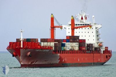
Container Ship
Current Trip
| Time Travelled | 1 day |
|---|---|
| Remaining Time | --- |
| Distance Travelled | 554.05 nm |
| Remaining Distance | 1903.37 nm |
| AVG Speed | 15.5 Noeuds |
| MAX Speed | 18 Noeuds |
| AVG Wind | 14.9 knots |
| MAX Wind | 22 knots |
| MIN Temp | 18.8°C / 65.84°F |
| MAX Temp | 24.3°C / 75.74°F |
| Tirant d eau | 10.8 m |
| Position reçue | 1 d depuis |
Current Position
| Longitude | 31.19915° |
|---|---|
| Latitude | -29.90892° |
| Etat | Under way using engine |
| Vitesse | 14.8 Noeuds |
| Parcours | 151.4° |
| Zone | Indian Ocean |
| Station | T-AIS |
| Position reçue | 1 d depuis |
Info
Information
The current position of IRENES RESOLVE is in Indian Ocean with coordinates -29.90892° / 31.19915° as reported on 2024-04-25 13:58 by AIS to our vessel tracker app. The vessel's current speed is 14.8 Noeuds and is heading at the port of LUANDA. The estimated time of arrival as calculated by MyShipTracking vessel tracking app is 2024-05-02 09:00 LT
The vessel IRENES RESOLVE (IMO: 9227273, MMSI: 636015524) is a Container Ship that was built in 2001 ( 23 Age ). It's sailing under the flag of [LR] Liberia.
In this page you can find informations about the vessels current position, last detected port calls, and current voyage information. If the vessels is not in coverage by AIS you will find the latest position.
The current position of IRENES RESOLVE is detected by our AIS receivers and we are not responsible for the reliability of the data. The last position was recorded while the vessel was in Coverage by the Ais receivers of our vessel tracking app.
The current draught of IRENES RESOLVE as reported by AIS is 10.8 meters
Weather
| Temperature | 19°C / 66.2°F |
|---|---|
| Wind Speed | 19 knots |
| Direction | 97° E |
| Pressure | 1026.5 hPa |
| Humidity | 72.4 % |
| Cloud Coverage | 47 % |
Featured Company
Last Port Calls
| Port | Arrival | Departure | Time In Port |
|---|---|---|---|
| 2024-04-22 01:31 | 2024-04-25 13:19 | 3 d | |
| 2024-03-27 12:10 | 2024-03-27 21:14 | 9 h | |
| 2024-03-22 13:33 | 2024-03-24 10:46 | 1 d | |
| 2024-03-21 00:32 | 2024-03-22 06:24 | 1 d | |
| 2024-03-19 03:11 | 2024-03-20 10:37 | 1 d | |
| 2024-03-09 06:10 | |||
| 2024-02-25 11:25 | 2024-03-01 10:36 | 4 d | |
| 2024-02-15 13:26 | 2024-02-15 18:41 | 5 h |
Last Trips
| Origin | Departure | Destination | Arrival | Distance | |
|---|---|---|---|---|---|
| 2024-03-27 18:14 | 2024-04-22 03:31 | 4600.91 nm | |||
| 2024-03-24 07:46 | 2024-03-27 09:10 | 224.15 nm | |||
| 2024-03-22 03:24 | 2024-03-22 10:33 | 14.72 nm | |||
| 2024-03-20 07:37 | 2024-03-20 21:32 | 175.41 nm | |||
| 2024-03-09 07:10 | 2024-03-19 00:11 | 3771.18 nm | |||
| 2024-02-15 20:41 | 2024-02-25 13:25 | 87.65 nm | |||
| 2024-01-21 12:46 | 2024-02-15 15:26 | 4328.68 nm |
Events
| Heure | Evenement | Détails | Position/ Destination | Info |
|---|---|---|---|---|
| 2024-04-25 14:03 | Etat Changé | Default Under way using engine |
-29.92785 / 31.21115
ZADUR => AOLAD
|
Vitesse: 14.8 kn Parcours: 151.4° |
| 2024-04-25 13:58 | Hors de la zone couverte |
-29.90892 / 31.19915
Indian Ocean
ZADUR => AOLAD
|
Vitesse: 14.8 kn Parcours: 151.4° |
|
| 2024-04-25 13:33 | Tirant d'eau modifié | 10.8 12.2 |
-29.85083 / 31.10787
ZADUR => AOLAD
|
Vitesse: 13.4 kn Parcours: 89.4° |
| 2024-04-25 13:33 | Changement de destination | ZADUR => AOLAD BRNVT => ZADUR |
-29.85083 / 31.10787
ZADUR => AOLAD
|
Vitesse: 13.4 kn Parcours: 89.4° |
| 2024-04-25 13:33 | Changement d'ETA | 2024/05/02 09:00 2024/04/15 11:00 |
-29.85083 / 31.10787
ZADUR => AOLAD
|
Vitesse: 13.4 kn Parcours: 89.4° |
| 2024-04-25 13:24 | Etat Changé | Under way using engine Default |
-29.85138 / 31.07739
BRNVT => ZADUR
|
Vitesse: 9.5 kn Parcours: 68° |
| 2024-04-25 13:23 | Etat Changé | Default Under way using engine |
-29.85203 / 31.07497
BRNVT => ZADUR
|
Vitesse: 9.7 kn Parcours: 64.2° |
| 2024-04-25 13:23 | Etat Changé | Under way using engine Default |
-29.85219 / 31.07451
BRNVT => ZADUR
|
Vitesse: 9.1 kn Parcours: 40° |
| 2024-04-25 13:19 | Etat Changé | Default Under way using engine |
-29.86007 / 31.06588
BRNVT => ZADUR
|
Vitesse: 5.3 kn Parcours: 40° |
| 2024-04-25 13:19 | PORT DE DEPART |
|
-29.86007 / 31.06588
BRNVT => ZADUR
|
Vitesse: 5.3 kn Parcours: 40° |