
INCEPTUM
Cargo
Current Trip
MAAGDENBURG
| Time Travelled | 16 h, 15 mins |
|---|---|
| Remaining Time | --- |
| Distance Travelled | 33.87 nm |
| Remaining Distance | --- |
| AVG Speed | 7.5 Noeuds |
| MAX Speed | 8.9 Noeuds |
| AVG Wind | 9.6 knots |
| MAX Wind | 13 knots |
| MIN Temp | 7.1°C / 44.78°F |
| MAX Temp | 9.8°C / 49.64°F |
| Tirant d eau | 2.7 m |
| Position reçue | 1 m depuis |
Current Position
| Longitude | --- |
|---|---|
| Latitude | --- |
| Etat | Moored |
| Vitesse | |
| Parcours | 21° |
| Zone | North Sea |
| Station | T-AIS |
| Position reçue | 1 m depuis |
Info
Information
The current position of INCEPTUM is in North Sea with coordinates 52.85775° / 5.67943° as reported on 2025-12-16 23:09 by AIS to our vessel tracker app. The vessel's current speed is 0 Noeuds
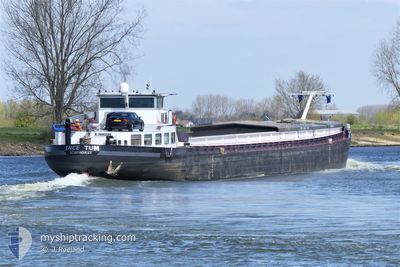
The vessel INCEPTUM (MMSI: 244129543) is a Cargo It's sailing under the flag of [NL] Netherlands.
In this page you can find informations about the vessels current position, last detected port calls, and current voyage information. If the vessels is not in coverage by AIS you will find the latest position.
The current position of INCEPTUM is detected by our AIS receivers and we are not responsible for the reliability of the data. The last position was recorded while the vessel was in Coverage by the Ais receivers of our vessel tracking app.
The current draught of INCEPTUM as reported by AIS is 2.7 meters
Weather
| Temperature | 7.5°C / 45.5°F |
|---|---|
| Wind Speed | 6 knots |
| Direction | 205° SSW |
| Pressure | 1013.9 hPa |
| Humidity | 83.9 % |
| Cloud Coverage | 100 % |
Featured Company
Last Port Calls
| Port | Arrival | Departure | Time In Port |
|---|---|---|---|
| 2025-12-15 15:15 | 2025-12-16 07:55 | 16 h | |
| 2025-12-12 13:26 | 2025-12-15 14:37 | 3 d | |
| 2025-12-12 12:30 | 2025-12-12 12:55 | 24 m | |
| 2025-12-01 04:00 | 2025-12-01 04:13 | 12 m | |
| 2025-11-27 12:48 | 2025-11-27 13:16 | 27 m | |
| 2025-11-26 08:57 | 2025-11-26 09:31 | 34 m | |
| 2025-11-24 21:37 | 2025-11-26 04:13 | 1 d | |
| 2025-11-24 18:07 | 2025-11-24 18:54 | 46 m | |
| 2025-11-19 18:40 | 2025-11-21 12:47 | 1 d | |
| 2025-10-30 22:36 | 2025-11-03 16:46 | 3 d |
Last Trips
| Origin | Departure | Destination | Arrival | Distance | |
|---|---|---|---|---|---|
| 2025-12-15 14:37 | 2025-12-15 15:15 | 4.09 nm | |||
| 2025-12-12 12:55 | 2025-12-12 13:26 | 3.18 nm | |||
| 2025-12-01 04:13 | 2025-12-12 12:30 | 429.20 nm | |||
| 2025-11-27 13:16 | 2025-12-01 04:00 | 17.11 nm | |||
| 2025-11-26 09:31 | 2025-11-27 12:48 | 113.11 nm | |||
| 2025-11-26 04:13 | 2025-11-26 08:57 | 46.04 nm | |||
| 2025-11-24 18:54 | 2025-11-24 21:37 | 28.39 nm | |||
| 2025-11-21 12:47 | 2025-11-24 18:07 | 116.01 nm | |||
| 2025-11-03 16:46 | 2025-11-19 18:40 | 399.50 nm | |||
| 2025-10-30 21:30 | 2025-10-30 22:36 | 8.48 nm |
Events
| Heure | Evenement | Détails | Position/ Destination | Info |
|---|---|---|---|---|
| 2025-12-16 22:15 | Etat Changé | Moored Default |
52.85773 / 5.67945
MAAGDENBURG
|
Vitesse: Parcours: 20° |
| 2025-12-16 22:12 | Etat Changé | Default Moored |
52.85772 / 5.67941
MAAGDENBURG
|
Vitesse: Parcours: 20° |
| 2025-12-16 22:03 | Etat Changé | Moored Default |
52.85775 / 5.67943
MAAGDENBURG
|
Vitesse: Parcours: -1° |
| 2025-12-16 21:51 | Etat Changé | Default Moored |
52.85776 / 5.67941
MAAGDENBURG
|
Vitesse: Parcours: 511° |
| 2025-12-16 21:33 | Etat Changé | Moored Default |
52.85774 / 5.67943
MAAGDENBURG
|
Vitesse: Parcours: 18° |
| 2025-12-16 21:24 | Etat Changé | Default Moored |
52.85775 / 5.67943
MAAGDENBURG
|
Vitesse: Parcours: 18° |
| 2025-12-16 21:06 | Etat Changé | Moored Default |
52.85774 / 5.67944
MAAGDENBURG
|
Vitesse: Parcours: 20° |
| 2025-12-16 21:00 | Etat Changé | Default Moored |
52.85775 / 5.67940
MAAGDENBURG
|
Vitesse: Parcours: 19° |
| 2025-12-16 20:51 | Etat Changé | Moored Default |
52.85773 / 5.67944
MAAGDENBURG
|
Vitesse: Parcours: 19° |
| 2025-12-16 20:48 | Etat Changé | Default Moored |
52.85774 / 5.67943
MAAGDENBURG
|
Vitesse: Parcours: 20° |