
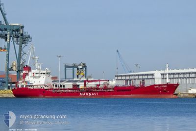
IEVOLI STAR
Oil/Chemical Tanker
Current Trip
| Time Travelled | 13 h, 13 mins |
|---|---|
| Remaining Time | --- |
| Distance Travelled | 146.46 nm |
| Remaining Distance | --- |
| AVG Speed | 11.5 Noeuds |
| MAX Speed | 13 Noeuds |
| AVG Wind | 5.5 knots |
| MAX Wind | 8.9 knots |
| MIN Temp | 17.1°C / 62.78°F |
| MAX Temp | 20.5°C / 68.9°F |
| Tirant d eau | 5.5 m |
| Position reçue | 1 m depuis |
Current Position
| Longitude | 25.39035° |
|---|---|
| Latitude | 39.13792° |
| Etat | Under way using engine |
| Vitesse | 10.7 Noeuds |
| Parcours | 26.8° |
| Zone | Aegean Sea |
| Station | T-AIS |
| Position reçue | 1 m depuis |
Info
Information
The current position of IEVOLI STAR is in Aegean Sea with coordinates 39.13792° / 25.39035° as reported on 2024-05-15 20:15 by AIS to our vessel tracker app. The vessel's current speed is 10.7 Noeuds and is heading at the port of CANAKKALE. The estimated time of arrival as calculated by MyShipTracking vessel tracking app is 2024-05-16 06:00 LT
The vessel IEVOLI STAR (IMO: 9221786, MMSI: 215872000) is a Oil/Chemical Tanker that was built in 2003 ( 21 Age ). It's sailing under the flag of [MT] Malta.
In this page you can find informations about the vessels current position, last detected port calls, and current voyage information. If the vessels is not in coverage by AIS you will find the latest position.
The current position of IEVOLI STAR is detected by our AIS receivers and we are not responsible for the reliability of the data. The last position was recorded while the vessel was in Coverage by the Ais receivers of our vessel tracking app.
The current draught of IEVOLI STAR as reported by AIS is 5.5 meters
Weather
| Temperature | 17.9°C / 64.22°F |
|---|---|
| Wind Speed | 8 knots |
| Direction | 29° NNE |
| Pressure | 1017.6 hPa |
| Humidity | 68.5 % |
| Cloud Coverage | 97 % |
Featured Company
Last Port Calls
| Port | Arrival | Departure | Time In Port |
|---|---|---|---|
| 2024-05-14 09:24 | 2024-05-15 10:03 | 1 d | |
| 2024-05-12 07:51 | 2024-05-13 10:42 | 1 d | |
| 2024-05-05 20:48 | 2024-05-07 09:20 | 1 d | |
| 2024-05-04 11:16 | |||
| 2024-04-26 20:48 | 2024-04-28 22:18 | 2 d | |
| 2024-04-17 18:41 | 2024-04-18 20:26 | 1 d | |
| 2024-04-11 14:21 | 2024-04-13 02:17 | 1 d | |
| 2024-04-08 21:23 | 2024-04-09 01:56 | 4 h | |
| 2024-03-27 11:33 | 2024-03-29 08:12 | 1 d | |
| 2024-03-21 14:45 | 2024-03-25 12:29 | 3 d |
Last Trips
| Origin | Departure | Destination | Arrival | Distance | |
|---|---|---|---|---|---|
| 2024-05-13 10:42 | 2024-05-14 09:24 | 272.75 nm | |||
| 2024-05-07 09:20 | 2024-05-12 07:51 | 1375.02 nm | |||
| 2024-05-04 11:16 | 2024-05-05 20:48 | 420.59 nm | |||
| 2024-04-18 20:26 | 2024-04-26 20:48 | 1005.36 nm | |||
| 2024-04-13 02:17 | 2024-04-17 18:41 | 1229.41 nm | |||
| 2024-04-09 01:56 | 2024-04-11 14:21 | 720.89 nm | |||
| 2024-03-29 08:12 | 2024-04-08 21:23 | 1460.27 nm | |||
| 2024-03-25 12:29 | 2024-03-27 11:33 | 364.91 nm | |||
| 2024-03-13 22:33 | 2024-03-21 14:45 | 1200.72 nm | |||
| 2024-03-07 15:29 | 2024-03-11 05:06 | 670.49 nm |
Events
| Heure | Evenement | Détails | Position/ Destination | Info |
|---|---|---|---|---|
| 2024-05-15 11:22 | Changement d'ETA | 2024/05/16 03:00 2024/05/15 03:00 |
37.91275 / 24.27911
TRCKZ
|
Vitesse: 12.4 kn Parcours: 115.9° |
| 2024-05-15 10:10 | Tirant d'eau modifié | 5.5 5.7 |
38.10619 / 24.13198
TRCKZ
|
Vitesse: 12.5 kn Parcours: 185.2° |
| 2024-05-15 10:10 | Changement de destination | TRCKZ GRCLK |
38.10619 / 24.13198
TRCKZ
|
Vitesse: 12.5 kn Parcours: 185.2° |
| 2024-05-15 10:10 | Changement d'ETA | 2024/05/15 03:00 2024/05/14 05:00 |
38.10619 / 24.13198
TRCKZ
|
Vitesse: 12.5 kn Parcours: 185.2° |
| 2024-05-15 10:01 | Etat Changé | Under way using engine Default |
38.13419 / 24.12980
GRCLK
|
Vitesse: 12.3 kn Parcours: 169° |
| 2024-05-15 09:48 | Etat Changé | Default Under way using engine |
38.17776 / 24.11856
GRCLK
|
Vitesse: 12.3 kn Parcours: 125.3° |
| 2024-05-15 09:32 | Etat Changé | Under way using engine Default |
38.21764 / 24.07616
GRCLK
|
Vitesse: 12.2 kn Parcours: 141° |
| 2024-05-15 09:28 | Etat Changé | Default Under way using engine |
38.22917 / 24.06462
GRCLK
|
Vitesse: 12.2 kn Parcours: 142.5° |
| 2024-05-15 09:18 | Etat Changé | Under way using engine Default |
38.25496 / 24.03902
GRCLK
|
Vitesse: 12.3 kn Parcours: 119° |
| 2024-05-15 09:18 | Dans la zone couverte |
38.25496 / 24.03902
Aegean Sea
|
Vitesse: 12.1 kn Parcours: 137.2° |