
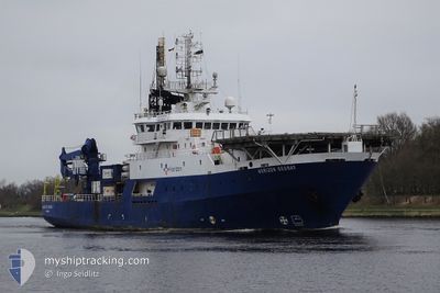
HORIZON GEOBAY
Research/Survey Vessel
Current Trip
SHELTER AREA
| Time Travelled | 21 days |
|---|---|
| Remaining Time | --- |
| Distance Travelled | 421.66 nm |
| Remaining Distance | --- |
| AVG Speed | 8 Noeuds |
| MAX Speed | 10 Noeuds |
| AVG Wind | 20 knots |
| MAX Wind | 28 knots |
| MIN Temp | 1.6°C / 34.88°F |
| MAX Temp | 11.5°C / 52.7°F |
| Tirant d eau | 6.9 m |
| Position reçue | 19 h, 43 m depuis |
Current Position
| Longitude | -2.48521° |
|---|---|
| Latitude | 58.24223° |
| Etat | Restricted manoeuverability |
| Vitesse | 0.1 Noeuds |
| Parcours | 106° |
| Zone | North Sea |
| Station | T-AIS |
| Position reçue | 19 h, 43 m depuis |
Info
Information
The current position of HORIZON GEOBAY is in North Sea with coordinates 58.24223° / -2.48521° as reported on 2024-05-01 06:59 by AIS to our vessel tracker app. The vessel's current speed is 0.1 Noeuds
The vessel HORIZON GEOBAY (IMO: 7801556, MMSI: 354641000) is a Research/Survey Vessel that was built in 1978 ( 46 Age ). It's sailing under the flag of [PA] Panama.
In this page you can find informations about the vessels current position, last detected port calls, and current voyage information. If the vessels is not in coverage by AIS you will find the latest position.
The current position of HORIZON GEOBAY is detected by our AIS receivers and we are not responsible for the reliability of the data. The last position was recorded while the vessel was in Coverage by the Ais receivers of our vessel tracking app.
The current draught of HORIZON GEOBAY as reported by AIS is 6.9 meters
Weather
| Temperature | 9.1°C / 48.38°F |
|---|---|
| Wind Speed | 9 knots |
| Direction | 76° ENE |
| Pressure | 1015.6 hPa |
| Humidity | 87 % |
| Cloud Coverage | 94 % |
Featured Company
Events
| Heure | Evenement | Détails | Position/ Destination | Info |
|---|---|---|---|---|
| 2024-05-01 07:06 | Etat Changé | Default Restricted manoeuverability |
58.24224 / -2.48521
SHELTER AREA
|
Vitesse: 0.1 kn Parcours: 106° |
| 2024-05-01 06:59 | Hors de la zone couverte |
58.24223 / -2.48521
North Sea
|
Vitesse: 0.1 kn Parcours: 199° |
|
| 2024-05-01 06:39 | Etat Changé | Restricted manoeuverability Default |
58.24225 / -2.48522
SHELTER AREA
|
Vitesse: Parcours: 107° |
| 2024-05-01 06:38 | Etat Changé | Default Restricted manoeuverability |
58.24224 / -2.48523
SHELTER AREA
|
Vitesse: 0.1 kn Parcours: 106° |
| 2024-05-01 06:19 | Etat Changé | Restricted manoeuverability Default |
58.24225 / -2.48521
SHELTER AREA
|
Vitesse: 0.1 kn Parcours: 106° |
| 2024-05-01 05:42 | Etat Changé | Default Restricted manoeuverability |
58.24229 / -2.48517
SHELTER AREA
|
Vitesse: 0.2 kn Parcours: 106° |
| 2024-05-01 04:58 | Etat Changé | Restricted manoeuverability Default |
58.24226 / -2.48520
SHELTER AREA
|
Vitesse: 0.1 kn Parcours: 106° |
| 2024-05-01 04:46 | Etat Changé | Default Restricted manoeuverability |
58.24225 / -2.48515
SHELTER AREA
|
Vitesse: Parcours: 106° |
| 2024-05-01 04:01 | Changement de destination | SHELTER AREA CALEDONIA WIND |
58.24223 / -2.48522
SHELTER AREA
|
Vitesse: Parcours: 106° |
| 2024-05-01 04:01 | Changement d'ETA | 2025/04/28 19:00 2024/04/11 04:00 |
58.24223 / -2.48522
SHELTER AREA
|
Vitesse: Parcours: 106° |