
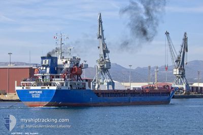
HOPTERIX
Cargo A
Current Trip
| Time Travelled | 12 days |
|---|---|
| Remaining Time | 1 h, 35 mins |
| Distance Travelled | 1984.89 nm |
| Remaining Distance | 14.27 nm |
| AVG Speed | 8.2 Noeuds |
| MAX Speed | 12.9 Noeuds |
| AVG Wind | 18.2 knots |
| MAX Wind | 31.7 knots |
| MIN Temp | 0.7°C / 33.26°F |
| MAX Temp | 14.8°C / 58.64°F |
| Tirant d eau | 4.9 m |
| Position reçue | 5 h, 1 m depuis |
Current Position
| Longitude | --- |
|---|---|
| Latitude | --- |
| Etat | Under way using engine |
| Vitesse | 7.3 Noeuds |
| Parcours | 101.6° |
| Zone | Bay of Biscay |
| Station | T-AIS |
| Position reçue | 5 h, 1 m depuis |
Info
Information
The current position of HOPTERIX is in Bay of Biscay with coordinates 43.60035° / -3.30352° as reported on 2025-12-05 06:08 by AIS to our vessel tracker app. The vessel's current speed is 7.3 Noeuds and is heading at the port of BILBAO. The estimated time of arrival as calculated by MyShipTracking vessel tracking app is 2025-12-05 13:45 LT
The vessel HOPTERIX (IMO: 9645841, MMSI: 314645000) is a Cargo A It's sailing under the flag of [BB] Barbados.
In this page you can find informations about the vessels current position, last detected port calls, and current voyage information. If the vessels is not in coverage by AIS you will find the latest position.
The current position of HOPTERIX is detected by our AIS receivers and we are not responsible for the reliability of the data. The last position was recorded while the vessel was in Coverage by the Ais receivers of our vessel tracking app.
The current draught of HOPTERIX as reported by AIS is 4.9 meters
Weather
| Temperature | 12°C / 53.6°F |
|---|---|
| Wind Speed | 10 knots |
| Direction | 179° S |
| Pressure | 1015.1 hPa |
| Humidity | 75.7 % |
| Cloud Coverage | 97 % |
Featured Company
Last Port Calls
| Port | Arrival | Departure | Time In Port |
|---|---|---|---|
| 2025-11-22 03:17 | 2025-11-22 21:39 | 18 h | |
| 2025-11-14 12:00 | 2025-11-18 00:15 | 3 d | |
| 2025-11-04 08:45 | 2025-11-10 11:12 | 6 d | |
| 2025-10-04 17:23 | 2025-10-05 07:33 | 14 h |
Most Visited Ports (Last year)
| Port | Arrivals | |
|---|---|---|
| 3 | ||
| 2 | ||
| 2 | ||
| 1 | ||
| 1 | ||
| 1 |
Last Trips
| Origin | Departure | Destination | Arrival | Distance | |
|---|---|---|---|---|---|
| 2025-11-18 00:15 | 2025-11-22 03:17 | 902.09 nm | |||
| 2025-11-10 11:12 | 2025-11-14 12:00 | 787.63 nm | |||
| 2025-10-05 07:33 | 2025-11-04 08:45 | 4261.71 nm | |||
| 2025-09-30 15:48 | 2025-10-04 17:23 | 416.21 nm |
Events
| Heure | Evenement | Détails | Position/ Destination | Info |
|---|---|---|---|---|
| 2025-12-05 06:14 | Etat Changé | Default Under way using engine |
43.59787 / -3.28752
ES BIO
|
Vitesse: 7.3 kn Parcours: 101.6° |
| 2025-12-05 06:08 | Hors de la zone couverte |
43.60035 / -3.30352
Bay of Biscay
|
Vitesse: 7.3 kn Parcours: 101.6° |
|
| 2025-12-05 05:43 | Etat Changé | Under way using engine Default |
43.61087 / -3.37381
ES BIO
|
Vitesse: 7.2 kn Parcours: 107° |
| 2025-12-05 05:43 | Etat Changé | Default Under way using engine |
43.61109 / -3.37523
ES BIO
|
Vitesse: 7.2 kn Parcours: 104.2° |
| 2025-12-05 03:14 | Etat Changé | Under way using engine Default |
43.69692 / -3.72794
ES BIO
|
Vitesse: 2.5 kn Parcours: 293° |
| 2025-12-05 02:58 | Etat Changé | Default Under way using engine |
43.69126 / -3.71237
ES BIO
|
Vitesse: 2.8 kn Parcours: 290° |
| 2025-12-05 02:12 | Etat Changé | Under way using engine Default |
43.67884 / -3.66771
ES BIO
|
Vitesse: 2.3 kn Parcours: 289° |
| 2025-12-05 02:03 | Etat Changé | Default Under way using engine |
43.67688 / -3.65920
ES BIO
|
Vitesse: 2.4 kn Parcours: 292° |
| 2025-12-05 01:58 | Etat Changé | Under way using engine Default |
43.67601 / -3.65544
ES BIO
|
Vitesse: 2 kn Parcours: -1° |
| 2025-12-05 01:26 | Etat Changé | Default Under way using engine |
43.66997 / -3.62622
ES BIO
|
Vitesse: 2.8 kn Parcours: 288° |