
HON JAMES L OBERSTAR
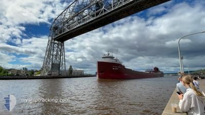
Self Discharging Bulk Carrier
Current Trip
| Trip Time | 16 h, 34 mins |
|---|---|
| Trip Distance | 134.95 nm |
| AVG Speed | 11.8 Noeuds |
| MAX Speed | 13.3 Noeuds |
| Tirant d eau | 6.2 m |
| AVG Wind | 10 knots |
| MAX Wind | 19.5 knots |
| MIN Temp | -11.5°C / 11.3°F |
| MAX Temp | -0.7°C / 30.74°F |
| Position reçue | 2 d depuis |
Current Position
| Longitude | --- |
|---|---|
| Latitude | --- |
| Etat | Under way using engine |
| Vitesse | 13.6 Noeuds |
| Parcours | 27.4° |
| Zone | --- |
| Station | T-AIS |
| Position reçue | 2 d depuis |
Info
Information
The current position of HON JAMES L OBERSTAR is in --- with coordinates 45.11598° / -86.90719° as reported on 2026-01-03 17:15 by AIS to our vessel tracker app. The vessel's current speed is 13.6 Noeuds and is currently inside the port of MARQUETTE.
The vessel HON JAMES L OBERSTAR (IMO: 5322518, MMSI: 366904890) is a Self Discharging Bulk Carrier that was built in 1959 ( 67 Age ). It's sailing under the flag of [US] USA.
In this page you can find informations about the vessels current position, last detected port calls, and current voyage information. If the vessels is not in coverage by AIS you will find the latest position.
The current position of HON JAMES L OBERSTAR is detected by our AIS receivers and we are not responsible for the reliability of the data. The last position was recorded while the vessel was in Coverage by the Ais receivers of our vessel tracking app.
The current draught of HON JAMES L OBERSTAR as reported by AIS is 6.2 meters
Weather
| Temperature | -4.4°C / 24.08°F |
|---|---|
| Wind Speed | 5 knots |
| Direction | 211° SSW |
| Pressure | 1008.2 hPa |
| Humidity | 98.1 % |
| Cloud Coverage | 100 % |
Featured Company
Last Port Calls
| Port | Arrival | Departure | Time In Port |
|---|---|---|---|
| 2026-01-05 09:23 | |||
| 2026-01-04 16:02 | 2026-01-04 16:49 | 47 m | |
| 2026-01-02 06:17 | 2026-01-02 15:58 | 9 h | |
| 2025-12-31 05:02 | 2025-12-31 19:38 | 14 h | |
| 2025-12-28 04:13 | 2025-12-29 17:40 | 1 d | |
| 2025-12-25 11:06 | 2025-12-25 14:44 | 3 h | |
| 2025-12-23 12:24 | 2025-12-24 04:20 | 15 h | |
| 2025-12-22 00:26 | 2025-12-22 02:35 | 2 h | |
| 2025-12-20 05:52 | 2025-12-20 18:31 | 12 h | |
| 2025-12-16 12:23 | 2025-12-16 13:11 | 48 m |
Most Visited Ports (Last year)
| Port | Arrivals | |
|---|---|---|
| 46 | ||
| 15 | ||
| 14 | ||
| 10 | ||
| 9 | ||
| 3 |
Last Trips
| Origin | Departure | Destination | Arrival | Distance | |
|---|---|---|---|---|---|
| 2026-01-04 16:49 | 2026-01-05 09:23 | 134.95 nm | |||
| 2026-01-02 15:58 | 2026-01-04 16:02 | 474.54 nm | |||
| 2025-12-31 19:38 | 2026-01-02 06:17 | 419.55 nm | |||
| 2025-12-29 17:40 | 2025-12-31 05:02 | 413.99 nm | |||
| 2025-12-25 14:44 | 2025-12-28 04:13 | 393.35 nm | |||
| 2025-12-24 04:20 | 2025-12-25 11:06 | 371.15 nm | |||
| 2025-12-22 02:35 | 2025-12-23 12:24 | 404.78 nm | |||
| 2025-12-20 18:31 | 2025-12-22 00:26 | 140.38 nm | |||
| 2025-12-16 13:11 | 2025-12-20 05:52 | 168.97 nm | |||
| 2025-12-15 07:26 | 2025-12-16 12:23 | 296.94 nm |
Events
| Heure | Evenement | Détails | Position/ Destination | Info |
|---|---|---|---|---|
| 2026-01-05 14:41 | Arret |
46.57834 / -87.38666
[US] MARQUETTE
|
Vitesse: Parcours: -1° |
|
| 2026-01-05 14:23 | Port d'arrivée |
|
46.57030 / -87.37547
[US] MARQUETTE
|
Vitesse: 4.7 kn Parcours: 319° |
| 2026-01-05 14:15 | Démarrage | 0.97 nm, North of MARQUETTE |
46.56244 / -87.36615
MARQUETTE
|
Vitesse: 4 kn Parcours: 320° |
| 2026-01-05 08:51 | Arret | 0.83 nm, North of MARQUETTE |
46.56007 / -87.36641
MARQUETTE
|
Vitesse: 0.2 kn Parcours: 94° |
| 2026-01-04 21:49 | PORT DE DEPART |
|
46.49486 / -84.41532
MARQUETTE
|
Vitesse: 8.8 kn Parcours: 254° |
| 2026-01-04 21:30 | Démarrage |
46.50266 / -84.35868
[CA] SAULT STE MARIE
|
Vitesse: 3.5 kn Parcours: 265° |
|
| 2026-01-04 21:03 | Arret |
46.50295 / -84.35363
[CA] SAULT STE MARIE
|
Vitesse: Parcours: 267° |
|
| 2026-01-04 21:02 | Port d'arrivée |
|
46.50295 / -84.35363
[CA] SAULT STE MARIE
|
Vitesse: 0.8 kn Parcours: 267° |
| 2026-01-04 14:58 | Démarrage | 2.4 nm, North of DE TOUR VILLAGE |
46.03263 / -83.89677
MARQUETTE
|
Vitesse: 5.3 kn Parcours: 294° |
| 2026-01-04 03:27 | Arret | 2.37 nm, North of DE TOUR VILLAGE |
46.03188 / -83.89057
MARQUETTE
|
Vitesse: Parcours: 320° |