
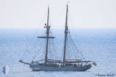
HMS GLADAN
Sailing
Current Trip
| Time Travelled | 2 days |
|---|---|
| Remaining Time | 3 days |
| Distance Travelled | 159.41 nm |
| Remaining Distance | 298.15 nm |
| AVG Speed | 4.9 Noeuds |
| MAX Speed | 8.6 Noeuds |
| AVG Wind | 18.4 knots |
| MAX Wind | 31.8 knots |
| MIN Temp | 13.3°C / 55.94°F |
| MAX Temp | 18.8°C / 65.84°F |
| Tirant d eau | 4.2 m |
| Position reçue | 40 m depuis |
Current Position
| Longitude | -10.30686° |
|---|---|
| Latitude | 39.72084° |
| Etat | Under way sailing |
| Vitesse | 5.2 Noeuds |
| Parcours | 15.8° |
| Zone | North Atlantic Ocean |
| Station | T-AIS |
| Position reçue | 40 m depuis |
Info
Information
The current position of HMS GLADAN is in North Atlantic Ocean with coordinates 39.72084° / -10.30686° as reported on 2024-04-27 03:41 by AIS to our vessel tracker app. The vessel's current speed is 5.2 Noeuds and is heading at the port of CORUNA. The estimated time of arrival as calculated by MyShipTracking vessel tracking app is 2024-04-30 08:14 LT
The vessel HMS GLADAN (MMSI: 265404000) is a Sailing It's sailing under the flag of [SE] Sweden.
In this page you can find informations about the vessels current position, last detected port calls, and current voyage information. If the vessels is not in coverage by AIS you will find the latest position.
The current position of HMS GLADAN is detected by our AIS receivers and we are not responsible for the reliability of the data. The last position was recorded while the vessel was in Coverage by the Ais receivers of our vessel tracking app.
The current draught of HMS GLADAN as reported by AIS is 4.2 meters
Weather
| Temperature | 12.9°C / 55.22°F |
|---|---|
| Wind Speed | 25 knots |
| Direction | 317° NW |
| Pressure | 998.4 hPa |
| Humidity | 71 % |
| Cloud Coverage | 80 % |
Featured Company
Last Port Calls
| Port | Arrival | Departure | Time In Port |
|---|---|---|---|
| 2024-03-26 13:12 | 2024-04-24 09:31 | 28 d | |
| 2024-02-19 20:36 | 2024-03-13 14:24 | 22 d | |
| 2024-02-16 10:06 | 2024-02-18 13:30 | 2 d | |
| 2024-02-13 09:50 | 2024-02-15 15:45 | 2 d | |
| 2024-02-09 08:04 | 2024-02-11 19:44 | 2 d | |
| 2024-02-07 11:49 |
Most Visited Ports (Last year)
| Port | Arrivals | |
|---|---|---|
| 4 | ||
| 3 | ||
| 3 | ||
| 2 | ||
| 2 | ||
| 2 |
Last Trips
| Origin | Departure | Destination | Arrival | Distance | |
|---|---|---|---|---|---|
| 2024-03-13 14:24 | 2024-03-26 13:12 | 833.24 nm | |||
| 2024-02-18 13:30 | 2024-02-19 20:36 | 116.54 nm | |||
| 2024-02-15 15:45 | 2024-02-16 10:06 | 77.63 nm | |||
| 2024-02-11 19:44 | 2024-02-13 09:50 | 165.15 nm | |||
| 2024-02-07 11:49 | 2024-02-09 08:04 | 163.01 nm |
Events
| Heure | Evenement | Détails | Position/ Destination | Info |
|---|---|---|---|---|
| 2024-04-27 03:41 | Dans la zone couverte |
39.72084 / -10.30686
North Atlantic Ocean
ES LCG
|
Vitesse: 5.2 kn Parcours: 15.8° |
|
| 2024-04-27 02:28 | Hors de la zone couverte |
39.63377 / -10.35087
North Atlantic Ocean
ES LCG
|
Vitesse: 3.9 kn Parcours: 7.1° |
|
| 2024-04-26 10:37 | Démarrage |
38.35790 / -10.30655
ES LCG
|
Vitesse: 3.2 kn Parcours: 355° |
|
| 2024-04-26 09:47 | Arret |
38.34381 / -10.30837
ES LCG
|
Vitesse: Parcours: 11° |
|
| 2024-04-26 08:54 | Dans la zone couverte |
38.32208 / -10.31287
North Atlantic Ocean
ES LCG
|
Vitesse: 1.6 kn Parcours: 4.3° |
|
| 2024-04-26 07:51 | Hors de la zone couverte |
38.28945 / -10.31602
North Atlantic Ocean
ES LCG
|
Vitesse: 2.4 kn Parcours: 355.4° |
|
| 2024-04-26 07:10 | Dans la zone couverte |
38.26737 / -10.32273
North Atlantic Ocean
ES LCG
|
Vitesse: 2 kn Parcours: 203.8° |
|
| 2024-04-26 05:01 | Hors de la zone couverte |
38.34956 / -10.24367
North Atlantic Ocean
ES LCG
|
Vitesse: 3 kn Parcours: 230.4° |
|
| 2024-04-26 00:49 | Démarrage |
38.43863 / -10.01884
ES LCG
|
Vitesse: 3.3 kn Parcours: 245° |
|
| 2024-04-25 23:46 | Arret |
38.46755 / -9.98314
ES LCG
|
Vitesse: 0.2 kn Parcours: 250° |