
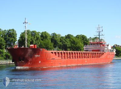
HENRIKE
General Cargo
Current Trip
| Time Travelled | 1 day |
|---|---|
| Remaining Time | 1 day |
| Distance Travelled | 236.28 nm |
| Remaining Distance | 258.49 nm |
| AVG Speed | 8 Noeuds |
| MAX Speed | 12.1 Noeuds |
| AVG Wind | 8.9 knots |
| MAX Wind | 15.7 knots |
| MIN Temp | 5.6°C / 42.08°F |
| MAX Temp | 8.3°C / 46.94°F |
| Tirant d eau | 4.7 m |
| Position reçue | 8 h, 25 m depuis |
Current Position
| Longitude | --- |
|---|---|
| Latitude | --- |
| Etat | Under way using engine |
| Vitesse | 8.6 Noeuds |
| Parcours | 69.6° |
| Zone | Baltic Sea |
| Station | T-AIS |
| Position reçue | 8 h, 25 m depuis |
Info
Information
The current position of HENRIKE is in Baltic Sea with coordinates 54.40308° / 12.13526° as reported on 2025-12-07 15:36 by AIS to our vessel tracker app. The vessel's current speed is 8.6 Noeuds and is heading at the port of KLAIPEDA. The estimated time of arrival as calculated by MyShipTracking vessel tracking app is 2025-12-09 06:42 LT
The vessel HENRIKE (IMO: 9218222, MMSI: 218858000) is a General Cargo that was built in 2000 ( 25 Age ). It's sailing under the flag of [DE] Germany.
In this page you can find informations about the vessels current position, last detected port calls, and current voyage information. If the vessels is not in coverage by AIS you will find the latest position.
The current position of HENRIKE is detected by our AIS receivers and we are not responsible for the reliability of the data. The last position was recorded while the vessel was in Coverage by the Ais receivers of our vessel tracking app.
The current draught of HENRIKE as reported by AIS is 4.7 meters
Weather
| Temperature | 7.5°C / 45.5°F |
|---|---|
| Wind Speed | 15 knots |
| Direction | 174° S |
| Pressure | 1008.3 hPa |
| Humidity | 95.1 % |
| Cloud Coverage | 100 % |
Featured Company
Last Port Calls
| Port | Arrival | Departure | Time In Port |
|---|---|---|---|
| 2025-12-06 05:24 | 2025-12-06 18:44 | 13 h | |
| 2025-12-01 16:44 | 2025-12-04 00:55 | 2 d | |
| 2025-11-26 20:29 | 2025-11-27 19:06 | 22 h | |
| 2025-11-22 21:36 | 2025-11-25 17:13 | 2 d | |
| 2025-11-21 00:54 | 2025-11-21 21:26 | 20 h | |
| 2025-11-19 11:47 | 2025-11-20 12:10 | 1 d | |
| 2025-11-16 08:52 | 2025-11-17 18:00 | 1 d | |
| 2025-11-12 11:24 | 2025-11-14 17:55 | 2 d | |
| 2025-11-08 18:21 | 2025-11-10 14:40 | 1 d | |
| 2025-11-07 04:10 | 2025-11-07 16:56 | 12 h |
Last Trips
| Origin | Departure | Destination | Arrival | Distance | |
|---|---|---|---|---|---|
| 2025-12-04 00:55 | 2025-12-06 05:24 | 418.85 nm | |||
| 2025-11-27 19:06 | 2025-12-01 16:44 | 609.08 nm | |||
| 2025-11-25 17:13 | 2025-11-26 20:29 | 223.82 nm | |||
| 2025-11-21 21:26 | 2025-11-22 21:36 | 171.83 nm | |||
| 2025-11-20 12:10 | 2025-11-21 00:54 | 129.23 nm | |||
| 2025-11-17 18:00 | 2025-11-19 11:47 | 337.40 nm | |||
| 2025-11-14 17:55 | 2025-11-16 08:52 | 286.66 nm | |||
| 2025-11-10 14:40 | 2025-11-12 11:24 | 428.06 nm | |||
| 2025-11-07 16:56 | 2025-11-08 18:21 | 220.05 nm | |||
| 2025-11-06 16:39 | 2025-11-07 04:10 | 111.20 nm |
Events
| Heure | Evenement | Détails | Position/ Destination | Info |
|---|---|---|---|---|
| 2025-12-07 15:41 | Etat Changé | Default Under way using engine |
54.40755 / 12.15512
LTKLJ
|
Vitesse: 8.6 kn Parcours: 69.6° |
| 2025-12-07 15:36 | Hors de la zone couverte |
54.40308 / 12.13526
Baltic Sea
LTKLJ
|
Vitesse: 8.6 kn Parcours: 69.6° |
|
| 2025-12-07 15:34 | Etat Changé | Under way using engine Default |
54.40196 / 12.13020
LTKLJ
|
Vitesse: 8.7 kn Parcours: 81° |
| 2025-12-07 15:33 | Etat Changé | Default Under way using engine |
54.40094 / 12.12511
LTKLJ
|
Vitesse: 8.9 kn Parcours: 92.5° |
| 2025-12-07 15:21 | Changement de zone | German part of the Baltic Sea Danish part of the Baltic Sea |
54.39857 / 12.07502
Baltic Sea
LTKLJ
|
Vitesse: 8.8 kn Parcours: 90.5° |
| 2025-12-07 12:37 | Detecté en mer | Danish part of the Baltic Sea |
54.50207 / 11.43850
Baltic Sea
LTKLJ
|
Vitesse: 7.7 kn Parcours: 116.9° |
| 2025-12-07 09:59 | Etat Changé | Under way using engine Default |
54.56108 / 10.82487
LTKLJ
|
Vitesse: 8.8 kn Parcours: 85° |
| 2025-12-07 09:45 | Dans la zone couverte |
54.56148 / 10.83395
Baltic Sea
LTKLJ
|
Vitesse: 8.9 kn Parcours: 85° |
|
| 2025-12-07 07:53 | Etat Changé | Default Under way using engine |
54.47905 / 10.30402
LTKLJ
|
Vitesse: 9.3 kn Parcours: 44.8° |
| 2025-12-07 07:52 | Hors de la zone couverte |
54.47785 / 10.30200
Baltic Sea
LTKLJ
|
Vitesse: 9.3 kn Parcours: 44.8° |