
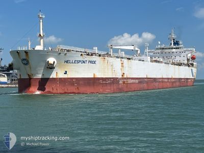
HELLESPONT PRIDE
Oil Products Tanker
Current Trip
| Trip Time | 21 days |
|---|---|
| Trip Distance | 3710.74 nm |
| AVG Speed | 10.4 Noeuds |
| MAX Speed | 14.5 Noeuds |
| Tirant d eau | 8.5 m |
| AVG Wind | 14.4 knots |
| MAX Wind | 23.1 knots |
| MIN Temp | 16.9°C / 62.42°F |
| MAX Temp | 30.2°C / 86.36°F |
| Position reçue | 21 d depuis |
Current Position
| Longitude | -93.18298° |
|---|---|
| Latitude | 26.00787° |
| Etat | Under way using engine |
| Vitesse | 8.8 Noeuds |
| Parcours | 116° |
| Zone | Gulf of Mexico |
| Station | T-AIS |
| Position reçue | 21 d depuis |
Info
Information
The current position of HELLESPONT PRIDE is in Gulf of Mexico with coordinates 26.00787° / -93.18298° as reported on 2024-04-06 08:47 by AIS to our vessel tracker app. The vessel's current speed is 8.8 Noeuds and is currently inside the port of CORPUS CHRISTI.
The vessel HELLESPONT PRIDE (IMO: 9351414, MMSI: 232012089) is a Oil Products Tanker that was built in 2006 ( 18 Age ). It's sailing under the flag of [GB] United Kingdom.
In this page you can find informations about the vessels current position, last detected port calls, and current voyage information. If the vessels is not in coverage by AIS you will find the latest position.
The current position of HELLESPONT PRIDE is detected by our AIS receivers and we are not responsible for the reliability of the data. The last position was recorded while the vessel was in Coverage by the Ais receivers of our vessel tracking app.
The current draught of HELLESPONT PRIDE as reported by AIS is 8.5 meters
Weather
| Temperature | 24.2°C / 75.56°F |
|---|---|
| Wind Speed | 16 knots |
| Direction | 145° SE |
| Pressure | 1009.2 hPa |
| Humidity | 86.2 % |
| Cloud Coverage | 85 % |
Featured Company
Last Port Calls
| Port | Arrival | Departure | Time In Port |
|---|---|---|---|
| 2024-04-26 20:52 | |||
| 2024-04-03 15:39 | 2024-04-05 09:26 | 1 d | |
| 2024-03-11 04:17 | |||
| 2024-03-03 18:22 | |||
| 2024-02-05 19:47 | 2024-02-09 01:05 | 3 d | |
| 2024-02-02 09:16 | 2024-02-04 07:48 | 1 d |
Most Visited Ports (Last year)
| Port | Arrivals | |
|---|---|---|
| 7 | ||
| 4 | ||
| 3 | ||
| 2 | ||
| 1 | ||
| 1 |
Last Trips
| Origin | Departure | Destination | Arrival | Distance | |
|---|---|---|---|---|---|
| 2024-04-05 04:26 | 2024-04-26 15:52 | 3710.74 nm | |||
| 2024-03-10 22:17 | 2024-04-03 10:39 | 3356.24 nm | |||
| 2024-02-08 19:05 | 2024-03-03 12:22 | 2852.50 nm | |||
| 2024-02-04 01:48 | 2024-02-05 13:47 | 202.52 nm | |||
| 2024-01-28 05:51 | 2024-02-02 03:16 | 1437.22 nm |
Events
| Heure | Evenement | Détails | Position/ Destination | Info |
|---|---|---|---|---|
| 2024-04-26 20:52 | Arret |
27.82285 / -97.43745
[US] CORPUS CHRISTI
|
Vitesse: Parcours: 272° |
|
| 2024-04-26 20:52 | Port d'arrivée |
|
27.82285 / -97.43745
[US] CORPUS CHRISTI
|
Vitesse: 1 kn Parcours: 266° |
| 2024-04-26 16:18 | Démarrage | 9.37 nm, East of PORT ARANSAS |
27.78567 / -96.90242
PA CTB
|
Vitesse: 4.5 kn Parcours: 277° |
| 2024-04-25 06:58 | Arret | 9.48 nm, East of PORT ARANSAS |
27.79282 / -96.89751
PA CTB
|
Vitesse: 0.1 kn Parcours: 71° |
| 2024-04-24 22:02 | Démarrage |
27.03440 / -95.33643
PA CTB
|
Vitesse: 3.7 kn Parcours: 346° |
|
| 2024-04-24 20:50 | Arret |
27.01468 / -95.33700
PA CTB
|
Vitesse: 0.1 kn Parcours: 307° |
|
| 2024-04-18 15:21 | Démarrage |
12.43692 / -70.12440
PA CTB
|
Vitesse: 3.9 kn Parcours: 110° |
|
| 2024-04-17 13:11 | Arret |
12.41482 / -70.11095
PA CTB
|
Vitesse: 0.1 kn Parcours: 121° |