
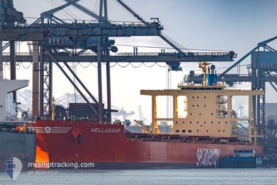
HELLASSHIP
Bulk Carrier
Current Trip
| Time Travelled | 32 days |
|---|---|
| Remaining Time | --- |
| Distance Travelled | 4746.61 nm |
| Remaining Distance | --- |
| AVG Speed | 11 Noeuds |
| MAX Speed | 15.7 Noeuds |
| AVG Wind | 10.5 knots |
| MAX Wind | 26.4 knots |
| MIN Temp | 10.8°C / 51.44°F |
| MAX Temp | 31.3°C / 88.34°F |
| Tirant d eau | 17.5 m |
| Position reçue | 2 d depuis |
Current Position
| Longitude | 103.51623° |
|---|---|
| Latitude | 1.21153° |
| Etat | At anchor |
| Vitesse | 12.2 Noeuds |
| Parcours | 282.5° |
| Zone | Singapore Strait |
| Station | T-AIS |
| Position reçue | 2 d depuis |
Info
Information
The current position of HELLASSHIP is in Singapore Strait with coordinates 1.21153° / 103.51623° as reported on 2024-05-30 18:58 by AIS to our vessel tracker app. The vessel's current speed is 12.2 Noeuds and is heading at the port of MUNDRA. The estimated time of arrival as calculated by MyShipTracking vessel tracking app is 2024-06-09 20:30 LT
The vessel HELLASSHIP (IMO: 9574236, MMSI: 636020735) is a Bulk Carrier that was built in 2012 ( 12 Age ). It's sailing under the flag of [LR] Liberia.
In this page you can find informations about the vessels current position, last detected port calls, and current voyage information. If the vessels is not in coverage by AIS you will find the latest position.
The current position of HELLASSHIP is detected by our AIS receivers and we are not responsible for the reliability of the data. The last position was recorded while the vessel was in Coverage by the Ais receivers of our vessel tracking app.
The current draught of HELLASSHIP as reported by AIS is 17.5 meters
Weather
| Temperature | 29.9°C / 85.82°F |
|---|---|
| Wind Speed | 17 knots |
| Direction | 203° SSW |
| Pressure | 1009.5 hPa |
| Humidity | 75.2 % |
| Cloud Coverage | 100 % |
Featured Company
Last Port Calls
| Port | Arrival | Departure | Time In Port |
|---|---|---|---|
| 2024-04-26 20:24 | 2024-04-30 11:28 | 3 d | |
| 2024-04-21 17:48 | 2024-04-23 05:32 | 1 d | |
| 2024-04-05 12:08 | 2024-04-07 09:05 | 1 d |
Last Trips
| Origin | Departure | Destination | Arrival | Distance | |
|---|---|---|---|---|---|
| 2024-04-23 05:32 | 2024-04-26 20:24 | 1004.13 nm | |||
| 2024-04-07 09:05 | 2024-04-21 17:48 | 3459.68 nm | |||
| 2024-03-14 15:20 | 2024-04-05 12:08 | 3577.40 nm |
Events
| Heure | Evenement | Détails | Position/ Destination | Info |
|---|---|---|---|---|
| 2024-05-30 19:02 | Etat Changé | Default At anchor |
1.21443 / 103.50313
IN MUN
|
Vitesse: 12.2 kn Parcours: 282.5° |
| 2024-05-30 18:58 | Hors de la zone couverte |
1.21153 / 103.51623
Singapore Strait
IN MUN
|
Vitesse: 12.2 kn Parcours: 282.5° |
|
| 2024-05-30 18:38 | Changement de zone | Malaysian part of the Singapore Strait Indonesian part of the Singapore Strait |
1.19528 / 103.58264
Singapore Strait
IN MUN
|
Vitesse: 12.4 kn Parcours: 284.6° |
| 2024-05-30 17:50 | Changement de zone | Indonesian part of the Singapore Strait Singaporean part of the Singapore Strait |
1.13497 / 103.72653
Singapore Strait
IN MUN
|
Vitesse: 12.1 kn Parcours: 263.7° |
| 2024-05-30 16:07 | Démarrage | 3.1 nm, South West of TANAH MERAH |
1.27241 / 103.98479
IN MUN
|
Vitesse: 3.1 kn Parcours: 150° |
| 2024-05-30 13:01 | Etat Changé | At anchor Default |
1.27463 / 103.98206
IN MUN
|
Vitesse: Parcours: 64° |
| 2024-05-30 12:56 | Etat Changé | Default At anchor |
1.27468 / 103.98199
IN MUN
|
Vitesse: Parcours: 64° |
| 2024-05-30 10:39 | Tirant d'eau modifié | 17.5 17.2 |
1.27579 / 103.98192
IN MUN
|
Vitesse: Parcours: 113° |
| 2024-05-30 10:39 | Changement de destination | IN MUN PEBGC |
1.27579 / 103.98192
IN MUN
|
Vitesse: Parcours: 113° |
| 2024-05-30 10:39 | Changement d'ETA | 2024/06/09 15:00 2024/05/30 11:00 |
1.27579 / 103.98192
IN MUN
|
Vitesse: Parcours: 113° |