
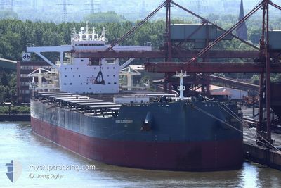
HEIDE OLDENDORFF
Cargo
Current Trip
| Time Travelled | 21 h, 56 mins |
|---|---|
| Remaining Time | 15 h, 31 mins |
| Distance Travelled | 207.45 nm |
| Remaining Distance | 182.48 nm |
| AVG Speed | 10.5 Noeuds |
| MAX Speed | 12.2 Noeuds |
| AVG Wind | 18 knots |
| MAX Wind | 24 knots |
| MIN Temp | 26.1°C / 78.98°F |
| MAX Temp | 28.4°C / 83.12°F |
| Tirant d eau | 12 m |
| Position reçue | 1 d depuis |
Current Position
| Longitude | --- |
|---|---|
| Latitude | --- |
| Etat | Moored |
| Vitesse | |
| Parcours | 131° |
| Zone | Caribbean Sea |
| Station | T-AIS |
| Position reçue | 1 d depuis |
Info
Information
The current position of HEIDE OLDENDORFF is in Caribbean Sea with coordinates 11.07406° / -74.23213° as reported on 2025-12-08 11:57 by AIS to our vessel tracker app. The vessel's current speed is 0 Noeuds and is heading at the port of SANTA MARTA. The estimated time of arrival as calculated by MyShipTracking vessel tracking app is 2025-12-10 21:53 LT
The vessel HEIDE OLDENDORFF (IMO: 9871103, MMSI: 255805818) is a Cargo It's sailing under the flag of [PT] Portugal.
In this page you can find informations about the vessels current position, last detected port calls, and current voyage information. If the vessels is not in coverage by AIS you will find the latest position.
The current position of HEIDE OLDENDORFF is detected by our AIS receivers and we are not responsible for the reliability of the data. The last position was recorded while the vessel was in Coverage by the Ais receivers of our vessel tracking app.
The current draught of HEIDE OLDENDORFF as reported by AIS is 12 meters
Weather
| Temperature | 26.8°C / 80.24°F |
|---|---|
| Wind Speed | 20 knots |
| Direction | 90° E |
| Pressure | 1011.1 hPa |
| Humidity | 83.9 % |
| Cloud Coverage | 29 % |
Featured Company
Last Port Calls
| Port | Arrival | Departure | Time In Port |
|---|---|---|---|
| 2025-12-06 17:19 | 2025-12-09 08:26 | 2 d | |
| 2025-11-15 22:30 | 2025-11-22 01:43 | 6 d | |
| 2025-10-28 17:14 | 2025-10-31 05:30 | 2 d | |
| 2025-10-11 14:30 | 2025-10-18 21:53 | 7 d |
Most Visited Ports (Last year)
| Port | Arrivals | |
|---|---|---|
| 3 | ||
| 2 | ||
| 1 | ||
| 1 | ||
| 1 | ||
| 1 |
Last Trips
| Origin | Departure | Destination | Arrival | Distance | |
|---|---|---|---|---|---|
| 2025-11-22 01:43 | 2025-12-06 17:19 | 4612.77 nm | |||
| 2025-10-31 05:30 | 2025-11-15 22:30 | 2818.33 nm | |||
| 2025-10-18 21:53 | 2025-10-28 17:14 | 2764.63 nm | |||
| 2025-09-03 15:05 | 2025-10-11 14:30 | 7425.82 nm |
Events
| Heure | Evenement | Détails | Position/ Destination | Info |
|---|---|---|---|---|
| 2025-12-09 17:15 | Démarrage | 5.24 nm, North West of PUERTO DRUMMOND |
11.12565 / -74.29619
COSMR
|
Vitesse: 4.9 kn Parcours: 2° |
| 2025-12-09 14:37 | Arret | 4.9 nm, North West of PUERTO DRUMMOND |
11.12213 / -74.29153
COSMR
|
Vitesse: 0.3 kn Parcours: 100° |
| 2025-12-09 13:26 | Démarrage | 0.98 nm, North West of PUERTO DRUMMOND |
11.07500 / -74.24500
COSMR
|
Vitesse: 5 kn Parcours: -1° |
| 2025-12-09 13:26 | PORT DE DEPART |
|
11.07500 / -74.24500
COSMR
|
Vitesse: 2 kn Parcours: -1° |
| 2025-12-08 11:59 | Etat Changé | Default Moored |
11.07333 / -74.23167
[CO] PUERTO DRUMMOND
|
Vitesse: Parcours: 131° |
| 2025-12-08 11:57 | Hors de la zone couverte |
11.07406 / -74.23213
Caribbean Sea
[CO] PUERTO DRUMMOND
|
Vitesse: Parcours: 153.8° |
|
| 2025-12-08 11:12 | Etat Changé | Moored Default |
11.07406 / -74.23213
[CO] PUERTO DRUMMOND
|
Vitesse: Parcours: -1° |
| 2025-12-08 11:08 | Etat Changé | Default Moored |
11.07333 / -74.23167
[CO] PUERTO DRUMMOND
|
Vitesse: Parcours: 131° |
| 2025-12-08 10:45 | Etat Changé | Moored Default |
11.07406 / -74.23212
[CO] PUERTO DRUMMOND
|
Vitesse: Parcours: -1° |
| 2025-12-08 10:41 | Etat Changé | Default Moored |
11.07333 / -74.23167
[CO] PUERTO DRUMMOND
|
Vitesse: Parcours: 130° |