
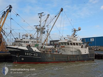
HD42 GRIETJECORNELIA
Fishing
Current Trip
| Trip Time | 7 days |
|---|---|
| Trip Distance | 58.16 nm |
| AVG Speed | 5.9 Noeuds |
| MAX Speed | 7.7 Noeuds |
| Tirant d eau | 3.2 m |
| AVG Wind | 13.6 knots |
| MAX Wind | 23.3 knots |
| MIN Temp | 5.9°C / 42.62°F |
| MAX Temp | 7.4°C / 45.32°F |
| Position reçue | 1 m depuis |
Current Position
| Longitude | --- |
|---|---|
| Latitude | --- |
| Etat | Engaged in Fishing |
| Vitesse | |
| Parcours | 251° |
| Zone | North Sea |
| Station | T-AIS |
| Position reçue | 1 m depuis |
Info
Information
The current position of HD42 GRIETJECORNELIA is in North Sea with coordinates 53.41046° / 6.21084° as reported on 2025-12-05 10:01 by AIS to our vessel tracker app. The vessel's current speed is 0 Noeuds and is currently inside the port of LAUWERSOOG.
The vessel HD42 GRIETJECORNELIA (IMO: 9860001, MMSI: 245795000) is a Fishing It's sailing under the flag of [NL] Netherlands.
In this page you can find informations about the vessels current position, last detected port calls, and current voyage information. If the vessels is not in coverage by AIS you will find the latest position.
The current position of HD42 GRIETJECORNELIA is detected by our AIS receivers and we are not responsible for the reliability of the data. The last position was recorded while the vessel was in Coverage by the Ais receivers of our vessel tracking app.
The current draught of HD42 GRIETJECORNELIA as reported by AIS is 3.2 meters
Weather
| Temperature | 6.6°C / 43.88°F |
|---|---|
| Wind Speed | 7 knots |
| Direction | 185° S |
| Pressure | 1010.1 hPa |
| Humidity | 85.5 % |
| Cloud Coverage | 100 % |
Featured Company
Last Port Calls
| Port | Arrival | Departure | Time In Port |
|---|---|---|---|
| 2025-12-04 12:05 | |||
| 2025-11-27 03:22 | |||
| 2025-11-07 00:00 | 2025-11-10 17:25 | 3 d | |
| 2025-10-23 15:52 | 2025-10-29 05:34 | 5 d |
Most Visited Ports (Last year)
| Port | Arrivals | |
|---|---|---|
| 18 | ||
| 12 | ||
| 6 | ||
| 4 | ||
| 3 | ||
| 2 |
Last Trips
| Origin | Departure | Destination | Arrival | Distance | |
|---|---|---|---|---|---|
| 2025-11-27 03:22 | 2025-12-04 12:05 | 58.16 nm | |||
| 2025-10-29 05:34 | 2025-11-07 00:00 | 103.75 nm | |||
| 2025-10-01 00:23 | 2025-10-23 15:52 | 108.06 nm |
Events
| Heure | Evenement | Détails | Position/ Destination | Info |
|---|---|---|---|---|
| 2025-12-04 15:10 | Arret |
53.41045 / 6.21090
[NL] LAUWERSOOG
|
Vitesse: 0.2 kn Parcours: 251° |
|
| 2025-12-04 15:03 | Démarrage |
53.40960 / 6.20873
[NL] LAUWERSOOG
|
Vitesse: 3.1 kn Parcours: 50° |
|
| 2025-12-04 11:06 | Arret |
53.40852 / 6.20554
[NL] LAUWERSOOG
|
Vitesse: 0.2 kn Parcours: 270° |
|
| 2025-12-04 11:05 | Port d'arrivée |
|
53.40848 / 6.20543
[NL] LAUWERSOOG
|
Vitesse: 0.8 kn Parcours: 227° |
| 2025-12-04 10:04 | Changement de zone | Dutch part of the North Sea German part of the North Sea |
53.47339 / 6.08962
North Sea
|
Vitesse: 5.9 kn Parcours: 140.3° |
| 2025-12-04 10:03 | Dans la zone couverte |
53.47339 / 6.08962
North Sea
|
Vitesse: 5.9 kn Parcours: 140.3° |
|
| 2025-12-02 15:34 | Hors de la zone couverte |
53.78599 / 7.04640
North Sea
|
Vitesse: 7.3 kn Parcours: 251.4° |
|
| 2025-12-02 15:17 | Dans la zone couverte |
53.79684 / 7.10051
North Sea
|
Vitesse: 7.7 kn Parcours: 251.5° |
|
| 2025-11-27 02:22 | Hors de la zone couverte |
53.76378 / 6.79572
North Sea
|
Vitesse: 2.9 kn Parcours: 233.9° |
|
| 2025-11-27 02:22 | Detecté en mer | German part of the North Sea |
53.76378 / 6.79572
North Sea
|
Vitesse: 2.9 kn Parcours: 233.9° |