
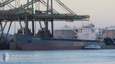
HANNES OLDENDORFF
Cargo
Current Trip
| Time Travelled | 32 days |
|---|---|
| Remaining Time | --- |
| Distance Travelled | 9170.08 nm |
| Remaining Distance | --- |
| AVG Speed | 11.4 Noeuds |
| MAX Speed | 16.3 Noeuds |
| AVG Wind | 12.3 knots |
| MAX Wind | 32 knots |
| MIN Temp | 9.3°C / 48.74°F |
| MAX Temp | 30.5°C / 86.9°F |
| Tirant d eau | 9.8 m |
| Position reçue | 2 d depuis |
Current Position
| Longitude | 18.06628° |
|---|---|
| Latitude | -34.43543° |
| Etat | Under way using engine |
| Vitesse | 12.3 Noeuds |
| Parcours | 319.6° |
| Zone | South Atlantic Ocean |
| Station | T-AIS |
| Position reçue | 2 d depuis |
Info
Information
The current position of HANNES OLDENDORFF is in South Atlantic Ocean with coordinates -34.43543° / 18.06628° as reported on 2024-05-10 23:01 by AIS to our vessel tracker app. The vessel's current speed is 12.3 Noeuds and is heading at the port of JARDIM CAMBURI. The estimated time of arrival as calculated by MyShipTracking vessel tracking app is 2024-05-21 06:00 LT
The vessel HANNES OLDENDORFF (IMO: 9750402, MMSI: 255805936) is a Cargo It's sailing under the flag of [PT] Portugal.
In this page you can find informations about the vessels current position, last detected port calls, and current voyage information. If the vessels is not in coverage by AIS you will find the latest position.
The current position of HANNES OLDENDORFF is detected by our AIS receivers and we are not responsible for the reliability of the data. The last position was recorded while the vessel was in Coverage by the Ais receivers of our vessel tracking app.
The current draught of HANNES OLDENDORFF as reported by AIS is 9.8 meters
Weather
| Temperature | 19.8°C / 67.64°F |
|---|---|
| Wind Speed | 14 knots |
| Direction | 157° SSE |
| Pressure | 1015.1 hPa |
| Humidity | 80.3 % |
| Cloud Coverage | --- |
Featured Company
Events
| Heure | Evenement | Détails | Position/ Destination | Info |
|---|---|---|---|---|
| 2024-05-10 23:06 | Etat Changé | Default Under way using engine |
-34.42125 / 18.05189
TUBARAO,BRAZIL
|
Vitesse: 12.3 kn Parcours: 319.6° |
| 2024-05-10 23:01 | Hors de la zone couverte |
-34.43543 / 18.06628
South Atlantic Ocean
TUBARAO,BRAZIL
|
Vitesse: 12.3 kn Parcours: 319.6° |
|
| 2024-05-10 23:01 | Etat Changé | Under way using engine Default |
-34.43592 / 18.06676
TUBARAO,BRAZIL
|
Vitesse: 12.4 kn Parcours: 318° |
| 2024-05-10 22:58 | Etat Changé | Default Under way using engine |
-34.44410 / 18.07493
TUBARAO,BRAZIL
|
Vitesse: 12.3 kn Parcours: 319.1° |
| 2024-05-10 22:52 | Etat Changé | Under way using engine Default |
-34.45783 / 18.08882
TUBARAO,BRAZIL
|
Vitesse: 12 kn Parcours: 323° |
| 2024-05-10 22:31 | Etat Changé | Default Under way using engine |
-34.51440 / 18.14566
TUBARAO,BRAZIL
|
Vitesse: 12.2 kn Parcours: 322.1° |
| 2024-05-10 22:06 | Etat Changé | Under way using engine Default |
-34.58177 / 18.21209
TUBARAO,BRAZIL
|
Vitesse: 12.2 kn Parcours: 322° |
| 2024-05-10 21:59 | Etat Changé | Default Under way using engine |
-34.60137 / 18.23103
TUBARAO,BRAZIL
|
Vitesse: 12 kn Parcours: 323° |
| 2024-05-10 21:37 | Dans la zone couverte |
-34.65361 / 18.28967
South Atlantic Ocean
TUBARAO,BRAZIL
|
Vitesse: 11.4 kn Parcours: 306.4° |
|
| 2024-05-10 21:37 | Etat Changé | Under way using engine Default |
-34.65449 / 18.29114
TUBARAO,BRAZIL
|
Vitesse: 11 kn Parcours: 297° |