
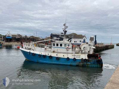
GV NORTHERN VENTURE
Other Type
Current Trip
NEU CONNECT
| Time Travelled | 9 days |
|---|---|
| Remaining Time | --- |
| Distance Travelled | 459.78 nm |
| Remaining Distance | --- |
| AVG Speed | 4.3 Noeuds |
| MAX Speed | 9.8 Noeuds |
| AVG Wind | 20.5 knots |
| MAX Wind | 37 knots |
| MIN Temp | 6.4°C / 43.52°F |
| MAX Temp | 12.8°C / 55.04°F |
| Tirant d eau | 2.7 m |
| Position reçue | 5 m depuis |
Current Position
| Longitude | --- |
|---|---|
| Latitude | --- |
| Etat | Under way using engine |
| Vitesse | 3.3 Noeuds |
| Parcours | 356° |
| Zone | North Sea |
| Station | T-AIS |
| Position reçue | 5 m depuis |
Info
Information
The current position of GV NORTHERN VENTURE is in North Sea with coordinates 51.77772° / 1.65977° as reported on 2025-12-05 21:12 by AIS to our vessel tracker app. The vessel's current speed is 3.3 Noeuds
The vessel GV NORTHERN VENTURE (MMSI: 235076636) is a Other Type It's sailing under the flag of [GB] United Kingdom.
In this page you can find informations about the vessels current position, last detected port calls, and current voyage information. If the vessels is not in coverage by AIS you will find the latest position.
The current position of GV NORTHERN VENTURE is detected by our AIS receivers and we are not responsible for the reliability of the data. The last position was recorded while the vessel was in Coverage by the Ais receivers of our vessel tracking app.
The current draught of GV NORTHERN VENTURE as reported by AIS is 2.7 meters
Weather
| Temperature | 8°C / 46.4°F |
|---|---|
| Wind Speed | 37 knots |
| Direction | 170° S |
| Pressure | 999.4 hPa |
| Humidity | 86.8 % |
| Cloud Coverage | 100 % |
Featured Company
Most Visited Ports (Last year)
| Port | Arrivals | |
|---|---|---|
| 4 | ||
| 2 | ||
| 1 |
Events
| Heure | Evenement | Détails | Position/ Destination | Info |
|---|---|---|---|---|
| 2025-12-05 11:43 | Démarrage | 14.33 nm, East of F HALLS COMPANY BOAT |
51.78113 / 1.64655
NEU CONNECT
|
Vitesse: 3.2 kn Parcours: 175° |
| 2025-12-05 10:45 | Arret | 14.51 nm, East of F HALLS COMPANY BOAT |
51.77070 / 1.64667
NEU CONNECT
|
Vitesse: 0.3 kn Parcours: 294° |
| 2025-12-05 05:16 | Démarrage | 14.17 nm, East of F HALLS COMPANY BOAT |
51.77310 / 1.63828
NEU CONNECT
|
Vitesse: 3.2 kn Parcours: 343° |
| 2025-12-05 03:46 | Arret | 14.1 nm, East of F HALLS COMPANY BOAT |
51.77577 / 1.63760
NEU CONNECT
|
Vitesse: 0.3 kn Parcours: 259° |
| 2025-12-05 00:19 | Démarrage | 14.84 nm, East of F HALLS COMPANY BOAT |
51.81163 / 1.67078
NEU CONNECT
|
Vitesse: 3.1 kn Parcours: 311° |
| 2025-12-04 17:07 | Arret | 15.15 nm, East of F HALLS COMPANY BOAT |
51.79432 / 1.67443
NEU CONNECT
|
Vitesse: 0.3 kn Parcours: 317° |
| 2025-12-04 12:47 | Démarrage | 15.72 nm, East of F HALLS COMPANY BOAT |
51.79120 / 1.68908
NEU CONNECT
|
Vitesse: 3.1 kn Parcours: 232° |
| 2025-12-04 12:17 | Arret | 15.85 nm, East of F HALLS COMPANY BOAT |
51.77027 / 1.68392
NEU CONNECT
|
Vitesse: 0.3 kn Parcours: 211° |
| 2025-12-03 23:40 | Démarrage | 15.35 nm, East of F HALLS COMPANY BOAT |
51.81502 / 1.68520
NEU CONNECT
|
Vitesse: 3.3 kn Parcours: 220° |
| 2025-12-03 21:10 | Arret | 16.02 nm, East of F HALLS COMPANY BOAT |
51.76883 / 1.68825
NEU CONNECT
|
Vitesse: 0.3 kn Parcours: 299° |