
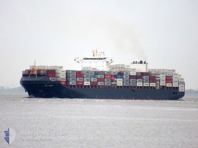
GSL TRIPOLI
Container Ship
Current Trip
| Time Travelled | 3 days |
|---|---|
| Remaining Time | --- |
| Distance Travelled | 1135.03 nm |
| Remaining Distance | --- |
| AVG Speed | 16 Noeuds |
| MAX Speed | 19.1 Noeuds |
| AVG Wind | 9.5 knots |
| MAX Wind | 16 knots |
| MIN Temp | 11.6°C / 52.88°F |
| MAX Temp | 20.5°C / 68.9°F |
| Tirant d eau | 11.2 m |
| Position reçue | 6 d depuis |
Current Position
| Longitude | -79.50480° |
|---|---|
| Latitude | 8.86613° |
| Etat | Under way using engine |
| Vitesse | 12.6 Noeuds |
| Parcours | 140.9° |
| Zone | North Pacific Ocean |
| Station | T-AIS |
| Position reçue | 6 d depuis |
Info
Information
The current position of GSL TRIPOLI is in North Pacific Ocean with coordinates 8.86613° / -79.50480° as reported on 2024-05-01 00:40 by AIS to our vessel tracker app. The vessel's current speed is 12.6 Noeuds and is heading at the port of PANAMA CITY. The estimated time of arrival as calculated by MyShipTracking vessel tracking app is 2024-04-28 14:15 LT
The vessel GSL TRIPOLI (IMO: 9437048, MMSI: 636020986) is a Container Ship that was built in 2009 ( 15 Age ). It's sailing under the flag of [LR] Liberia.
In this page you can find informations about the vessels current position, last detected port calls, and current voyage information. If the vessels is not in coverage by AIS you will find the latest position.
The current position of GSL TRIPOLI is detected by our AIS receivers and we are not responsible for the reliability of the data. The last position was recorded while the vessel was in Coverage by the Ais receivers of our vessel tracking app.
The current draught of GSL TRIPOLI as reported by AIS is 11.2 meters
Weather
| Temperature | 11.5°C / 52.7°F |
|---|---|
| Wind Speed | 2 knots |
| Direction | 33° NNE |
| Pressure | 1014.7 hPa |
| Humidity | 60.1 % |
| Cloud Coverage | 76 % |
Featured Company
Last Port Calls
| Port | Arrival | Departure | Time In Port |
|---|---|---|---|
| 2024-05-03 23:01 | 2024-05-04 11:05 | 12 h | |
| 2024-04-29 17:51 | 2024-04-30 23:47 | 1 d | |
| 2024-04-26 22:42 | 2024-04-28 00:46 | 1 d | |
| 2024-04-25 10:47 | 2024-04-26 06:10 | 19 h | |
| 2024-04-14 05:32 | 2024-04-14 19:15 | 13 h | |
| 2024-04-11 11:43 | 2024-04-12 16:28 | 1 d | |
| 2024-04-10 11:06 | 2024-04-11 01:26 | 14 h | |
| 2024-04-08 12:55 | 2024-04-09 11:40 | 22 h | |
| 2024-04-06 18:36 | 2024-04-07 15:30 | 20 h | |
| 2024-03-25 23:21 | 2024-03-26 11:11 | 11 h |
Most Visited Ports (Last year)
| Port | Arrivals | |
|---|---|---|
| 4 | ||
| 4 | ||
| 4 | ||
| 3 | ||
| 3 | ||
| 3 |
Last Trips
| Origin | Departure | Destination | Arrival | Distance | |
|---|---|---|---|---|---|
| 2024-04-30 18:47 | 2024-05-03 18:01 | 1356.62 nm | |||
| 2024-04-27 19:46 | 2024-04-29 12:51 | 65.91 nm | |||
| 2024-04-26 01:10 | 2024-04-26 17:42 | 280.69 nm | |||
| 2024-04-14 21:15 | 2024-04-25 05:47 | 4604.20 nm | |||
| 2024-04-12 18:28 | 2024-04-14 07:32 | 353.19 nm | |||
| 2024-04-11 03:26 | 2024-04-11 13:43 | 125.12 nm | |||
| 2024-04-09 13:40 | 2024-04-10 13:06 | 274.70 nm | |||
| 2024-04-07 17:30 | 2024-04-08 14:55 | 119.27 nm | |||
| 2024-03-26 06:11 | 2024-04-06 20:36 | 4649.13 nm | |||
| 2024-03-24 22:30 | 2024-03-25 18:21 | 360.91 nm |
Events
| Heure | Evenement | Détails | Position/ Destination | Info |
|---|---|---|---|---|
| 2024-05-07 11:32 | Arret | 0.34 nm, North East of COQUIMBO |
-29.94317 / -71.32988
PAMAN>PAPTY
|
Vitesse: 0.3 kn Parcours: 52° |
| 2024-05-04 11:05 | PORT DE DEPART |
|
-12.04622 / -77.16303
PAMAN>PAPTY
|
Vitesse: 3.3 kn Parcours: 280° |
| 2024-05-04 10:57 | Démarrage |
-12.04825 / -77.15198
[PE] CALLAO
|
Vitesse: 3.3 kn Parcours: 280° |
|
| 2024-05-03 23:35 | Arret |
-12.04463 / -77.14308
[PE] CALLAO
|
Vitesse: Parcours: 139° |
|
| 2024-05-03 23:01 | Port d'arrivée |
|
-12.04772 / -77.15455
[PE] CALLAO
|
Vitesse: 3.9 kn Parcours: 100° |
| 2024-05-03 22:37 | Démarrage | 2.09 nm, West of CALLAO |
-12.04388 / -77.18883
PAMAN>PAPTY
|
Vitesse: 3.1 kn Parcours: 95° |
| 2024-05-03 22:13 | Arret | 2.26 nm, West of CALLAO |
-12.04260 / -77.19141
PAMAN>PAPTY
|
Vitesse: 0.3 kn Parcours: 120° |
| 2024-05-01 00:46 | Etat Changé | Default Under way using engine |
8.84768 / -79.49005
PAMAN>PAPTY
|
Vitesse: 12.6 kn Parcours: 140.9° |
| 2024-05-01 00:40 | Hors de la zone couverte |
8.86613 / -79.50480
North Pacific Ocean
|
Vitesse: 12.6 kn Parcours: 140.9° |
|
| 2024-05-01 00:09 | Etat Changé | Under way using engine Default |
8.93122 / -79.55608
PAMAN>PAPTY
|
Vitesse: 5.9 kn Parcours: 142° |