
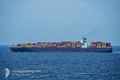
GSL NICOLETTA
Container Ship
Current Trip
| Time Travelled | 5 days |
|---|---|
| Remaining Time | 6 h, 59 mins |
| Distance Travelled | 2280.88 nm |
| Remaining Distance | 674.85 nm |
| AVG Speed | 17.4 Noeuds |
| MAX Speed | 21.5 Noeuds |
| AVG Wind | 11.7 knots |
| MAX Wind | 28 knots |
| MIN Temp | 15.5°C / 59.9°F |
| MAX Temp | 30.2°C / 86.36°F |
| Tirant d eau | 14.4 m |
| Position reçue | 3 d depuis |
Current Position
| Longitude | 121.39869° |
|---|---|
| Latitude | 26.01174° |
| Etat | Under way using engine |
| Vitesse | 14.9 Noeuds |
| Parcours | 219.5° |
| Zone | Eastern China Sea |
| Station | T-AIS |
| Position reçue | 3 d depuis |
Info
Information
The current position of GSL NICOLETTA is in Eastern China Sea with coordinates 26.01174° / 121.39869° as reported on 2024-05-12 07:59 by AIS to our vessel tracker app. The vessel's current speed is 14.9 Noeuds and is heading at the port of TANJUNG PELEPAS. The estimated time of arrival as calculated by MyShipTracking vessel tracking app is 2024-05-16 04:50 LT
The vessel GSL NICOLETTA (IMO: 9229348, MMSI: 636019673) is a Container Ship that was built in 2002 ( 22 Age ). It's sailing under the flag of [LR] Liberia.
In this page you can find informations about the vessels current position, last detected port calls, and current voyage information. If the vessels is not in coverage by AIS you will find the latest position.
The current position of GSL NICOLETTA is detected by our AIS receivers and we are not responsible for the reliability of the data. The last position was recorded while the vessel was in Coverage by the Ais receivers of our vessel tracking app.
The current draught of GSL NICOLETTA as reported by AIS is 14.4 meters
Weather
| Temperature | 29.4°C / 84.92°F |
|---|---|
| Wind Speed | 2 knots |
| Direction | 131° SE |
| Pressure | 1008.4 hPa |
| Humidity | 72.3 % |
| Cloud Coverage | 83 % |
Featured Company
Last Port Calls
| Port | Arrival | Departure | Time In Port |
|---|---|---|---|
| 2024-05-09 07:20 | 2024-05-10 12:39 | 1 d | |
| 2024-05-06 08:06 | 2024-05-07 10:28 | 1 d | |
| 2024-05-03 06:40 | 2024-05-04 11:04 | 1 d | |
| 2024-04-26 02:56 | 2024-04-26 18:13 | 15 h | |
| 2024-04-24 06:43 | 2024-04-25 06:08 | 23 h | |
| 2024-04-20 00:00 | 2024-04-21 01:12 | 1 d | |
| 2024-04-13 17:02 | 2024-04-14 23:16 | 1 d | |
| 2024-04-09 21:21 | 2024-04-10 07:42 | 10 h | |
| 2024-04-08 05:37 | 2024-04-08 20:21 | 14 h | |
| 2024-04-02 16:33 | 2024-04-02 22:16 | 5 h |
Most Visited Ports (Last year)
| Port | Arrivals | |
|---|---|---|
| 8 | ||
| 8 | ||
| 6 | ||
| 5 | ||
| 5 | ||
| 4 |
Last Trips
| Origin | Departure | Destination | Arrival | Distance | |
|---|---|---|---|---|---|
| 2024-05-07 18:28 | 2024-05-09 16:20 | 751.10 nm | |||
| 2024-05-04 19:04 | 2024-05-06 16:06 | 492.39 nm | |||
| 2024-04-27 02:13 | 2024-05-03 14:40 | 2584.58 nm | |||
| 2024-04-25 14:08 | 2024-04-26 10:56 | 195.09 nm | |||
| 2024-04-21 06:42 | 2024-04-24 14:43 | 1433.87 nm | |||
| 2024-04-15 04:46 | 2024-04-20 05:30 | 1254.61 nm | |||
| 2024-04-10 13:12 | 2024-04-13 22:32 | 732.65 nm | |||
| 2024-04-09 01:51 | 2024-04-10 02:51 | 215.23 nm | |||
| 2024-04-03 06:16 | 2024-04-08 11:07 | 2310.20 nm | |||
| 2024-03-31 04:48 | 2024-04-03 00:33 | 242.22 nm |
Events
| Heure | Evenement | Détails | Position/ Destination | Info |
|---|---|---|---|---|
| 2024-05-12 08:09 | Etat Changé | Default Under way using engine |
25.98047 / 121.36814
KRPUS>MYTPP
|
Vitesse: 14.9 kn Parcours: 219.5° |
| 2024-05-12 07:59 | Changement de zone | Taiwanese part of the Eastern China Sea Chinese part of the Eastern China Sea |
26.01174 / 121.39869
Eastern China Sea
KRPUS>MYTPP
|
Vitesse: 14.9 kn Parcours: 219.5° |
| 2024-05-12 07:59 | Etat Changé | Under way using engine Default |
26.01174 / 121.39869
KRPUS>MYTPP
|
Vitesse: 14.9 kn Parcours: 216° |
| 2024-05-12 07:59 | Dans la zone couverte |
26.01174 / 121.39869
Eastern China Sea
KRPUS>MYTPP
|
Vitesse: 14.9 kn Parcours: 219.5° |
|
| 2024-05-12 07:59 | Hors de la zone couverte |
26.01174 / 121.39869
Eastern China Sea
KRPUS>MYTPP
|
Vitesse: 14.9 kn Parcours: 219.5° |
|
| 2024-05-11 23:20 | Etat Changé | Default Under way using engine |
27.72279 / 123.00656
KRPUS>MYTPP
|
Vitesse: 15.9 kn Parcours: 223.3° |
| 2024-05-11 23:15 | Hors de la zone couverte |
27.73790 / 123.02275
Eastern China Sea
KRPUS>MYTPP
|
Vitesse: 15.9 kn Parcours: 223.3° |
|
| 2024-05-11 22:39 | Etat Changé | Under way using engine Default |
27.85963 / 123.14420
KRPUS>MYTPP
|
Vitesse: 16 kn Parcours: 221° |
| 2024-05-11 22:39 | Dans la zone couverte |
27.85963 / 123.14420
Eastern China Sea
KRPUS>MYTPP
|
Vitesse: 16.4 kn Parcours: 219.8° |
|
| 2024-05-11 16:27 | Hors de la zone couverte |
29.12519 / 124.26770
Eastern China Sea
KRPUS>MYTPP
|
Vitesse: 15.3 kn Parcours: 214.4° |