
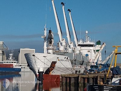
GREEN CRYSTAL
Reefer
Current Trip
| Time Travelled | 2 days |
|---|---|
| Remaining Time | 2 days |
| Distance Travelled | 727.97 nm |
| Remaining Distance | 1096.72 nm |
| AVG Speed | 12.9 Noeuds |
| MAX Speed | 15.9 Noeuds |
| AVG Wind | 15.5 knots |
| MAX Wind | 33 knots |
| MIN Temp | 9.4°C / 48.92°F |
| MAX Temp | 17.7°C / 63.86°F |
| Tirant d eau | 5.8 m |
| Position reçue | 1 d depuis |
Current Position
| Longitude | --- |
|---|---|
| Latitude | --- |
| Etat | Under way using engine |
| Vitesse | 13.1 Noeuds |
| Parcours | 355.6° |
| Zone | North Atlantic Ocean |
| Station | T-AIS |
| Position reçue | 1 d depuis |
Info
Information
The current position of GREEN CRYSTAL is in North Atlantic Ocean with coordinates 39.16353° / -9.86915° as reported on 2025-12-09 05:00 by AIS to our vessel tracker app. The vessel's current speed is 13.1 Noeuds and is heading at the port of HARLINGEN. The estimated time of arrival as calculated by MyShipTracking vessel tracking app is 2025-12-13 00:18 LT
The vessel GREEN CRYSTAL (IMO: 8920995, MMSI: 311009700) is a Reefer that was built in 1992 ( 33 Age ). It's sailing under the flag of [BS] Bahamas.
In this page you can find informations about the vessels current position, last detected port calls, and current voyage information. If the vessels is not in coverage by AIS you will find the latest position.
The current position of GREEN CRYSTAL is detected by our AIS receivers and we are not responsible for the reliability of the data. The last position was recorded while the vessel was in Coverage by the Ais receivers of our vessel tracking app.
The current draught of GREEN CRYSTAL as reported by AIS is 5.8 meters
Weather
| Temperature | 13.6°C / 56.48°F |
|---|---|
| Wind Speed | 12 knots |
| Direction | 322° NW |
| Pressure | 1023 hPa |
| Humidity | 69.2 % |
| Cloud Coverage | 4 % |
Featured Company
Last Port Calls
| Port | Arrival | Departure | Time In Port |
|---|---|---|---|
| 2025-12-07 21:04 | 2025-12-08 03:03 | 5 h | |
| 2025-12-01 20:41 | 2025-12-06 17:25 | 4 d | |
| 2025-11-24 06:45 | 2025-11-25 22:48 | 1 d | |
| 2025-11-10 17:35 | 2025-11-16 22:35 | 6 d | |
| 2025-10-30 01:46 | 2025-11-04 18:46 | 5 d |
Most Visited Ports (Last year)
| Port | Arrivals | |
|---|---|---|
| 7 | ||
| 2 | ||
| 2 | ||
| 2 | ||
| 2 | ||
| 2 |
Last Trips
| Origin | Departure | Destination | Arrival | Distance | |
|---|---|---|---|---|---|
| 2025-12-06 17:25 | 2025-12-07 21:04 | 283.41 nm | |||
| 2025-11-25 22:48 | 2025-12-01 20:41 | 1791.81 nm | |||
| 2025-11-16 22:35 | 2025-11-24 06:45 | 1828.79 nm | |||
| 2025-11-04 18:46 | 2025-11-10 17:35 | 1789.82 nm | |||
| 2025-09-24 21:42 | 2025-10-30 01:46 | 2008.57 nm |
Events
| Heure | Evenement | Détails | Position/ Destination | Info |
|---|---|---|---|---|
| 2025-12-09 05:17 | Etat Changé | Default Under way using engine |
39.22666 / -9.87667
NL HAR
|
Vitesse: 13.1 kn Parcours: 355.6° |
| 2025-12-09 05:00 | Hors de la zone couverte |
39.16353 / -9.86915
North Atlantic Ocean
NL HAR
|
Vitesse: 13.1 kn Parcours: 355.6° |
|
| 2025-12-09 04:56 | Etat Changé | Under way using engine Default |
39.14948 / -9.86892
NL HAR
|
Vitesse: 13 kn Parcours: 358° |
| 2025-12-09 04:53 | Etat Changé | Default Under way using engine |
39.13833 / -9.86833
NL HAR
|
Vitesse: 13.2 kn Parcours: 0.8° |
| 2025-12-09 04:44 | Etat Changé | Under way using engine Default |
39.10709 / -9.86958
NL HAR
|
Vitesse: 13 kn Parcours: 356° |
| 2025-12-09 04:41 | Etat Changé | Default Under way using engine |
39.09500 / -9.86833
NL HAR
|
Vitesse: 13 kn Parcours: 2.8° |
| 2025-12-09 02:07 | Etat Changé | Under way using engine Default |
38.54495 / -9.82292
NL HAR
|
Vitesse: 12.5 kn Parcours: 344° |
| 2025-12-09 02:07 | Etat Changé | Default Under way using engine |
38.54380 / -9.82248
NL HAR
|
Vitesse: 12.5 kn Parcours: 339.1° |
| 2025-12-09 01:14 | Changement d'ETA | 2025/12/12 20:00 2025/12/12 04:00 |
38.37251 / -9.74448
NL HAR
|
Vitesse: 11.9 kn Parcours: 339.8° |
| 2025-12-09 00:55 | Etat Changé | Under way using engine Default |
38.31147 / -9.71705
NL HAR
|
Vitesse: 12.2 kn Parcours: 339° |