
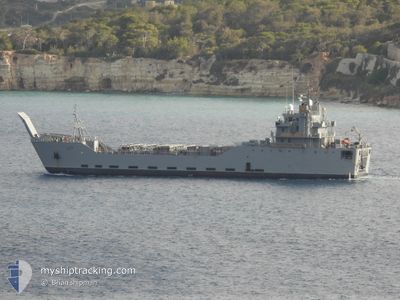
GENERAL FRANK BESSON
Not available
Current Trip
Unknown
| Time Travelled | 8 days |
|---|---|
| Remaining Time | --- |
| Distance Travelled | 436.11 nm |
| Remaining Distance | --- |
| AVG Speed | 9.8 Noeuds |
| MAX Speed | 11.2 Noeuds |
| AVG Wind | 13 knots |
| MAX Wind | 23.9 knots |
| MIN Temp | 17.6°C / 63.68°F |
| MAX Temp | 19.9°C / 67.82°F |
| Tirant d eau | 4.3 m |
| Position reçue | 7 d depuis |
Current Position
| Longitude | 32.02867° |
|---|---|
| Latitude | 32.71615° |
| Etat | Under way using engine |
| Vitesse | 9.9 Noeuds |
| Parcours | 112° |
| Zone | Mediterranean Sea - Eastern Basin |
| Station | T-AIS |
| Position reçue | 7 d depuis |
Info
Information
The current position of GENERAL FRANK BESSON is in Mediterranean Sea - Eastern Basin with coordinates 32.71615° / 32.02867° as reported on 2024-04-25 22:18 by AIS to our vessel tracker app. The vessel's current speed is 9.9 Noeuds
The vessel GENERAL FRANK BESSON (MMSI: 368766000) is a Not available It's sailing under the flag of [US] USA.
In this page you can find informations about the vessels current position, last detected port calls, and current voyage information. If the vessels is not in coverage by AIS you will find the latest position.
The current position of GENERAL FRANK BESSON is detected by our AIS receivers and we are not responsible for the reliability of the data. The last position was recorded while the vessel was in Coverage by the Ais receivers of our vessel tracking app.
The current draught of GENERAL FRANK BESSON as reported by AIS is 4.3 meters
Weather
| Temperature | 19.5°C / 67.1°F |
|---|---|
| Wind Speed | 24 knots |
| Direction | 311° NW |
| Pressure | 1008.1 hPa |
| Humidity | 80.7 % |
| Cloud Coverage | 100 % |
Featured Company
Last Trips
| Origin | Departure | Destination | Arrival | Distance |
|---|
Events
| Heure | Evenement | Détails | Position/ Destination | Info |
|---|---|---|---|---|
| 2024-04-25 22:18 | Hors de la zone couverte |
32.71615 / 32.02867
Mediterranean Sea - Eastern Basin
|
Vitesse: 9.9 kn Parcours: 112° |
|
| 2024-04-25 20:30 | Dans la zone couverte |
32.84038 / 31.71183
Mediterranean Sea - Eastern Basin
|
Vitesse: 10.2 kn Parcours: 116° |
|
| 2024-04-25 19:26 | Hors de la zone couverte |
32.92797 / 31.51704
Mediterranean Sea - Eastern Basin
|
Vitesse: 10.3 kn Parcours: 120° |
|
| 2024-04-25 18:00 | Dans la zone couverte |
33.04942 / 31.27438
Mediterranean Sea - Eastern Basin
|
Vitesse: 10.1 kn Parcours: 119° |
|
| 2024-04-25 16:16 | Hors de la zone couverte |
33.20089 / 30.97196
Mediterranean Sea - Eastern Basin
|
Vitesse: 10.1 kn Parcours: 124° |
|
| 2024-04-25 14:38 | Dans la zone couverte |
33.34185 / 30.68988
Mediterranean Sea - Eastern Basin
|
Vitesse: 10.6 kn Parcours: 122° |
|
| 2024-04-25 13:27 | Hors de la zone couverte |
33.48066 / 30.50285
Mediterranean Sea - Eastern Basin
|
Vitesse: 10 kn Parcours: 133° |
|
| 2024-04-25 09:23 | Changement de zone | Egyptian part of the Mediterranean Sea - Eastern Basin Greek part of the Mediterranean Sea - Eastern Basin |
33.78259 / 29.75068
Mediterranean Sea - Eastern Basin
|
Vitesse: 10.9 kn Parcours: 126° |
| 2024-04-24 23:36 | Dans la zone couverte |
34.57988 / 27.99447
Mediterranean Sea - Eastern Basin
|
Vitesse: 10.3 kn Parcours: 122° |
|
| 2024-04-24 22:26 | Hors de la zone couverte |
34.67909 / 27.78317
Mediterranean Sea - Eastern Basin
|
Vitesse: 10.8 kn Parcours: 119° |