
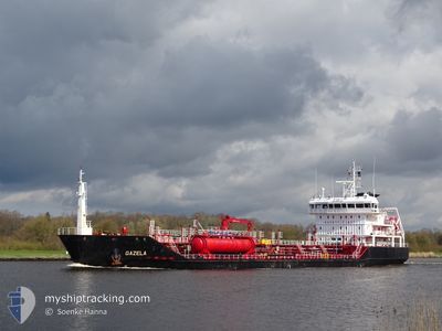
GAZELA
Oil/Chemical Tanker
Current Trip
| Time Travelled | 23 h, 3 mins |
|---|---|
| Remaining Time | 3 days |
| Distance Travelled | 232.16 nm |
| Remaining Distance | 820.00 nm |
| AVG Speed | 10.2 Noeuds |
| MAX Speed | 12.2 Noeuds |
| AVG Wind | 11.9 knots |
| MAX Wind | 16.7 knots |
| MIN Temp | 10.1°C / 50.18°F |
| MAX Temp | 16.1°C / 60.98°F |
| Tirant d eau | 6.8 m |
| Position reçue | 7 m depuis |
Current Position
| Longitude | -5.05472° |
|---|---|
| Latitude | 48.98967° |
| Etat | Under way using engine |
| Vitesse | 10.5 Noeuds |
| Parcours | 58.8° |
| Zone | Celtic Sea |
| Station | T-AIS |
| Position reçue | 7 m depuis |
Info
Information
The current position of GAZELA is in Celtic Sea with coordinates 48.98967° / -5.05472° as reported on 2024-06-09 03:15 by AIS to our vessel tracker app. The vessel's current speed is 10.5 Noeuds and is heading at the port of HUSOYA. The estimated time of arrival as calculated by MyShipTracking vessel tracking app is 2024-06-12 23:44 LT
The vessel GAZELA (IMO: 9525572, MMSI: 212878000) is a Oil/Chemical Tanker that was built in 2010 ( 14 Age ). It's sailing under the flag of [CY] Cyprus.
In this page you can find informations about the vessels current position, last detected port calls, and current voyage information. If the vessels is not in coverage by AIS you will find the latest position.
The current position of GAZELA is detected by our AIS receivers and we are not responsible for the reliability of the data. The last position was recorded while the vessel was in Coverage by the Ais receivers of our vessel tracking app.
The current draught of GAZELA as reported by AIS is 6.8 meters
Weather
| Temperature | 14°C / 57.2°F |
|---|---|
| Wind Speed | 15 knots |
| Direction | 7° N |
| Pressure | 1016.4 hPa |
| Humidity | 72.5 % |
| Cloud Coverage | 5 % |
Featured Company
Last Port Calls
| Port | Arrival | Departure | Time In Port |
|---|---|---|---|
| 2024-06-06 22:20 | 2024-06-08 06:19 | 1 d | |
| 2024-06-06 22:02 | 2024-06-06 22:09 | 7 m | |
| 2024-05-31 13:34 | 2024-06-04 15:41 | 4 d | |
| 2024-05-29 18:37 | 2024-05-29 19:27 | 50 m | |
| 2024-05-28 09:55 | 2024-05-29 06:15 | 20 h | |
| 2024-05-25 07:20 | 2024-05-25 16:00 | 8 h | |
| 2024-05-22 10:45 | 2024-05-22 19:18 | 8 h | |
| 2024-05-21 17:43 | 2024-05-22 03:08 | 9 h | |
| 2024-05-20 13:20 | 2024-05-21 05:47 | 16 h | |
| 2024-05-18 18:58 | 2024-05-19 13:22 | 18 h |
Most Visited Ports (Last year)
| Port | Arrivals | |
|---|---|---|
| 8 | ||
| 7 | ||
| 6 | ||
| 6 | ||
| 6 | ||
| 6 |
Last Trips
| Origin | Departure | Destination | Arrival | Distance | |
|---|---|---|---|---|---|
| 2024-06-06 22:09 | 2024-06-06 22:20 | 0.21 nm | |||
| 2024-06-04 15:41 | 2024-06-06 22:02 | 654.14 nm | |||
| 2024-05-29 19:27 | 2024-05-31 13:34 | 400.71 nm | |||
| 2024-05-29 06:15 | 2024-05-29 18:37 | 120.62 nm | |||
| 2024-05-25 16:00 | 2024-05-28 09:55 | 764.48 nm | |||
| 2024-05-22 19:18 | 2024-05-25 07:20 | 626.47 nm | |||
| 2024-05-22 03:08 | 2024-05-22 10:45 | 74.14 nm | |||
| 2024-05-21 05:47 | 2024-05-21 17:43 | 122.73 nm | |||
| 2024-05-19 13:22 | 2024-05-20 13:20 | 265.13 nm | |||
| 2024-05-15 22:40 | 2024-05-18 18:58 | 848.00 nm |
Events
| Heure | Evenement | Détails | Position/ Destination | Info |
|---|---|---|---|---|
| 2024-06-08 22:23 | Etat Changé | Under way using engine Default |
48.47851 / -5.79964
NOHSO
|
Vitesse: 9.1 kn Parcours: 328° |
| 2024-06-08 21:59 | Etat Changé | Default Under way using engine |
48.42691 / -5.75344
NOHSO
|
Vitesse: 9.3 kn Parcours: 330.1° |
| 2024-06-08 21:39 | Etat Changé | Under way using engine Default |
48.38242 / -5.71338
NOHSO
|
Vitesse: 9.2 kn Parcours: 324° |
| 2024-06-08 21:39 | Dans la zone couverte |
48.38242 / -5.71338
Celtic Sea
NOHSO
|
Vitesse: 9 kn Parcours: 329.3° |
|
| 2024-06-08 19:35 | Hors de la zone couverte |
48.12128 / -5.43470
Celtic Sea
NOHSO
|
Vitesse: 9.9 kn Parcours: 325.9° |
|
| 2024-06-08 14:58 | Detecté en mer | French part of the Celtic Sea |
47.62595 / -4.53894
Celtic Sea
NOHSO
|
Vitesse: 10.5 kn Parcours: 307.9° |
| 2024-06-08 11:04 | Changement d'ETA | 2024/06/12 04:00 2024/06/11 22:00 |
47.24921 / -3.70625
NOHSO
|
Vitesse: 11 kn Parcours: 298.8° |
| 2024-06-08 04:19 | PORT DE DEPART |
|
47.30188 / -2.12602
NOHSO
|
Vitesse: 6.5 kn Parcours: 255° |
| 2024-06-08 04:17 | Démarrage |
47.30284 / -2.11987
[FR] DONGES
|
Vitesse: 5.6 kn Parcours: 257° |
|
| 2024-06-08 03:11 | Tirant d'eau modifié | 6.8 4.1 |
47.30449 / -2.11735
[FR] DONGES
|
Vitesse: 0.1 kn Parcours: 79° |