
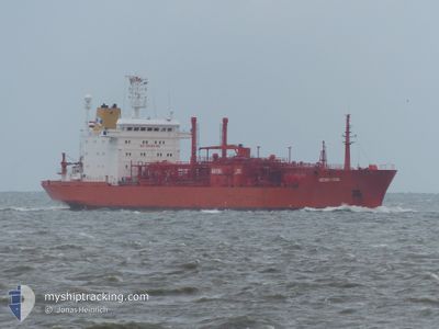
GAS NORA
Lpg Tanker
Current Trip
| Time Travelled | 23 h, 49 mins |
|---|---|
| Remaining Time | 1 day |
| Distance Travelled | 55.72 nm |
| Remaining Distance | 719.83 nm |
| AVG Speed | 12.5 Noeuds |
| MAX Speed | 15.7 Noeuds |
| AVG Wind | 11 knots |
| MAX Wind | 15.7 knots |
| MIN Temp | 22.1°C / 71.78°F |
| MAX Temp | 28.8°C / 83.84°F |
| Tirant d eau | 8.9 m |
| Position reçue | 11 d depuis |
Current Position
| Longitude | --- |
|---|---|
| Latitude | --- |
| Etat | Under way using engine |
| Vitesse | 12 Noeuds |
| Parcours | 189.6° |
| Zone | Gulf of Oman |
| Station | T-AIS |
| Position reçue | 11 d depuis |
Info
Information
The current position of GAS NORA is in Gulf of Oman with coordinates 24.73729° / 56.70715° as reported on 2025-11-24 16:37 by AIS to our vessel tracker app. The vessel's current speed is 12 Noeuds and is heading at the port of SOHAR. The estimated time of arrival as calculated by MyShipTracking vessel tracking app is 2025-12-08 07:20 LT
The vessel GAS NORA (IMO: 8813116, MMSI: 268245700) is a Lpg Tanker that was built in 1991 ( 34 Age ). It's sailing under the flag of [SM] San Marino.
In this page you can find informations about the vessels current position, last detected port calls, and current voyage information. If the vessels is not in coverage by AIS you will find the latest position.
The current position of GAS NORA is detected by our AIS receivers and we are not responsible for the reliability of the data. The last position was recorded while the vessel was in Coverage by the Ais receivers of our vessel tracking app.
The current draught of GAS NORA as reported by AIS is 8.9 meters
Weather
| Temperature | 23.3°C / 73.94°F |
|---|---|
| Wind Speed | 10 knots |
| Direction | 79° E |
| Pressure | 1020 hPa |
| Humidity | 56 % |
| Cloud Coverage | 76 % |
Featured Company
Last Port Calls
| Port | Arrival | Departure | Time In Port |
|---|---|---|---|
| 2025-12-04 12:13 | 2025-12-05 12:44 | 1 d | |
| 2025-11-03 15:35 | 2025-11-05 04:46 | 1 d | |
| 2025-10-07 04:53 | 2025-10-08 18:36 | 1 d |
Most Visited Ports (Last year)
| Port | Arrivals | |
|---|---|---|
| 3 | ||
| 2 | ||
| 2 | ||
| 2 | ||
| 1 | ||
| 1 |
Last Trips
| Origin | Departure | Destination | Arrival | Distance | |
|---|---|---|---|---|---|
| 2025-11-05 04:46 | 2025-12-04 12:13 | 3099.85 nm | |||
| 2025-10-08 18:36 | 2025-11-03 15:35 | 3282.11 nm | |||
| 2025-08-24 13:45 | 2025-10-07 04:53 | 2348.89 nm |
Events
| Heure | Evenement | Détails | Position/ Destination | Info |
|---|---|---|---|---|
| 2025-12-06 00:33 | Démarrage | 15.87 nm, South West of KANDLA |
22.78854 / 70.07143
OM SOH
|
Vitesse: 7 kn Parcours: 238° |
| 2025-12-05 09:10 | Arret | 15.48 nm, South West of KANDLA |
22.79424 / 70.07481
OM SOH
|
Vitesse: Parcours: 42° |
| 2025-12-05 07:14 | PORT DE DEPART |
|
22.93317 / 70.23460
OM SOH
|
Vitesse: 11.4 kn Parcours: 160° |
| 2025-12-05 06:38 | Démarrage |
23.03317 / 70.22553
[IN] KANDLA
|
Vitesse: 6.6 kn Parcours: 155° |
|
| 2025-12-04 06:55 | Arret |
23.03728 / 70.22267
[IN] KANDLA
|
Vitesse: 0.1 kn Parcours: 167° |
|
| 2025-12-04 06:43 | Port d'arrivée |
|
23.03742 / 70.22302
[IN] KANDLA
|
Vitesse: 2.1 kn Parcours: 227° |
| 2025-12-04 04:24 | Démarrage | 14.75 nm, South West of KANDLA |
22.80056 / 70.09111
OM SOH
|
Vitesse: 5.8 kn Parcours: 16° |
| 2025-11-30 09:29 | Arret | 15.32 nm, South West of KANDLA |
22.79161 / 70.08743
OM SOH
|
Vitesse: 0.2 kn Parcours: 55° |
| 2025-11-27 17:41 | Démarrage | 7.24 nm, North East of SOHAR |
24.61556 / 56.68658
OM SOH
|
Vitesse: 3.7 kn Parcours: 125° |