
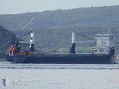
FWN ARCTIC
Cargo
Current Trip
CNYPG
| Time Travelled | 2 days |
|---|---|
| Remaining Time | --- |
| Distance Travelled | 467.21 nm |
| Remaining Distance | --- |
| AVG Speed | 8.7 Noeuds |
| MAX Speed | 12.8 Noeuds |
| AVG Wind | 15.9 knots |
| MAX Wind | 25 knots |
| MIN Temp | 19.4°C / 66.92°F |
| MAX Temp | 23.7°C / 74.66°F |
| Tirant d eau | 5.3 m |
| Position reçue | 9 d depuis |
Current Position
| Longitude | --- |
|---|---|
| Latitude | --- |
| Etat | Under way using engine |
| Vitesse | 10.7 Noeuds |
| Parcours | 48.9° |
| Zone | South China Sea |
| Station | T-AIS |
| Position reçue | 9 d depuis |
Info
Information
The current position of FWN ARCTIC is in South China Sea with coordinates 1.32386° / 104.37040° as reported on 2025-12-03 12:04 by AIS to our vessel tracker app. The vessel's current speed is 10.7 Noeuds
The vessel FWN ARCTIC (IMO: 9931484, MMSI: 244130525) is a Cargo It's sailing under the flag of [NL] Netherlands.
In this page you can find informations about the vessels current position, last detected port calls, and current voyage information. If the vessels is not in coverage by AIS you will find the latest position.
The current position of FWN ARCTIC is detected by our AIS receivers and we are not responsible for the reliability of the data. The last position was recorded while the vessel was in Coverage by the Ais receivers of our vessel tracking app.
The current draught of FWN ARCTIC as reported by AIS is 5.3 meters
Weather
| Temperature | 19.6°C / 67.28°F |
|---|---|
| Wind Speed | 23 knots |
| Direction | 66° ENE |
| Pressure | 1018.3 hPa |
| Humidity | 78.9 % |
| Cloud Coverage | 74 % |
Featured Company
Last Port Calls
| Port | Arrival | Departure | Time In Port |
|---|---|---|---|
| 2025-12-09 08:21 | 2025-12-10 23:29 | 1 d | |
| 2025-11-18 04:46 | 2025-11-20 15:25 | 2 d | |
| 2025-11-12 07:31 | 2025-11-14 06:33 | 1 d | |
| 2025-11-08 17:39 | 2025-11-09 16:19 | 22 h | |
| 2025-11-05 05:39 | 2025-11-06 03:34 | 21 h | |
| 2025-10-11 06:24 | 2025-10-11 13:43 | 7 h | |
| 2025-10-02 10:42 |
Most Visited Ports (Last year)
| Port | Arrivals | |
|---|---|---|
| 2 | ||
| 2 | ||
| 2 | ||
| 1 | ||
| 1 | ||
| 1 |
Last Trips
| Origin | Departure | Destination | Arrival | Distance | |
|---|---|---|---|---|---|
| 2025-11-20 15:25 | 2025-12-09 08:21 | 4744.43 nm | |||
| 2025-11-14 06:33 | 2025-11-18 04:46 | 942.65 nm | |||
| 2025-11-09 16:19 | 2025-11-12 07:31 | 167.42 nm | |||
| 2025-11-06 03:34 | 2025-11-08 17:39 | 812.46 nm | |||
| 2025-10-11 13:43 | 2025-11-05 05:39 | 6707.17 nm | |||
| 2025-10-02 10:42 | 2025-10-11 06:24 | 1978.66 nm |
Events
| Heure | Evenement | Détails | Position/ Destination | Info |
|---|---|---|---|---|
| 2025-12-10 15:29 | PORT DE DEPART |
|
19.70403 / 109.16856
CNYPG
|
Vitesse: 6.5 kn Parcours: 226° |
| 2025-12-10 15:13 | Démarrage |
19.72588 / 109.19690
[CN] YANGPU
|
Vitesse: 6.2 kn Parcours: 257° |
|
| 2025-12-09 01:05 | Arret |
19.72609 / 109.20747
[CN] YANGPU
|
Vitesse: Parcours: 93° |
|
| 2025-12-09 00:21 | Port d'arrivée |
|
19.71546 / 109.18110
[CN] YANGPU
|
Vitesse: 7.1 kn Parcours: 43° |
| 2025-12-08 23:37 | Démarrage | 3.98 nm, South West of YANGPU |
19.70606 / 109.08889
CNYPG
|
Vitesse: 7.8 kn Parcours: 103° |
| 2025-12-08 23:21 | Arret | 4.36 nm, West of YANGPU |
19.70750 / 109.08109
CNYPG
|
Vitesse: 0.3 kn Parcours: 107° |
| 2025-12-08 22:21 | Démarrage | 7.31 nm, West of YANGPU |
19.70639 / 109.02718
CNYPG
|
Vitesse: 3.8 kn Parcours: 120° |
| 2025-12-08 07:53 | Arret | 7.58 nm, West of YANGPU |
19.70940 / 109.02169
CNYPG
|
Vitesse: 0.1 kn Parcours: 29° |
| 2025-12-03 12:04 | Hors de la zone couverte |
1.32386 / 104.37040
South China Sea
CNYPG
|
Vitesse: 10.7 kn Parcours: 48.9° |
|
| 2025-12-03 12:04 | Changement de zone | Malaysian part of the South China Sea Malaysian part of the Singapore Strait |
1.32386 / 104.37040
South China Sea
CNYPG
|
Vitesse: 10.7 kn Parcours: 48.9° |