
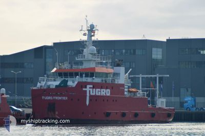
FUGRO FRONTIER
Other Type
Current Trip
SURVEY AREA
| Time Travelled | 2 days |
|---|---|
| Remaining Time | --- |
| Distance Travelled | 263.08 nm |
| Remaining Distance | --- |
| AVG Speed | 5.7 Noeuds |
| MAX Speed | 9.3 Noeuds |
| AVG Wind | 9 knots |
| MAX Wind | 17 knots |
| MIN Temp | 4.9°C / 40.82°F |
| MAX Temp | 10.2°C / 50.36°F |
| Tirant d eau | 3.3 m |
| Position reçue | 2 h, 48 m depuis |
Current Position
| Longitude | 6.33813° |
|---|---|
| Latitude | 54.90477° |
| Etat | Restricted manoeuverability |
| Vitesse | 4.2 Noeuds |
| Parcours | 98° |
| Zone | North Sea |
| Station | T-AIS |
| Position reçue | 2 h, 48 m depuis |
Info
Information
The current position of FUGRO FRONTIER is in North Sea with coordinates 54.90477° / 6.33813° as reported on 2024-04-27 22:50 by AIS to our vessel tracker app. The vessel's current speed is 4.2 Noeuds
The vessel FUGRO FRONTIER (IMO: 9701657, MMSI: 311000263) is a Other Type It's sailing under the flag of [BS] Bahamas.
In this page you can find informations about the vessels current position, last detected port calls, and current voyage information. If the vessels is not in coverage by AIS you will find the latest position.
The current position of FUGRO FRONTIER is detected by our AIS receivers and we are not responsible for the reliability of the data. The last position was recorded while the vessel was in Coverage by the Ais receivers of our vessel tracking app.
The current draught of FUGRO FRONTIER as reported by AIS is 3.3 meters
Weather
| Temperature | 10.2°C / 50.36°F |
|---|---|
| Wind Speed | 11 knots |
| Direction | 118° ESE |
| Pressure | 1006.3 hPa |
| Humidity | 91.6 % |
| Cloud Coverage | 100 % |
Featured Company
Last Port Calls
| Port | Arrival | Departure | Time In Port |
|---|---|---|---|
| 2024-04-24 12:50 | 2024-04-25 18:25 | 1 d | |
| 2024-04-19 07:48 | 2024-04-21 14:16 | 2 d | |
| 2024-04-16 16:04 | 2024-04-17 12:18 | 20 h | |
| 2024-04-14 08:55 | 2024-04-16 06:35 | 1 d | |
| 2024-04-09 10:12 | 2024-04-12 13:28 | 3 d | |
| 2024-04-03 17:34 | 2024-04-05 19:12 | 2 d | |
| 2024-03-26 13:02 | 2024-03-29 12:30 | 2 d | |
| 2024-03-22 08:54 | 2024-03-26 11:07 | 4 d | |
| 2024-03-14 13:24 | 2024-03-17 15:09 | 3 d | |
| 2024-03-07 20:24 | 2024-03-11 18:19 | 3 d |
Most Visited Ports (Last year)
| Port | Arrivals | |
|---|---|---|
| 14 | ||
| 8 | ||
| 6 | ||
| 4 | ||
| 3 | ||
| 2 |
Last Trips
| Origin | Departure | Destination | Arrival | Distance | |
|---|---|---|---|---|---|
| 2024-04-21 16:16 | 2024-04-24 14:50 | 344.24 nm | |||
| 2024-04-17 14:18 | 2024-04-19 09:48 | 194.23 nm | |||
| 2024-04-16 08:35 | 2024-04-16 18:04 | 50.75 nm | |||
| 2024-04-12 15:28 | 2024-04-14 10:55 | 240.53 nm | |||
| 2024-04-05 21:12 | 2024-04-09 12:12 | 412.60 nm | |||
| 2024-03-29 13:30 | 2024-04-03 19:34 | 611.00 nm | |||
| 2024-03-26 12:07 | 2024-03-26 14:02 | 13.50 nm | |||
| 2024-03-17 16:09 | 2024-03-22 09:54 | 453.89 nm | |||
| 2024-03-11 19:19 | 2024-03-14 14:24 | 216.14 nm | |||
| 2024-03-06 18:36 | 2024-03-07 21:24 | 190.42 nm |
Events
| Heure | Evenement | Détails | Position/ Destination | Info |
|---|---|---|---|---|
| 2024-04-27 22:51 | Etat Changé | Default Restricted manoeuverability |
54.90462 / 6.33982
SURVEY AREA
|
Vitesse: 4.2 kn Parcours: 98° |
| 2024-04-27 22:50 | Etat Changé | Restricted manoeuverability Default |
54.90477 / 6.33813
SURVEY AREA
|
Vitesse: 4.6 kn Parcours: 98° |
| 2024-04-27 22:50 | Hors de la zone couverte |
54.90477 / 6.33813
North Sea
|
Vitesse: 4.2 kn Parcours: 96.2° |
|
| 2024-04-27 22:33 | Dans la zone couverte |
54.90477 / 6.33813
North Sea
|
Vitesse: 4.2 kn Parcours: 96.2° |
|
| 2024-04-27 21:30 | Etat Changé | Default Restricted manoeuverability |
54.90333 / 6.36667
SURVEY AREA
|
Vitesse: 5 kn Parcours: 270.7° |
| 2024-04-27 21:23 | Etat Changé | Restricted manoeuverability Default |
54.90542 / 6.38273
SURVEY AREA
|
Vitesse: 4 kn Parcours: -1° |
| 2024-04-27 21:23 | Dans la zone couverte |
54.90542 / 6.38273
North Sea
|
Vitesse: 5 kn Parcours: 270.7° |
|
| 2024-04-27 21:23 | Hors de la zone couverte |
54.90542 / 6.38273
North Sea
|
Vitesse: 5 kn Parcours: 270.7° |
|
| 2024-04-27 12:12 | Etat Changé | Default Restricted manoeuverability |
54.91032 / 6.27913
SURVEY AREA
|
Vitesse: 4.4 kn Parcours: 237° |
| 2024-04-27 12:06 | Hors de la zone couverte |
54.91728 / 6.28010
North Sea
|
Vitesse: 4.4 kn Parcours: 242.4° |