
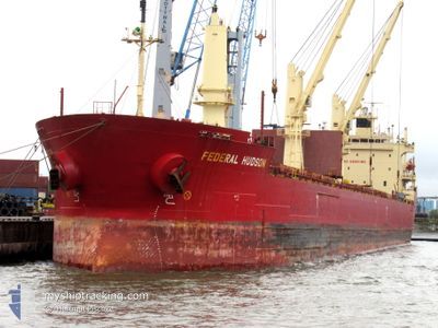
FEDERAL HUDSON
Bulk Carrier
Current Trip
| Time Travelled | 7 days |
|---|---|
| Remaining Time | --- |
| Distance Travelled | 2141.91 nm |
| Remaining Distance | --- |
| AVG Speed | 11.7 Noeuds |
| MAX Speed | 17.5 Noeuds |
| AVG Wind | 11.9 knots |
| MAX Wind | 28.1 knots |
| MIN Temp | 8.6°C / 47.48°F |
| MAX Temp | 20.8°C / 69.44°F |
| Tirant d eau | 8.1 m |
| Position reçue | 1 m depuis |
Current Position
| Longitude | --- |
|---|---|
| Latitude | --- |
| Etat | Under way using engine |
| Vitesse | 13.3 Noeuds |
| Parcours | 102° |
| Zone | North Atlantic Ocean |
| Station | T-AIS |
| Position reçue | 1 m depuis |
Info
Information
The current position of FEDERAL HUDSON is in North Atlantic Ocean with coordinates 39.90533° / -29.03805° as reported on 2024-10-06 11:48 by AIS to our vessel tracker app. The vessel's current speed is 13.3 Noeuds and is heading at the port of ORISTANO. The estimated time of arrival as calculated by MyShipTracking vessel tracking app is 2024-10-12 14:00 LT
The vessel FEDERAL HUDSON (IMO: 9205902, MMSI: 538006779) is a Bulk Carrier that was built in 2000 ( 24 Age ). It's sailing under the flag of [MH] Marshall Is.
In this page you can find informations about the vessels current position, last detected port calls, and current voyage information. If the vessels is not in coverage by AIS you will find the latest position.
The current position of FEDERAL HUDSON is detected by our AIS receivers and we are not responsible for the reliability of the data. The last position was recorded while the vessel was in Coverage by the Ais receivers of our vessel tracking app.
The current draught of FEDERAL HUDSON as reported by AIS is 8.1 meters
Weather
| Temperature | 20.3°C / 68.54°F |
|---|---|
| Wind Speed | 15 knots |
| Direction | 282° WNW |
| Pressure | 1015 hPa |
| Humidity | 58.2 % |
| Cloud Coverage | 77 % |
Featured Company
Last Port Calls
| Port | Arrival | Departure | Time In Port |
|---|---|---|---|
| 2024-09-26 08:04 | 2024-09-28 18:35 | 2 d | |
| 2024-09-24 23:26 | 2024-09-25 00:04 | 38 m | |
| 2024-09-22 15:59 | 2024-09-22 16:58 | 59 m | |
| 2024-09-19 15:56 | 2024-09-21 19:47 | 2 d | |
| 2024-08-26 07:30 | 2024-08-26 08:01 | 30 m | |
| 2024-08-25 01:01 | 2024-08-25 06:43 | 5 h | |
| 2024-08-18 12:22 | 2024-08-24 08:13 | 5 d | |
| 2024-08-17 22:00 | 2024-08-17 23:26 | 1 h | |
| 2024-08-08 01:42 | 2024-08-17 18:50 | 9 d | |
| 2024-08-06 12:35 | 2024-08-06 16:02 | 3 h |
Most Visited Ports (Last year)
| Port | Arrivals | |
|---|---|---|
| 4 | ||
| 4 | ||
| 4 | ||
| 4 | ||
| 2 | ||
| 2 |
Last Trips
| Origin | Departure | Destination | Arrival | Distance | |
|---|---|---|---|---|---|
| 2024-09-25 00:04 | 2024-09-26 08:04 | 295.52 nm | |||
| 2024-09-22 16:58 | 2024-09-24 23:26 | 524.44 nm | |||
| 2024-09-21 19:47 | 2024-09-22 15:59 | 237.56 nm | |||
| 2024-08-26 08:01 | 2024-09-19 15:56 | 258.28 nm | |||
| 2024-08-25 06:43 | 2024-08-26 07:30 | 285.88 nm | |||
| 2024-08-24 08:13 | 2024-08-25 01:01 | 221.29 nm | |||
| 2024-08-17 23:26 | 2024-08-18 12:22 | 40.43 nm | |||
| 2024-08-17 18:50 | 2024-08-17 22:00 | 27.35 nm | |||
| 2024-08-06 16:02 | 2024-08-08 01:42 | 315.44 nm | |||
| 2024-07-11 12:03 | 2024-08-06 12:35 | 6752.18 nm |
Events
| Heure | Evenement | Détails | Position/ Destination | Info |
|---|---|---|---|---|
| 2024-10-06 10:21 | Changement d'ETA | 2024/10/12 12:00 2024/10/15 12:00 |
39.98313 / -29.44520
ITQOS
|
Vitesse: 13.6 kn Parcours: 102° |
| 2024-10-06 10:05 | Changement de zone | Portuguese (Azores) part of the North Atlantic Ocean Canadian part of the Gulf of St-Lawrence |
39.99572 / -29.51643
North Atlantic Ocean
ITQOS
|
Vitesse: 13.1 kn Parcours: 98° |
| 2024-10-06 10:05 | Etat Changé | Under way using engine Default |
39.99572 / -29.51643
ITQOS
|
Vitesse: 13.2 kn Parcours: 99° |
| 2024-10-06 09:57 | Dans la zone couverte |
39.99572 / -29.51643
North Atlantic Ocean
ITQOS
|
Vitesse: 13.1 kn Parcours: 98° |
|
| 2024-09-29 11:55 | Etat Changé | Default Under way using engine |
47.21203 / -70.59448
ITQOS
|
Vitesse: 14.9 kn Parcours: 31° |
| 2024-09-29 11:39 | Hors de la zone couverte |
47.15853 / -70.65938
Gulf of St-Lawrence
ITQOS
|
Vitesse: 14.9 kn Parcours: 31° |
|
| 2024-09-29 09:51 | Etat Changé | Under way using engine Default |
46.84800 / -71.02038
ITQOS
|
Vitesse: 11.1 kn Parcours: 74° |
| 2024-09-29 09:47 | Etat Changé | Default Under way using engine |
46.84448 / -71.03944
ITQOS
|
Vitesse: 10.9 kn Parcours: 75° |
| 2024-09-29 08:20 | Etat Changé | Under way using engine Default |
46.74345 / -71.29877
ITQOS
|
Vitesse: 8.9 kn Parcours: 75° |
| 2024-09-29 08:19 | Etat Changé | Default Under way using engine |
46.74315 / -71.30057
ITQOS
|
Vitesse: 9 kn Parcours: 73° |