
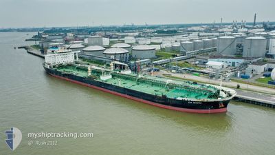
EVA MAERSK
Tanker
Current Trip
| Time Travelled | 9 days |
|---|---|
| Remaining Time | 18 h, 17 mins |
| Distance Travelled | 2681.25 nm |
| Remaining Distance | 263.53 nm |
| AVG Speed | 12.5 Noeuds |
| MAX Speed | 16 Noeuds |
| AVG Wind | 13.4 knots |
| MAX Wind | 31.6 knots |
| MIN Temp | 10.5°C / 50.9°F |
| MAX Temp | 21.8°C / 71.24°F |
| Tirant d eau | 16.9 m |
| Position reçue | 9 h, 15 m depuis |
Current Position
| Longitude | 7.79045° |
|---|---|
| Latitude | 37.82926° |
| Etat | Under way using engine |
| Vitesse | 12.2 Noeuds |
| Parcours | 84° |
| Zone | Mediterranean Sea - Western Basin |
| Station | T-AIS |
| Position reçue | 9 h, 15 m depuis |
Info
Information
The current position of EVA MAERSK is in Mediterranean Sea - Western Basin with coordinates 37.82926° / 7.79045° as reported on 2024-06-11 15:34 by AIS to our vessel tracker app. The vessel's current speed is 12.2 Noeuds and is heading at the port of VALLETTA. The estimated time of arrival as calculated by MyShipTracking vessel tracking app is 2024-06-12 21:07 LT
The vessel EVA MAERSK (IMO: 9682992, MMSI: 219312000) is a Tanker It's sailing under the flag of [DK] Denmark.
In this page you can find informations about the vessels current position, last detected port calls, and current voyage information. If the vessels is not in coverage by AIS you will find the latest position.
The current position of EVA MAERSK is detected by our AIS receivers and we are not responsible for the reliability of the data. The last position was recorded while the vessel was in Coverage by the Ais receivers of our vessel tracking app.
The current draught of EVA MAERSK as reported by AIS is 16.9 meters
Weather
| Temperature | 21.8°C / 71.24°F |
|---|---|
| Wind Speed | 10 knots |
| Direction | 320° NW |
| Pressure | 1013.2 hPa |
| Humidity | 82.3 % |
| Cloud Coverage | 50 % |
Featured Company
Last Port Calls
| Port | Arrival | Departure | Time In Port |
|---|---|---|---|
| 2024-06-01 16:54 | 2024-06-03 02:07 | 1 d | |
| 2024-05-29 05:25 | 2024-05-30 20:23 | 1 d | |
| 2024-05-26 01:22 | 2024-05-27 11:59 | 1 d | |
| 2024-05-19 11:10 | 2024-05-20 23:20 | 1 d | |
| 2024-05-15 00:14 | 2024-05-15 23:31 | 23 h | |
| 2024-05-08 10:08 | 2024-05-09 23:55 | 1 d |
Most Visited Ports (Last year)
| Port | Arrivals | |
|---|---|---|
| 5 | ||
| 3 | ||
| 2 | ||
| 2 | ||
| 1 | ||
| 1 |
Last Trips
| Origin | Departure | Destination | Arrival | Distance | |
|---|---|---|---|---|---|
| 2024-05-30 20:23 | 2024-06-01 16:54 | 490.42 nm | |||
| 2024-05-27 11:59 | 2024-05-29 05:25 | 491.76 nm | |||
| 2024-05-20 23:20 | 2024-05-26 01:22 | 965.78 nm | |||
| 2024-05-15 23:31 | 2024-05-19 11:10 | 937.52 nm | |||
| 2024-05-09 23:55 | 2024-05-15 00:14 | 925.27 nm | |||
| 2024-03-27 09:30 | 2024-05-08 10:08 | 6899.66 nm |
Events
| Heure | Evenement | Détails | Position/ Destination | Info |
|---|---|---|---|---|
| 2024-06-11 15:43 | Etat Changé | Default Under way using engine |
37.83227 / 7.82679
MALTA OPL
|
Vitesse: 12.2 kn Parcours: 84° |
| 2024-06-11 15:34 | Changement de zone | Algerian part of the Mediterranean Sea - Western Basin Spanish part of the Mediterranean Sea - Western Basin |
37.82926 / 7.79045
Mediterranean Sea - Western Basin
MALTA OPL
|
Vitesse: 12.2 kn Parcours: 84° |
| 2024-06-11 15:34 | Hors de la zone couverte |
37.82926 / 7.79045
Mediterranean Sea - Western Basin
MALTA OPL
|
Vitesse: 12.2 kn Parcours: 84° |
|
| 2024-06-11 15:34 | Etat Changé | Under way using engine Default |
37.82901 / 7.78747
MALTA OPL
|
Vitesse: 11.9 kn Parcours: 84° |
| 2024-06-11 15:34 | Dans la zone couverte |
37.82926 / 7.79045
Mediterranean Sea - Western Basin
MALTA OPL
|
Vitesse: 12.2 kn Parcours: 84° |
|
| 2024-06-10 02:15 | Etat Changé | Default Under way using engine |
36.42743 / -1.82936
MALTA OPL
|
Vitesse: 12.4 kn Parcours: 77° |
| 2024-06-10 02:10 | Detecté en mer | Spanish part of the Mediterranean Sea - Western Basin |
36.42313 / -1.85227
Mediterranean Sea - Western Basin
MALTA OPL
|
Vitesse: 12.4 kn Parcours: 77° |
| 2024-06-10 02:10 | Etat Changé | Under way using engine Default |
36.42313 / -1.85227
MALTA OPL
|
Vitesse: 12.4 kn Parcours: 77° |
| 2024-06-10 02:10 | Hors de la zone couverte |
36.42313 / -1.85227
Mediterranean Sea - Western Basin
MALTA OPL
|
Vitesse: 12.4 kn Parcours: 77° |
|
| 2024-06-10 01:55 | Etat Changé | Default Under way using engine |
36.41180 / -1.91266
MALTA OPL
|
Vitesse: 12.3 kn Parcours: 77.2° |