
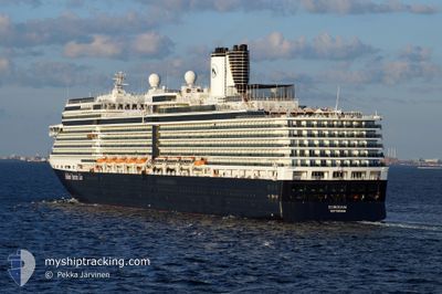
EURODAM
Passengers Ship
Current Trip
| Time Travelled | 3 h, 12 mins |
|---|---|
| Remaining Time | 1 day |
| Distance Travelled | 62.39 nm |
| Remaining Distance | 815.74 nm |
| AVG Speed | 20.6 Noeuds |
| MAX Speed | 23.2 Noeuds |
| AVG Wind | 3.6 knots |
| MAX Wind | 8.2 knots |
| MIN Temp | 11.6°C / 52.88°F |
| MAX Temp | 14.9°C / 58.82°F |
| Tirant d eau | 8 m |
| Position reçue | Maintenant |
Current Position
| Longitude | -123.36012° |
|---|---|
| Latitude | 48.14485° |
| Etat | Under way using engine |
| Vitesse | 10 Noeuds |
| Parcours | 288.7° |
| Zone | The Coastal Waters of Southeast Alaska and British Columbia |
| Station | T-AIS |
| Position reçue | Maintenant |
Info
Information
The current position of EURODAM is in The Coastal Waters of Southeast Alaska and British Columbia with coordinates 48.14485° / -123.36012° as reported on 2024-05-05 01:33 by AIS to our vessel tracker app. The vessel's current speed is 10 Noeuds and is heading at the port of JUNEAU. The estimated time of arrival as calculated by MyShipTracking vessel tracking app is 2024-05-06 15:22 LT
The vessel EURODAM (IMO: 9378448, MMSI: 245206000) is a Passengers Ship that was built in 2008 ( 16 Age ). It's sailing under the flag of [NL] Netherlands.
In this page you can find informations about the vessels current position, last detected port calls, and current voyage information. If the vessels is not in coverage by AIS you will find the latest position.
The current position of EURODAM is detected by our AIS receivers and we are not responsible for the reliability of the data. The last position was recorded while the vessel was in Coverage by the Ais receivers of our vessel tracking app.
The current draught of EURODAM as reported by AIS is 8 meters
Weather
| Temperature | 12°C / 53.6°F |
|---|---|
| Wind Speed | 6 knots |
| Direction | 208° SSW |
| Pressure | 1000.8 hPa |
| Humidity | 82.1 % |
| Cloud Coverage | 100 % |
Featured Company
Last Port Calls
| Port | Arrival | Departure | Time In Port |
|---|---|---|---|
| 2024-05-04 13:18 | 2024-05-04 22:22 | 9 h | |
| 2024-05-03 12:57 | 2024-05-03 23:34 | 10 h | |
| 2024-04-30 13:36 | 2024-05-01 05:49 | 16 h | |
| 2024-04-27 12:46 | 2024-04-28 00:20 | 11 h | |
| 2024-04-24 14:25 | 2024-04-24 23:04 | 8 h | |
| 2024-04-22 16:53 | 2024-04-22 23:48 | 6 h | |
| 2024-04-21 13:33 | 2024-04-21 22:09 | 8 h | |
| 2024-04-19 09:55 | 2024-04-20 00:36 | 14 h | |
| 2024-04-16 11:10 | 2024-04-16 18:25 | 7 h | |
| 2024-04-13 18:49 | 2024-04-13 20:19 | 1 h |
Most Visited Ports (Last year)
| Port | Arrivals | |
|---|---|---|
| 25 | ||
| 23 | ||
| 22 | ||
| 21 | ||
| 21 | ||
| 17 |
Last Trips
| Origin | Departure | Destination | Arrival | Distance | |
|---|---|---|---|---|---|
| 2024-05-03 16:34 | 2024-05-04 06:18 | 161.12 nm | |||
| 2024-04-30 22:49 | 2024-05-03 05:57 | 857.73 nm | |||
| 2024-04-27 17:20 | 2024-04-30 06:36 | 534.13 nm | |||
| 2024-04-24 18:04 | 2024-04-27 05:46 | 1052.94 nm | |||
| 2024-04-22 18:48 | 2024-04-24 09:25 | 698.70 nm | |||
| 2024-04-21 16:09 | 2024-04-22 11:53 | 342.17 nm | |||
| 2024-04-19 18:36 | 2024-04-21 07:33 | 478.78 nm | |||
| 2024-04-16 13:25 | 2024-04-19 03:55 | 823.74 nm | |||
| 2024-04-13 16:19 | 2024-04-16 06:10 | 1146.65 nm | |||
| 2024-04-12 08:28 | 2024-04-13 14:49 | 282.66 nm |
Events
| Heure | Evenement | Détails | Position/ Destination | Info |
|---|---|---|---|---|
| 2024-05-05 00:20 | Démarrage | 4.67 nm, North of PORT TOWNSEND |
48.18654 / -122.77700
US JNU
|
Vitesse: 22.8 kn Parcours: 302° |
| 2024-05-05 00:20 | Arret | 4.58 nm, North of PORT TOWNSEND |
48.18538 / -122.77432
US JNU
|
Vitesse: Parcours: 302° |
| 2024-05-04 23:54 | Démarrage | 5.6 nm, South East of PORT TOWNSEND |
48.06190 / -122.63505
US JNU
|
Vitesse: 22.1 kn Parcours: 350.1° |
| 2024-05-04 23:54 | Arret | 5.67 nm, South East of PORT TOWNSEND |
48.06009 / -122.63460
US JNU
|
Vitesse: Parcours: 349° |
| 2024-05-04 23:36 | Changement d'ETA | 2024/05/06 19:00 |
47.96334 / -122.56268
US JNU
|
Vitesse: 22.5 kn Parcours: 307° |
| 2024-05-04 23:32 | Démarrage | 7.58 nm, West of CLINTON |
47.94907 / -122.53251
US JNU
|
Vitesse: 21.8 kn Parcours: 312.7° |
| 2024-05-04 23:32 | Arret | 7.52 nm, West of CLINTON |
47.94784 / -122.53054
US JNU
|
Vitesse: Parcours: 313° |
| 2024-05-04 23:22 | Démarrage | 6.34 nm, North of KINGSTON FERRY |
47.90004 / -122.48348
US JNU
|
Vitesse: 19.3 kn Parcours: 329° |
| 2024-05-04 23:22 | Arret | 6.22 nm, North of KINGSTON FERRY |
47.89811 / -122.48179
US JNU
|
Vitesse: Parcours: 329° |
| 2024-05-04 22:59 | Démarrage | 1.44 nm, West of POINT WELLS |
47.77715 / -122.43380
US JNU
|
Vitesse: 20.9 kn Parcours: 351.9° |