
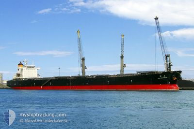
ETERNAL BRIGHT
Bulk Carrier
Current Trip
| Time Travelled | 14 days |
|---|---|
| Remaining Time | 5 days |
| Distance Travelled | 3281.84 nm |
| Remaining Distance | 1607.73 nm |
| AVG Speed | 9.9 Noeuds |
| MAX Speed | 12.6 Noeuds |
| AVG Wind | 17.2 knots |
| MAX Wind | 38 knots |
| MIN Temp | 3.1°C / 37.58°F |
| MAX Temp | 18.1°C / 64.58°F |
| Tirant d eau | 14.1 m |
| Position reçue | 1 d depuis |
Current Position
| Longitude | --- |
|---|---|
| Latitude | --- |
| Etat | Under way using engine |
| Vitesse | 10.8 Noeuds |
| Parcours | 85.5° |
| Zone | Alboran Sea |
| Station | T-AIS |
| Position reçue | 1 d depuis |
Info
Information
The current position of ETERNAL BRIGHT is in Alboran Sea with coordinates 36.12801° / -4.29031° as reported on 2025-12-14 20:06 by AIS to our vessel tracker app. The vessel's current speed is 10.8 Noeuds and is heading at the port of PORT SAID. The estimated time of arrival as calculated by MyShipTracking vessel tracking app is 2025-12-21 18:02 LT
The vessel ETERNAL BRIGHT (IMO: 9287780, MMSI: 352001571) is a Bulk Carrier that was built in 2004 ( 21 Age ). It's sailing under the flag of [PA] Panama.
In this page you can find informations about the vessels current position, last detected port calls, and current voyage information. If the vessels is not in coverage by AIS you will find the latest position.
The current position of ETERNAL BRIGHT is detected by our AIS receivers and we are not responsible for the reliability of the data. The last position was recorded while the vessel was in Coverage by the Ais receivers of our vessel tracking app.
The current draught of ETERNAL BRIGHT as reported by AIS is 14.1 meters
Weather
| Temperature | 16.2°C / 61.16°F |
|---|---|
| Wind Speed | 7 knots |
| Direction | 191° S |
| Pressure | 1010.8 hPa |
| Humidity | 66.1 % |
| Cloud Coverage | 1 % |
Featured Company
Last Port Calls
| Port | Arrival | Departure | Time In Port |
|---|---|---|---|
| 2025-11-30 16:28 | 2025-12-01 19:11 | 1 d | |
| 2025-11-10 09:53 | 2025-11-12 19:45 | 2 d | |
| 2025-10-07 22:22 | 2025-10-10 13:44 | 2 d |
Most Visited Ports (Last year)
| Port | Arrivals | |
|---|---|---|
| 3 | ||
| 3 | ||
| 2 | ||
| 2 | ||
| 1 | ||
| 1 |
Last Trips
| Origin | Departure | Destination | Arrival | Distance | |
|---|---|---|---|---|---|
| 2025-11-12 19:45 | 2025-11-30 16:28 | 4501.93 nm | |||
| 2025-10-10 13:44 | 2025-11-10 09:53 | 4682.00 nm | |||
| 2025-09-12 05:58 | 2025-10-07 22:22 | 6173.82 nm |
Events
| Heure | Evenement | Détails | Position/ Destination | Info |
|---|---|---|---|---|
| 2025-12-14 20:11 | Etat Changé | Default Under way using engine |
36.12833 / -4.27333
PORT SAID
|
Vitesse: 10.8 kn Parcours: 85.5° |
| 2025-12-14 20:06 | Etat Changé | Under way using engine Default |
36.12801 / -4.29031
PORT SAID
|
Vitesse: 10.7 kn Parcours: 84° |
| 2025-12-14 20:06 | Hors de la zone couverte |
36.12801 / -4.29031
Alboran Sea
PORT SAID
|
Vitesse: 10.8 kn Parcours: 85.5° |
|
| 2025-12-14 19:39 | Etat Changé | Default Under way using engine |
36.11646 / -4.38947
PORT SAID
|
Vitesse: 10.6 kn Parcours: 74.8° |
| 2025-12-14 19:21 | Etat Changé | Under way using engine Default |
36.10262 / -4.45397
PORT SAID
|
Vitesse: 10.8 kn Parcours: 65° |
| 2025-12-14 19:14 | Etat Changé | Default Under way using engine |
36.09167 / -4.47667
PORT SAID
|
Vitesse: 10.7 kn Parcours: 65.3° |
| 2025-12-14 19:09 | Etat Changé | Under way using engine Default |
36.08726 / -4.49408
PORT SAID
|
Vitesse: 10.5 kn Parcours: 71° |
| 2025-12-14 18:59 | Etat Changé | Default Under way using engine |
36.07500 / -4.52833
PORT SAID
|
Vitesse: 10.1 kn Parcours: 91.3° |
| 2025-12-14 18:50 | Etat Changé | Under way using engine Default |
36.07326 / -4.55803
PORT SAID
|
Vitesse: 10 kn Parcours: 90° |
| 2025-12-14 18:46 | Etat Changé | Default Under way using engine |
36.07316 / -4.57413
PORT SAID
|
Vitesse: 9.9 kn Parcours: 87.3° |