
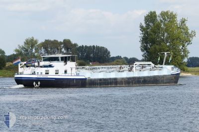
ESLABON
Tanker
Current Trip
VAN A NAAR B
| Time Travelled | 13 h, 13 mins |
|---|---|
| Remaining Time | --- |
| Distance Travelled | 17.97 nm |
| Remaining Distance | --- |
| AVG Speed | 6.2 Noeuds |
| MAX Speed | 6.8 Noeuds |
| AVG Wind | 9.8 knots |
| MAX Wind | 17 knots |
| MIN Temp | 3.7°C / 38.66°F |
| MAX Temp | 5.6°C / 42.08°F |
| Tirant d eau | 2.5 m |
| Position reçue | Maintenant |
Current Position
| Longitude | --- |
|---|---|
| Latitude | --- |
| Etat | Under way using engine |
| Vitesse | 6.2 Noeuds |
| Parcours | 214.1° |
| Zone | North Sea |
| Station | T-AIS |
| Position reçue | Maintenant |
Info
Information
The current position of ESLABON is in North Sea with coordinates 52.82438° / 5.63565° as reported on 2025-12-06 05:57 by AIS to our vessel tracker app. The vessel's current speed is 6.2 Noeuds
The vessel ESLABON (MMSI: 244780231) is a Tanker It's sailing under the flag of [NL] Netherlands.
In this page you can find informations about the vessels current position, last detected port calls, and current voyage information. If the vessels is not in coverage by AIS you will find the latest position.
The current position of ESLABON is detected by our AIS receivers and we are not responsible for the reliability of the data. The last position was recorded while the vessel was in Coverage by the Ais receivers of our vessel tracking app.
The current draught of ESLABON as reported by AIS is 2.5 meters
Weather
| Temperature | 5.5°C / 41.9°F |
|---|---|
| Wind Speed | 17 knots |
| Direction | 166° SSE |
| Pressure | 1000.7 hPa |
| Humidity | 82.2 % |
| Cloud Coverage | 100 % |
Featured Company
Last Port Calls
| Port | Arrival | Departure | Time In Port |
|---|---|---|---|
| 2025-12-05 17:45 | |||
| 2025-11-14 00:30 | 2025-11-15 07:52 | 1 d | |
| 2025-11-11 19:28 | 2025-11-13 16:52 | 1 d | |
| 2025-11-11 02:24 | 2025-11-11 08:25 | 6 h | |
| 2025-11-08 21:22 | 2025-11-09 09:12 | 11 h | |
| 2025-11-07 03:37 | 2025-11-08 07:21 | 1 d | |
| 2025-11-06 12:48 | 2025-11-06 13:11 | 23 m | |
| 2025-10-30 18:09 | 2025-11-06 08:33 | 6 d | |
| 2025-10-30 12:20 | 2025-10-30 13:05 | 45 m | |
| 2025-10-30 01:17 | 2025-10-30 07:56 | 6 h |
Last Trips
| Origin | Departure | Destination | Arrival | Distance | |
|---|---|---|---|---|---|
| 2025-11-13 16:52 | 2025-11-14 00:30 | 40.60 nm | |||
| 2025-11-11 08:25 | 2025-11-11 19:28 | 60.67 nm | |||
| 2025-11-09 09:12 | 2025-11-11 02:24 | 86.22 nm | |||
| 2025-11-08 07:21 | 2025-11-08 21:22 | 100.02 nm | |||
| 2025-11-06 13:11 | 2025-11-07 03:37 | 77.79 nm | |||
| 2025-11-06 08:33 | 2025-11-06 12:48 | 31.22 nm | |||
| 2025-10-30 13:05 | 2025-10-30 18:09 | 30.94 nm | |||
| 2025-10-30 07:56 | 2025-10-30 12:20 | 26.20 nm | |||
| 2025-10-29 16:38 | 2025-10-30 01:17 | 43.23 nm | |||
| 2025-10-29 14:08 | 2025-10-29 15:40 | 10.77 nm |
Events
| Heure | Evenement | Détails | Position/ Destination | Info |
|---|---|---|---|---|
| 2025-12-06 05:36 | Démarrage | 0.99 nm, West of LEMMER |
52.84664 / 5.67353
VAN A NAAR B
|
Vitesse: 4.9 kn Parcours: 197.3° |
| 2025-12-05 19:58 | Arret | 0.93 nm, West of LEMMER |
52.84833 / 5.67503
VAN A NAAR B
|
Vitesse: 0.2 kn Parcours: 511° |
| 2025-12-05 19:54 | Démarrage | 0.92 nm, West of LEMMER |
52.84963 / 5.67520
VAN A NAAR B
|
Vitesse: 4.3 kn Parcours: 203.5° |
| 2025-12-05 19:45 | Arret | 0.89 nm, West of LEMMER |
52.85180 / 5.67648
VAN A NAAR B
|
Vitesse: 0.2 kn Parcours: 511° |
| 2025-12-05 19:05 | Démarrage | 1.05 nm, South of IDSKENHUIZEN |
52.91311 / 5.69993
VAN A NAAR B
|
Vitesse: 6 kn Parcours: 177.6° |
| 2025-12-05 18:38 | Arret | 0.94 nm, South of IDSKENHUIZEN |
52.91504 / 5.69949
VAN A NAAR B
|
Vitesse: 0.2 kn Parcours: 511° |
| 2025-12-05 16:50 | Dans la zone couverte |
53.03876 / 5.82305
North Sea
|
Vitesse: 6.7 kn Parcours: 306.2° |
|
| 2025-12-05 16:45 | PORT DE DEPART |
|
53.03876 / 5.82305
VAN A NAAR B
|
Vitesse: Parcours: 511° |
| 2025-12-05 11:31 | Hors de la zone couverte |
53.04057 / 5.83977
North Sea
[NL] AKKRUM
|
Vitesse: Parcours: 260.9° |
|
| 2025-12-05 11:08 | Etat Changé | Under way using engine Default |
53.04063 / 5.83974
[NL] AKKRUM
|
Vitesse: Parcours: -1° |