
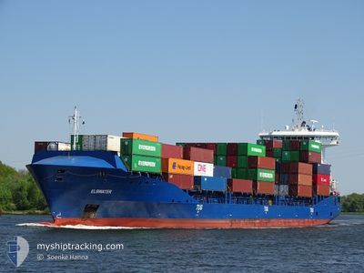
ELBWATER
Container Ship
Current Trip
| Time Travelled | 1 day |
|---|---|
| Remaining Time | 17 h, 19 mins |
| Distance Travelled | 492.06 nm |
| Remaining Distance | 220.21 nm |
| AVG Speed | 12.4 Noeuds |
| MAX Speed | 13.1 Noeuds |
| AVG Wind | 13.9 knots |
| MAX Wind | 21.8 knots |
| MIN Temp | 4.5°C / 40.1°F |
| MAX Temp | 9.8°C / 49.64°F |
| Tirant d eau | 8.2 m |
| Position reçue | Maintenant |
Current Position
| Longitude | 13.27900° |
|---|---|
| Latitude | 54.91478° |
| Etat | Under way using engine |
| Vitesse | 12.6 Noeuds |
| Parcours | 251.1° |
| Zone | Baltic Sea |
| Station | T-AIS |
| Position reçue | Maintenant |
Info
Information
The current position of ELBWATER is in Baltic Sea with coordinates 54.91478° / 13.27900° as reported on 2024-05-02 04:31 by AIS to our vessel tracker app. The vessel's current speed is 12.6 Noeuds and is heading at the port of HAMBURG. The estimated time of arrival as calculated by MyShipTracking vessel tracking app is 2024-05-02 21:51 LT
The vessel ELBWATER (IMO: 9504073, MMSI: 210359000) is a Container Ship that was built in 2012 ( 12 Age ). It's sailing under the flag of [CY] Cyprus.
In this page you can find informations about the vessels current position, last detected port calls, and current voyage information. If the vessels is not in coverage by AIS you will find the latest position.
The current position of ELBWATER is detected by our AIS receivers and we are not responsible for the reliability of the data. The last position was recorded while the vessel was in Coverage by the Ais receivers of our vessel tracking app.
The current draught of ELBWATER as reported by AIS is 8.2 meters
Weather
| Temperature | 8.2°C / 46.76°F |
|---|---|
| Wind Speed | 20 knots |
| Direction | 65° ENE |
| Pressure | 1010.8 hPa |
| Humidity | 90.1 % |
| Cloud Coverage | 35 % |
Featured Company
Last Port Calls
| Port | Arrival | Departure | Time In Port |
|---|---|---|---|
| 2024-04-30 00:40 | 2024-04-30 13:11 | 12 h | |
| 2024-04-29 04:32 | 2024-04-29 20:37 | 16 h | |
| 2024-04-25 06:06 | 2024-04-26 06:36 | 1 d | |
| 2024-04-24 15:13 | 2024-04-25 04:27 | 13 h | |
| 2024-04-22 07:21 | 2024-04-23 08:29 | 1 d | |
| 2024-04-16 04:54 | 2024-04-16 16:58 | 12 h | |
| 2024-04-13 00:23 | 2024-04-14 09:39 | 1 d | |
| 2024-04-12 06:44 | 2024-04-12 14:31 | 7 h | |
| 2024-04-11 14:05 | 2024-04-11 14:42 | 36 m | |
| 2024-04-10 03:01 | 2024-04-10 13:56 | 10 h |
Most Visited Ports (Last year)
| Port | Arrivals | |
|---|---|---|
| 36 | ||
| 34 | ||
| 23 | ||
| 10 | ||
| 10 | ||
| 9 |
Last Trips
| Origin | Departure | Destination | Arrival | Distance | |
|---|---|---|---|---|---|
| 2024-04-29 23:37 | 2024-04-30 03:40 | 46.48 nm | |||
| 2024-04-26 08:36 | 2024-04-29 07:32 | 977.59 nm | |||
| 2024-04-25 06:27 | 2024-04-25 08:06 | 16.39 nm | |||
| 2024-04-23 10:29 | 2024-04-24 17:13 | 339.73 nm | |||
| 2024-04-16 18:58 | 2024-04-22 09:21 | 1177.09 nm | |||
| 2024-04-14 11:39 | 2024-04-16 06:54 | 559.39 nm | |||
| 2024-04-12 16:31 | 2024-04-13 02:23 | 112.42 nm | |||
| 2024-04-11 16:42 | 2024-04-12 08:44 | 126.34 nm | |||
| 2024-04-10 15:56 | 2024-04-11 16:05 | 360.93 nm | |||
| 2024-04-10 01:24 | 2024-04-10 05:01 | 19.01 nm |
Events
| Heure | Evenement | Détails | Position/ Destination | Info |
|---|---|---|---|---|
| 2024-05-02 02:59 | Changement de zone | German part of the Baltic Sea Swedish part of the Baltic Sea |
55.01525 / 13.80543
Baltic Sea
DEHAM VIA NOK
|
Vitesse: 12.6 kn Parcours: 246.4° |
| 2024-05-01 23:38 | Detecté en mer | Swedish part of the Baltic Sea |
55.48347 / 14.71864
Baltic Sea
DEHAM VIA NOK
|
Vitesse: 12.5 kn Parcours: 238.7° |
| 2024-05-01 22:05 | Detecté en mer | Danish part of the Kattegat |
55.65135 / 15.21466
Kattegat
DEHAM VIA NOK
|
Vitesse: 12.7 kn Parcours: 238.9° |
| 2024-05-01 12:44 | Etat Changé | Under way using engine Default |
56.73636 / 18.17152
DEHAM VIA NOK
|
Vitesse: 12.5 kn Parcours: 235° |
| 2024-05-01 12:40 | Etat Changé | Default Under way using engine |
56.74352 / 18.19056
DEHAM VIA NOK
|
Vitesse: 12.5 kn Parcours: 234.2° |
| 2024-05-01 12:31 | Etat Changé | Under way using engine Default |
56.76291 / 18.24062
DEHAM VIA NOK
|
Vitesse: 12.5 kn Parcours: 233° |
| 2024-05-01 12:12 | Dans la zone couverte |
56.76088 / 18.23544
Baltic Sea
DEHAM VIA NOK
|
Vitesse: 12.6 kn Parcours: 234.6° |
|
| 2024-05-01 08:00 | Etat Changé | Default Under way using engine |
57.46988 / 19.37778
DEHAM VIA NOK
|
Vitesse: 12.6 kn Parcours: 215.7° |
| 2024-05-01 07:49 | Hors de la zone couverte |
57.50284 / 19.42304
Baltic Sea
DEHAM VIA NOK
|
Vitesse: 12.6 kn Parcours: 215.7° |
|
| 2024-05-01 04:04 | Changement de zone | Swedish part of the Baltic Sea Estonian part of the Baltic Sea |
58.08886 / 20.38013
Baltic Sea
DEHAM VIA NOK
|
Vitesse: 12.4 kn Parcours: 221.1° |