
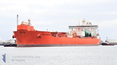
EAGLE BALDER
Tanker
Current Trip
NJORD
| Time Travelled | 16 days |
|---|---|
| Remaining Time | --- |
| Distance Travelled | 1183.45 nm |
| Remaining Distance | --- |
| AVG Speed | 7 Noeuds |
| MAX Speed | 12.3 Noeuds |
| AVG Wind | 10.7 knots |
| MAX Wind | 27 knots |
| MIN Temp | 10.2°C / 50.36°F |
| MAX Temp | 16.8°C / 62.24°F |
| Tirant d eau | 9.6 m |
| Position reçue | 1 m depuis |
Current Position
| Longitude | -2.46172° |
|---|---|
| Latitude | 58.81407° |
| Etat | Under way using engine |
| Vitesse | 6.5 Noeuds |
| Parcours | 64.6° |
| Zone | North Sea |
| Station | T-AIS |
| Position reçue | 1 m depuis |
Info
Information
The current position of EAGLE BALDER is in North Sea with coordinates 58.81407° / -2.46172° as reported on 2024-06-01 00:52 by AIS to our vessel tracker app. The vessel's current speed is 6.5 Noeuds
The vessel EAGLE BALDER (IMO: 9833113, MMSI: 257089150) is a Tanker It's sailing under the flag of [NO] Norway.
In this page you can find informations about the vessels current position, last detected port calls, and current voyage information. If the vessels is not in coverage by AIS you will find the latest position.
The current position of EAGLE BALDER is detected by our AIS receivers and we are not responsible for the reliability of the data. The last position was recorded while the vessel was in Coverage by the Ais receivers of our vessel tracking app.
The current draught of EAGLE BALDER as reported by AIS is 9.6 meters
Weather
| Temperature | 10.5°C / 50.9°F |
|---|---|
| Wind Speed | 13 knots |
| Direction | 315° NW |
| Pressure | 1026.2 hPa |
| Humidity | 91.5 % |
| Cloud Coverage | 100 % |
Featured Company
Events
| Heure | Evenement | Détails | Position/ Destination | Info |
|---|---|---|---|---|
| 2024-05-31 20:04 | Démarrage | 3.55 nm, North West of ST MARGARET'S HOPE |
58.88555 / -3.00857
NJORD
|
Vitesse: 3.1 kn Parcours: 287° |
| 2024-05-31 20:03 | Changement de destination | NJORD SCAPA FLOW |
58.88493 / -3.00801
NJORD
|
Vitesse: 2.6 kn Parcours: 306° |
| 2024-05-31 20:03 | Changement d'ETA | 2024/06/03 14:00 2024/05/28 07:00 |
58.88493 / -3.00801
NJORD
|
Vitesse: 2.6 kn Parcours: 306° |
| 2024-05-31 20:03 | Etat Changé | Under way using engine At anchor |
58.88481 / -3.00796
SCAPA FLOW
|
Vitesse: 0.3 kn Parcours: 330° |
| 2024-05-31 18:14 | Etat Changé | At anchor Default |
58.88334 / -3.00526
SCAPA FLOW
|
Vitesse: Parcours: -1° |
| 2024-05-31 18:12 | Etat Changé | Default At anchor |
58.88334 / -3.00500
SCAPA FLOW
|
Vitesse: 0.1 kn Parcours: 313° |
| 2024-05-31 06:35 | Etat Changé | At anchor Default |
58.88417 / -3.00449
SCAPA FLOW
|
Vitesse: Parcours: 288° |
| 2024-05-31 06:31 | Etat Changé | Default At anchor |
58.88419 / -3.00452
SCAPA FLOW
|
Vitesse: Parcours: 290° |
| 2024-05-31 06:17 | Etat Changé | At anchor Default |
58.88407 / -3.00457
SCAPA FLOW
|
Vitesse: Parcours: -1° |
| 2024-05-31 06:15 | Etat Changé | Default At anchor |
58.88334 / -3.00333
SCAPA FLOW
|
Vitesse: Parcours: 294° |