
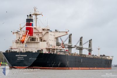
DRAFTDODGER
Cargo
Current Trip
BR SSZ
| Time Travelled | 8 days |
|---|---|
| Remaining Time | --- |
| Distance Travelled | 1166.82 nm |
| Remaining Distance | --- |
| AVG Speed | 9.8 Noeuds |
| MAX Speed | 12 Noeuds |
| AVG Wind | 7.8 knots |
| MAX Wind | 18 knots |
| MIN Temp | 20°C / 68°F |
| MAX Temp | 27.8°C / 82.04°F |
| Tirant d eau | 6.5 m |
| Position reçue | 2025-10-27 09:38 |
Current Position
| Longitude | --- |
|---|---|
| Latitude | --- |
| Etat | Under way using engine |
| Vitesse | 12.1 Noeuds |
| Parcours | 12.2° |
| Zone | South Atlantic Ocean |
| Station | T-AIS |
| Position reçue | 2025-10-27 09:38 |
Info
Information
The current position of DRAFTDODGER is in South Atlantic Ocean with coordinates -27.68951° / -47.38740° as reported on 2025-10-27 09:38 by AIS to our vessel tracker app. The vessel's current speed is 12.1 Noeuds
The vessel DRAFTDODGER (IMO: 9746102, MMSI: 241421000) is a Cargo It's sailing under the flag of [GR] Greece.
In this page you can find informations about the vessels current position, last detected port calls, and current voyage information. If the vessels is not in coverage by AIS you will find the latest position.
The current position of DRAFTDODGER is detected by our AIS receivers and we are not responsible for the reliability of the data. The last position was recorded while the vessel was in Coverage by the Ais receivers of our vessel tracking app.
The current draught of DRAFTDODGER as reported by AIS is 6.5 meters
Weather
| Temperature | 20.8°C / 69.44°F |
|---|---|
| Wind Speed | 4 knots |
| Direction | 1° N |
| Pressure | 1015.1 hPa |
| Humidity | 71.4 % |
| Cloud Coverage | --- |
Featured Company
Last Port Calls
| Port | Arrival | Departure | Time In Port |
|---|---|---|---|
| 2025-12-11 12:01 | 2025-12-11 20:44 | 8 h | |
| 2025-11-05 10:01 | 2025-11-10 02:29 | 4 d | |
| 2025-10-11 15:25 | 2025-10-23 06:17 | 11 d | |
| 2025-10-06 17:01 | 2025-10-11 09:13 | 4 d |
Most Visited Ports (Last year)
| Port | Arrivals | |
|---|---|---|
| 2 | ||
| 2 | ||
| 1 | ||
| 1 | ||
| 1 | ||
| 1 |
Last Trips
| Origin | Departure | Destination | Arrival | Distance | |
|---|---|---|---|---|---|
| 2025-11-10 02:29 | 2025-12-11 12:01 | 7869.14 nm | |||
| 2025-10-23 06:17 | 2025-11-05 10:01 | 1260.78 nm | |||
| 2025-10-11 09:13 | 2025-10-11 15:25 | 55.95 nm | |||
| 2025-09-29 14:41 | 2025-10-06 17:01 | 343.63 nm |
Events
| Heure | Evenement | Détails | Position/ Destination | Info |
|---|---|---|---|---|
| 2025-12-16 09:38 | Arret |
21.78007 / 91.78048
BR SSZ
|
Vitesse: 0.2 kn Parcours: 337° |
|
| 2025-12-11 15:14 | PORT DE DEPART |
|
6.10013 / 81.11628
BR SSZ
|
Vitesse: 6.5 kn Parcours: 151° |
| 2025-12-11 15:01 | Démarrage |
6.12310 / 81.10017
[LK] HAMBANTOTA
|
Vitesse: 6.5 kn Parcours: 151° |
|
| 2025-12-11 06:50 | Arret |
6.13351 / 81.09308
[LK] HAMBANTOTA
|
Vitesse: 0.1 kn Parcours: 270° |
|
| 2025-12-11 06:31 | Port d'arrivée |
|
6.12659 / 81.09953
[LK] HAMBANTOTA
|
Vitesse: 8.3 kn Parcours: 330° |
| 2025-12-11 04:57 | Démarrage | 10.94 nm, South East of HAMBANTOTA |
5.97218 / 81.20100
BR SSZ
|
Vitesse: 3.1 kn Parcours: 325° |
| 2025-12-11 04:17 | Arret | 11.17 nm, South East of HAMBANTOTA |
5.97640 / 81.21375
BR SSZ
|
Vitesse: 0.2 kn Parcours: 82° |
| 2025-12-11 01:06 | Démarrage | 18.56 nm, South West of HAMBANTOTA |
5.85934 / 80.94023
BR SSZ
|
Vitesse: 5 kn Parcours: 80° |
| 2025-12-11 00:52 | Arret | 18.92 nm, South West of HAMBANTOTA |
5.85778 / 80.93109
BR SSZ
|
Vitesse: 0.3 kn Parcours: 80° |