
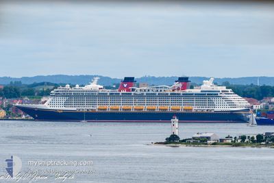
DISNEY DREAM
Passengers Ship
Current Trip
| Trip Time | 3 days |
|---|---|
| Trip Distance | 715.26 nm |
| AVG Speed | 10.8 Noeuds |
| MAX Speed | 14.2 Noeuds |
| Tirant d eau | 8.6 m |
| AVG Wind | 9.6 knots |
| MAX Wind | 16 knots |
| MIN Temp | 23.8°C / 74.84°F |
| MAX Temp | 25.9°C / 78.62°F |
| Position reçue | 2 m depuis |
Current Position
| Longitude | --- |
|---|---|
| Latitude | --- |
| Etat | Moored |
| Vitesse | |
| Parcours | 269° |
| Zone | North Atlantic Ocean |
| Station | T-AIS |
| Position reçue | 2 m depuis |
Info
Information
The current position of DISNEY DREAM is in North Atlantic Ocean with coordinates 26.09521° / -80.12308° as reported on 2025-12-05 14:23 by AIS to our vessel tracker app. The vessel's current speed is 0 Noeuds and is currently inside the port of PORT EVERGLADES.
The vessel DISNEY DREAM (IMO: 9434254, MMSI: 311042900) is a Passengers Ship that was built in 2010 ( 15 Age ). It's sailing under the flag of [BS] Bahamas.
In this page you can find informations about the vessels current position, last detected port calls, and current voyage information. If the vessels is not in coverage by AIS you will find the latest position.
The current position of DISNEY DREAM is detected by our AIS receivers and we are not responsible for the reliability of the data. The last position was recorded while the vessel was in Coverage by the Ais receivers of our vessel tracking app.
The current draught of DISNEY DREAM as reported by AIS is 8.6 meters
Weather
| Temperature | 24.8°C / 76.64°F |
|---|---|
| Wind Speed | 9 knots |
| Direction | 163° SSE |
| Pressure | 1019.3 hPa |
| Humidity | 74.5 % |
| Cloud Coverage | 1 % |
Featured Company
Last Port Calls
| Port | Arrival | Departure | Time In Port |
|---|---|---|---|
| 2025-12-05 05:22 | |||
| 2025-12-01 05:23 | 2025-12-01 17:17 | 11 h | |
| 2025-11-28 07:03 | 2025-11-28 17:54 | 10 h | |
| 2025-11-26 05:41 | 2025-11-26 16:59 | 11 h | |
| 2025-11-23 07:12 | 2025-11-23 17:47 | 10 h | |
| 2025-11-22 04:10 | 2025-11-22 16:34 | 12 h | |
| 2025-11-20 07:04 | 2025-11-20 18:22 | 11 h | |
| 2025-11-17 05:37 | 2025-11-17 17:40 | 12 h | |
| 2025-11-14 07:10 | 2025-11-14 18:03 | 10 h | |
| 2025-11-12 05:43 | 2025-11-12 16:31 | 10 h |
Most Visited Ports (Last year)
| Port | Arrivals | |
|---|---|---|
| 83 | ||
| 58 | ||
| 19 | ||
| 9 |
Last Trips
| Origin | Departure | Destination | Arrival | Distance | |
|---|---|---|---|---|---|
| 2025-12-01 17:17 | 2025-12-05 05:22 | 715.26 nm | |||
| 2025-11-28 17:54 | 2025-12-01 05:23 | 579.46 nm | |||
| 2025-11-26 16:59 | 2025-11-28 07:03 | 282.74 nm | |||
| 2025-11-23 17:47 | 2025-11-26 05:41 | 552.20 nm | |||
| 2025-11-22 16:34 | 2025-11-23 07:12 | 186.29 nm | |||
| 2025-11-20 18:22 | 2025-11-22 04:10 | 309.45 nm | |||
| 2025-11-17 17:40 | 2025-11-20 07:04 | 503.09 nm | |||
| 2025-11-14 18:03 | 2025-11-17 05:37 | 551.09 nm | |||
| 2025-11-12 16:31 | 2025-11-14 07:10 | 359.98 nm | |||
| 2025-11-09 19:22 | 2025-11-12 05:43 | 574.67 nm |
Events
| Heure | Evenement | Détails | Position/ Destination | Info |
|---|---|---|---|---|
| 2025-12-05 13:14 | Etat Changé | Moored Default |
26.09521 / -80.12308
[US] PORT EVERGLADES
|
Vitesse: Parcours: 269° |
| 2025-12-05 13:08 | Etat Changé | Default Moored |
26.09521 / -80.12308
[US] PORT EVERGLADES
|
Vitesse: Parcours: 269° |
| 2025-12-05 12:56 | Etat Changé | Moored Default |
26.09521 / -80.12307
[US] PORT EVERGLADES
|
Vitesse: Parcours: 269° |
| 2025-12-05 12:53 | Etat Changé | Default Moored |
26.09521 / -80.12307
[US] PORT EVERGLADES
|
Vitesse: Parcours: 269° |
| 2025-12-05 10:43 | Etat Changé | Moored Under way using engine |
26.09518 / -80.12293
[US] PORT EVERGLADES
|
Vitesse: 0.3 kn Parcours: 270° |
| 2025-12-05 10:41 | Arret |
26.09518 / -80.12271
[US] PORT EVERGLADES
|
Vitesse: Parcours: 271° |
|
| 2025-12-05 10:22 | Port d'arrivée |
|
26.09353 / -80.11072
[US] PORT EVERGLADES
|
Vitesse: 7 kn Parcours: 268.7° |
| 2025-12-05 08:21 | Detecté en mer | United States part of the North Atlantic Ocean |
26.13003 / -79.73496
North Atlantic Ocean
US PEF
|
Vitesse: 9 kn Parcours: 254° |
| 2025-12-05 08:19 | Etat Changé | Under way using engine Default |
26.13090 / -79.73163
US PEF
|
Vitesse: 9.8 kn Parcours: 254° |
| 2025-12-05 07:50 | Etat Changé | Default Under way using engine |
26.15426 / -79.64615
US PEF
|
Vitesse: 9 kn Parcours: 249° |