
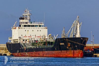
DIEGO
Oil/Chemical Tanker
Current Trip
| Trip Time | 1 day |
|---|---|
| Trip Distance | 350.53 nm |
| AVG Speed | 13.2 Noeuds |
| MAX Speed | 15.5 Noeuds |
| Tirant d eau | 5.3 m |
| AVG Wind | 14.8 knots |
| MAX Wind | 23 knots |
| MIN Temp | 5.6°C / 42.08°F |
| MAX Temp | 14.8°C / 58.64°F |
| Position reçue | 23 h, 19 m depuis |
Current Position
| Longitude | --- |
|---|---|
| Latitude | --- |
| Etat | Under way using engine |
| Vitesse | 13.3 Noeuds |
| Parcours | 244° |
| Zone | Aegean Sea |
| Station | T-AIS |
| Position reçue | 23 h, 19 m depuis |
Info
Information
The current position of DIEGO is in Aegean Sea with coordinates 37.78381° / 24.12525° as reported on 2025-12-10 01:40 by AIS to our vessel tracker app. The vessel's current speed is 13.3 Noeuds and is currently inside the port of SYRI.
The vessel DIEGO (IMO: 9279850, MMSI: 247104500) is a Oil/Chemical Tanker that was built in 2004 ( 21 Age ). It's sailing under the flag of [IT] Italy.
In this page you can find informations about the vessels current position, last detected port calls, and current voyage information. If the vessels is not in coverage by AIS you will find the latest position.
The current position of DIEGO is detected by our AIS receivers and we are not responsible for the reliability of the data. The last position was recorded while the vessel was in Coverage by the Ais receivers of our vessel tracking app.
The current draught of DIEGO as reported by AIS is 5.3 meters
Weather
| Temperature | 12°C / 53.6°F |
|---|---|
| Wind Speed | 7 knots |
| Direction | 349° N |
| Pressure | 1021.4 hPa |
| Humidity | 67.1 % |
| Cloud Coverage | 21 % |
Featured Company
Last Port Calls
| Port | Arrival | Departure | Time In Port |
|---|---|---|---|
| 2025-12-10 07:20 | |||
| 2025-12-07 23:18 | 2025-12-09 02:13 | 1 d | |
| 2025-11-30 21:36 | 2025-12-02 13:24 | 1 d | |
| 2025-11-15 22:39 | 2025-11-17 05:15 | 1 d | |
| 2025-11-13 06:56 | 2025-11-14 08:41 | 1 d | |
| 2025-11-11 19:34 | 2025-11-12 08:43 | 13 h | |
| 2025-11-06 09:16 | 2025-11-07 21:26 | 1 d | |
| 2025-11-02 12:12 | 2025-11-03 10:21 | 22 h | |
| 2025-10-25 09:24 | 2025-10-29 19:44 | 4 d | |
| 2025-10-19 22:46 | 2025-10-20 20:20 | 21 h |
Last Trips
| Origin | Departure | Destination | Arrival | Distance | |
|---|---|---|---|---|---|
| 2025-12-09 02:13 | 2025-12-10 07:20 | 350.53 nm | |||
| 2025-12-02 13:24 | 2025-12-07 23:18 | 1541.43 nm | |||
| 2025-11-17 05:15 | 2025-11-30 21:36 | 2606.99 nm | |||
| 2025-11-14 08:41 | 2025-11-15 22:39 | 516.76 nm | |||
| 2025-11-12 08:43 | 2025-11-13 06:56 | 45.71 nm | |||
| 2025-11-07 21:26 | 2025-11-11 19:34 | 1211.25 nm | |||
| 2025-11-03 10:21 | 2025-11-06 09:16 | 170.06 nm | |||
| 2025-10-29 19:44 | 2025-11-02 12:12 | 413.68 nm | |||
| 2025-10-20 20:20 | 2025-10-25 09:24 | 1143.35 nm | |||
| 2025-10-15 16:20 | 2025-10-19 22:46 | 1389.05 nm |
Events
| Heure | Evenement | Détails | Position/ Destination | Info |
|---|---|---|---|---|
| 2025-12-10 05:28 | Arret |
37.74227 / 24.06663
[GR] SYRI
|
Vitesse: 0.2 kn Parcours: 342° |
|
| 2025-12-10 05:20 | Port d'arrivée |
|
37.74194 / 24.06927
[GR] SYRI
|
Vitesse: 3.4 kn Parcours: 324° |
| 2025-12-10 05:13 | Démarrage | 0.44 nm, South East of SYRI |
37.73610 / 24.07531
GRLAV
|
Vitesse: 3.4 kn Parcours: 340° |
| 2025-12-10 02:31 | Arret | 0.82 nm, South of SYRI |
37.72864 / 24.07280
GRLAV
|
Vitesse: 0.3 kn Parcours: 352° |
| 2025-12-10 01:44 | Etat Changé | Default Under way using engine |
37.77669 / 24.11343
GRLAV
|
Vitesse: 13.3 kn Parcours: 244° |
| 2025-12-10 01:40 | Hors de la zone couverte |
37.78381 / 24.12525
Aegean Sea
GRLAV
|
Vitesse: 13.3 kn Parcours: 244° |
|
| 2025-12-10 00:02 | Etat Changé | Under way using engine Default |
37.92452 / 24.54702
GRLAV
|
Vitesse: 14.3 kn Parcours: 211° |
| 2025-12-09 23:52 | Etat Changé | Default Under way using engine |
37.95764 / 24.56963
GRLAV
|
Vitesse: 14.1 kn Parcours: 210° |
| 2025-12-09 21:40 | Etat Changé | Under way using engine Default |
38.41535 / 24.87871
GRLAV
|
Vitesse: 13.9 kn Parcours: 211° |
| 2025-12-09 21:23 | Dans la zone couverte |
38.41535 / 24.87871
Aegean Sea
GRLAV
|
Vitesse: 14.1 kn Parcours: 211° |