
DIAS
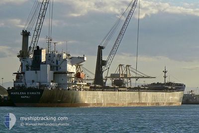
Bulk Carrier
Current Trip
| Time Travelled | 17 days |
|---|---|
| Remaining Time | 11 days |
| Distance Travelled | 3315.13 nm |
| Remaining Distance | 3108.99 nm |
| AVG Speed | 10.5 Noeuds |
| MAX Speed | 13.6 Noeuds |
| AVG Wind | 9 knots |
| MAX Wind | 22 knots |
| MIN Temp | 11.4°C / 52.52°F |
| MAX Temp | 32°C / 89.6°F |
| Tirant d eau | 13.9 m |
| Position reçue | 4 d depuis |
Current Position
| Longitude | 39.27461° |
|---|---|
| Latitude | 18.35919° |
| Etat | Under way using engine |
| Vitesse | 11.5 Noeuds |
| Parcours | 154.7° |
| Zone | Red Sea |
| Station | T-AIS |
| Position reçue | 4 d depuis |
Info
Information
The current position of DIAS is in Red Sea with coordinates 18.35919° / 39.27461° as reported on 2024-04-22 16:48 by AIS to our vessel tracker app. The vessel's current speed is 11.5 Noeuds and is heading at the port of SINGAPORE. The estimated time of arrival as calculated by MyShipTracking vessel tracking app is 2024-05-08 08:31 LT
The vessel DIAS (IMO: 9248904, MMSI: 636017280) is a Bulk Carrier that was built in 2001 ( 23 Age ). It's sailing under the flag of [LR] Liberia.
In this page you can find informations about the vessels current position, last detected port calls, and current voyage information. If the vessels is not in coverage by AIS you will find the latest position.
The current position of DIAS is detected by our AIS receivers and we are not responsible for the reliability of the data. The last position was recorded while the vessel was in Coverage by the Ais receivers of our vessel tracking app.
The current draught of DIAS as reported by AIS is 13.9 meters
Weather
| Temperature | 27.7°C / 81.86°F |
|---|---|
| Wind Speed | 5 knots |
| Direction | 126° SE |
| Pressure | 1007.1 hPa |
| Humidity | 72.5 % |
| Cloud Coverage | 56 % |
Featured Company
Last Port Calls
| Port | Arrival | Departure | Time In Port |
|---|---|---|---|
| 2024-04-19 06:51 | 2024-04-19 16:11 | 9 h | |
| 2024-04-05 06:49 | 2024-04-09 04:23 | 3 d | |
| 2024-03-20 04:39 | 2024-03-20 13:16 | 8 h | |
| 2024-02-14 01:39 | 2024-02-23 06:51 | 9 d |
Most Visited Ports (Last year)
| Port | Arrivals | |
|---|---|---|
| 5 | ||
| 4 | ||
| 2 | ||
| 2 | ||
| 1 | ||
| 1 |
Last Trips
| Origin | Departure | Destination | Arrival | Distance | |
|---|---|---|---|---|---|
| 2024-04-09 07:23 | 2024-04-19 08:51 | 1299.79 nm | |||
| 2024-02-23 14:51 | 2024-04-05 09:49 | 7034.04 nm | |||
| 2024-02-23 14:51 | 2024-03-20 06:39 | 7569.74 nm | |||
| 2023-12-17 16:48 | 2024-02-14 09:39 | 7863.80 nm |
Events
| Heure | Evenement | Détails | Position/ Destination | Info |
|---|---|---|---|---|
| 2024-04-22 16:56 | Etat Changé | Default Under way using engine |
18.33049 / 39.28938
SG SIN
|
Vitesse: 11.5 kn Parcours: 154.7° |
| 2024-04-22 16:48 | Hors de la zone couverte |
18.35919 / 39.27461
Red Sea
SG SIN
|
Vitesse: 11.5 kn Parcours: 154.7° |
|
| 2024-04-22 16:04 | Etat Changé | Under way using engine Default |
18.48872 / 39.21086
SG SIN
|
Vitesse: 11 kn Parcours: 156° |
| 2024-04-22 16:00 | Etat Changé | Default Under way using engine |
18.49167 / 39.20833
SG SIN
|
Vitesse: 11.6 kn Parcours: 155.9° |
| 2024-04-22 15:48 | Etat Changé | Under way using engine Default |
18.53570 / 39.18890
SG SIN
|
Vitesse: 11.6 kn Parcours: 156° |
| 2024-04-22 15:43 | Etat Changé | Default Under way using engine |
18.54355 / 39.18518
SG SIN
|
Vitesse: 11.5 kn Parcours: 155.4° |
| 2024-04-22 15:24 | Etat Changé | Under way using engine Default |
18.61275 / 39.15186
SG SIN
|
Vitesse: 11 kn Parcours: 154° |
| 2024-04-22 14:33 | Etat Changé | Default Under way using engine |
18.74500 / 39.08333
SG SIN
|
Vitesse: 11.3 kn Parcours: 156° |
| 2024-04-22 14:16 | Etat Changé | Under way using engine Default |
18.79312 / 39.06111
SG SIN
|
Vitesse: 11 kn Parcours: 156° |
| 2024-04-22 14:12 | Etat Changé | Default Under way using engine |
18.80500 / 39.05500
SG SIN
|
Vitesse: 11.5 kn Parcours: 157.4° |